Big Sur, California: May 2006
Part III: Wednesday - Saturday
May 10-13
Wednesday May 10: We had breakfast at the
Loma
Vista
Bakery this morning. They have baked goods and a large assortment of
teas. I had fritatta which
was huge; John had some muffins and buns. We picked up lunch at the
Deli next door and headed south to Limekiln State Park. There was some
roadwork along
the highway - they were clearing slide areas - but the delays were
brief.
 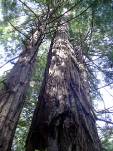 We
started out
on Hare Trail (which follows Hare Creek) - lots of nice little falls
(left) and large redwoods (right). Do you see in the picture at the
left that a tree has fallen across the stream?
And as it rotted, many little trees (and other vegetation) were growing
out of it? We saw a lot of those along the way and in some places could
see where the original log completely rotted away, but the new trees
had taken root and were growing along the banks. We
started out
on Hare Trail (which follows Hare Creek) - lots of nice little falls
(left) and large redwoods (right). Do you see in the picture at the
left that a tree has fallen across the stream?
And as it rotted, many little trees (and other vegetation) were growing
out of it? We saw a lot of those along the way and in some places could
see where the original log completely rotted away, but the new trees
had taken root and were growing along the banks.
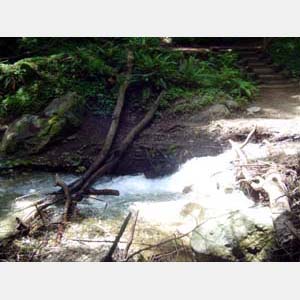
We branched off when we came to the intersection with Falls Trail and
immediately came to a halt where the trail ended at a stream (below
left). We could see that it did continue on the other side so
completely ignoring our recent experience with crossing streams - there
was a promise of a spectacular waterfall at the end, after all - we
crossed over on rocks and logs THREE different times. And didn't get
wet. (See me balancing precariously in the center below. Actually that
was one of the larger logs and wasn't so scary which is why I let John
take that picture!) And the 100-foot waterfall was indeed awesome
(below right).
  We
stopped and had
some of lunch at the falls then headed back down, crossing the stream
again in the absence of the "narrow wooden footbridges" the guide had
promised. I will confess that some of the pride in this
great accomplishment was dashed when, on the way back down, we passed a
field trip of a couple dozen 4th, 5th and 6th graders with 4 adults
making the same trek. Only they cheated - they brought towels and
"wading shoes" and just
walked across! That was safe since the water here was only ankle high -
nowhere near as deep as we had encountered at Andrew Molera. We then
took Kiln Trail up to the old kilns. This used to be a limestone mining
area and the kilns were used to fire the limestone and turn it into
quick lime that was then, apparently, sent in barrels down to the coast
where it was shipped to Monterey and San Francisco for making concrete.
One of the old kilns is at left, and we are at right posing at the kiln
site by Limekiln Creek. We
stopped and had
some of lunch at the falls then headed back down, crossing the stream
again in the absence of the "narrow wooden footbridges" the guide had
promised. I will confess that some of the pride in this
great accomplishment was dashed when, on the way back down, we passed a
field trip of a couple dozen 4th, 5th and 6th graders with 4 adults
making the same trek. Only they cheated - they brought towels and
"wading shoes" and just
walked across! That was safe since the water here was only ankle high -
nowhere near as deep as we had encountered at Andrew Molera. We then
took Kiln Trail up to the old kilns. This used to be a limestone mining
area and the kilns were used to fire the limestone and turn it into
quick lime that was then, apparently, sent in barrels down to the coast
where it was shipped to Monterey and San Francisco for making concrete.
One of the old kilns is at left, and we are at right posing at the kiln
site by Limekiln Creek.
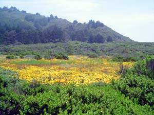 Next
on our agenda was Jade Beach. The trails start at Sand Dollar Beach
access which was closed for maintenance. That just meant that everybody
parked along the highway and walked in. There is a trail along the
bluff that goes through a lovely meadow (left) and eventually you pick
a place
to "scramble down" to the beach. No real trails going down. That's okay
- we've scrambled before. We spent about an hour there - John
collecting (below the "mean high tide line" which is the law) and me
enjoying the views and sounds and reading. The first set of pictures
below show where we had to "scramble" down (and then go
back up). It was really higher than it looks in that picture. The
center is just a view sitting in the cove and the right is what the
cliff looks like close up - see how green it is from the jade? Next
on our agenda was Jade Beach. The trails start at Sand Dollar Beach
access which was closed for maintenance. That just meant that everybody
parked along the highway and walked in. There is a trail along the
bluff that goes through a lovely meadow (left) and eventually you pick
a place
to "scramble down" to the beach. No real trails going down. That's okay
- we've scrambled before. We spent about an hour there - John
collecting (below the "mean high tide line" which is the law) and me
enjoying the views and sounds and reading. The first set of pictures
below show where we had to "scramble" down (and then go
back up). It was really higher than it looks in that picture. The
center is just a view sitting in the cove and the right is what the
cliff looks like close up - see how green it is from the jade?
  
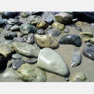
Next, some of the rocks that are available
(these
are
right at the edge of the water and legal for collecting) and John
sorting which rocks to keep before we climbed back up!
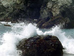
 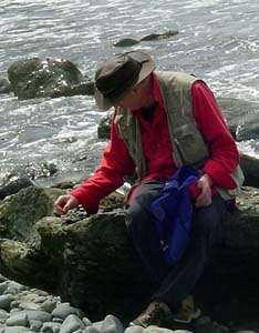 Finally, Barb sitting on jade (too high on beach - not
legal to "mine")
and some of the waves that were entertaining me.
Finally, Barb sitting on jade (too high on beach - not
legal to "mine")
and some of the waves that were entertaining me.
 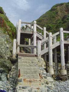 We
walked
over to Sand Dollar Beach (left) after we left the Jade Cove but it was
getting late and the tide was rather high by then so we just took a
short walk. There were, however, stairs down to the beach there (right)
which made it relatively easy! We
walked
over to Sand Dollar Beach (left) after we left the Jade Cove but it was
getting late and the tide was rather high by then so we just took a
short walk. There were, however, stairs down to the beach there (right)
which made it relatively easy!
We had browsed at Heart Beat - an art
gallery/gift
shop
next to River Inn - the other night just as they were closing but
wanted to get back earlier this evening to buy some prints and one
photo on canvas that I liked. We suddenly recognized how late it was
and so headed there before going back to the motel. After making our
purchases, we decided it had been a long day and to just eat leftovers
in the room and spend time in the hot tub. But, gasp!  - there was
no hot water. However, my husband is a genius - there was
no hot water. However, my husband is a genius  and
figured out that the circuit breaker for the on-demand hot water had
been tripped. He reset it and all was well. I have to admit that after
all the hiking we did we did really appreciate the hot soaks in the
evenings! and
figured out that the circuit breaker for the on-demand hot water had
been tripped. He reset it and all was well. I have to admit that after
all the hiking we did we did really appreciate the hot soaks in the
evenings!
Thursday May 11: We ate oatmeal and rolls in the room
this morning and
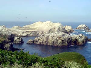
checked out around 9 AM, heading back north to Point Lobos again. This
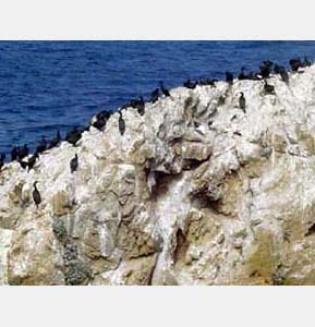
time we drove to the far end and took the Bird Island Trail (left - the
birds in question seem to be mostly Brandt's Cormorants, but also some
swallows and 2 types of gull). There is a closer picture below center.
(Can
you see the 2 gulls in amongst all the cormorants?) China Beach was
blocked off
because of what looked like (we obviously couldn't get too close) an
elephant seal resting there. Beautiful flowers and a nice walk.
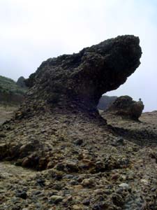
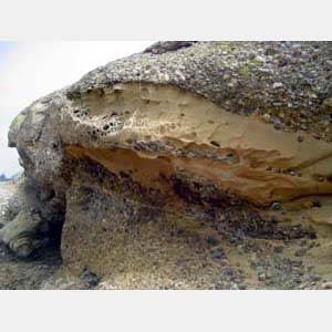
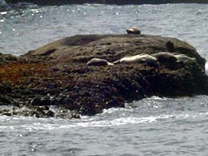 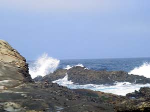 We then walked over to Sea Lion Point which was short on sea lions,
though there were a few (right), but we enjoyed the various rock
formations (below) and Barb once again captured some nice waves!
(left) After
that, we headed into Carmel, had a good Chinese lunch at the Crossroads
shopping area and then visited a few galleries we had missed the first
time through; John particularly wanted to visit Gallery 21 and see some
of Eyvind Earle's works.
We then walked over to Sea Lion Point which was short on sea lions,
though there were a few (right), but we enjoyed the various rock
formations (below) and Barb once again captured some nice waves!
(left) After
that, we headed into Carmel, had a good Chinese lunch at the Crossroads
shopping area and then visited a few galleries we had missed the first
time through; John particularly wanted to visit Gallery 21 and see some
of Eyvind Earle's works.
  The
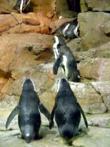
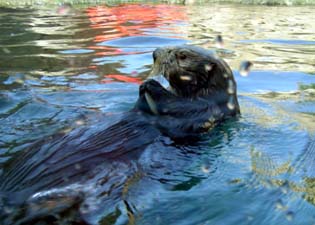
afternoon we spent
at the Monterey Bay Aquarium. This is a very expensive proposition but
everybody said it was a "must do" if you were in the area. And it was
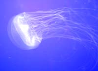
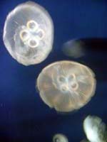
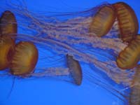
lots of fun. We enjoyed the "jellies" (below), the penguins and the
otters the most I think. We found a motel room out near Highway 1 for a
quick escape
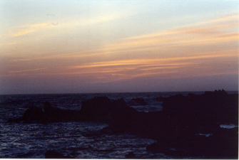
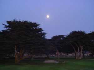
in the morning then had dinner at the Blue Moon Bistro
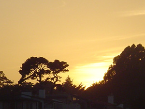
on Cannery Row, followed by the sunset and the moon rising along Sunset
Drive. The
afternoon we spent
at the Monterey Bay Aquarium. This is a very expensive proposition but
everybody said it was a "must do" if you were in the area. And it was
lots of fun. We enjoyed the "jellies" (below), the penguins and the
otters the most I think. We found a motel room out near Highway 1 for a
quick escape
in the morning then had dinner at the Blue Moon Bistro
on Cannery Row, followed by the sunset and the moon rising along Sunset
Drive.
  Friday
May 12: We
headed north on Highway 1 in dense fog. There were some twisty parts
but they were nothing compared to Highway 9! That was 20-30 mph, more
and tighter curves than any we had encountered so far. We stopped in
Felton at the New Leaf, a delightful natural foods market, and got some
great sandwiches at their deli for lunch, some local honey and
tomorrow's breakfast! Then we continued on up 9 to Hwy 236 and into Big
Basin Redwoods State Park (the first California State Park). That trip
took about 2 hours. Once in Big Basin, we first took the short nature
walk where we saw the "Mother" (tallest) tree, left, and the "Father"
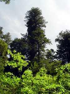
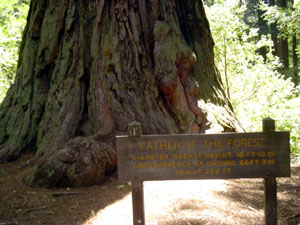
tree (oldest - approximately 2000 years old), right, of the forest. Friday
May 12: We
headed north on Highway 1 in dense fog. There were some twisty parts
but they were nothing compared to Highway 9! That was 20-30 mph, more
and tighter curves than any we had encountered so far. We stopped in
Felton at the New Leaf, a delightful natural foods market, and got some
great sandwiches at their deli for lunch, some local honey and
tomorrow's breakfast! Then we continued on up 9 to Hwy 236 and into Big
Basin Redwoods State Park (the first California State Park). That trip
took about 2 hours. Once in Big Basin, we first took the short nature
walk where we saw the "Mother" (tallest) tree, left, and the "Father"
tree (oldest - approximately 2000 years old), right, of the forest.
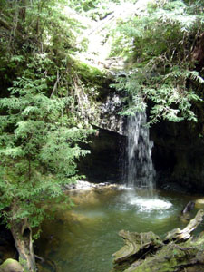  We
collected lunch
and backpacks and headed to Sempervirens Falls (right), planning to do
the 4 mile loop. We started on Sequoia Trail, but at the Bob Kirsch
Trail cutover, there was a sign pointing us to Shadowbrook Trail with a
"Wrong Way" sign on Sequoia. So we obediently went the "right" way.
Eventually, as we kept coming on these signs, we figured out they were
for an event coming up over the weekend and did not
apply to us! So after we got to the falls, we went back down Sequoia
Trail - just doing the loop in reverse of what we had planned. It was
interesting how different this redwood forest was from the coastal ones
- no poison oak (in the Big Sur area it was everywhere), no
wildflowers. Mostly lots of redwoods, tanbark oak and Douglas fir; also
some madrone and wax myrtle trees, lots of huckleberry. We saw an acorn
woodpecker and a different type of lizard: "scalier" and larger than
the ones further south. We
collected lunch
and backpacks and headed to Sempervirens Falls (right), planning to do
the 4 mile loop. We started on Sequoia Trail, but at the Bob Kirsch
Trail cutover, there was a sign pointing us to Shadowbrook Trail with a
"Wrong Way" sign on Sequoia. So we obediently went the "right" way.
Eventually, as we kept coming on these signs, we figured out they were
for an event coming up over the weekend and did not
apply to us! So after we got to the falls, we went back down Sequoia
Trail - just doing the loop in reverse of what we had planned. It was
interesting how different this redwood forest was from the coastal ones
- no poison oak (in the Big Sur area it was everywhere), no
wildflowers. Mostly lots of redwoods, tanbark oak and Douglas fir; also
some madrone and wax myrtle trees, lots of huckleberry. We saw an acorn
woodpecker and a different type of lizard: "scalier" and larger than
the ones further south.
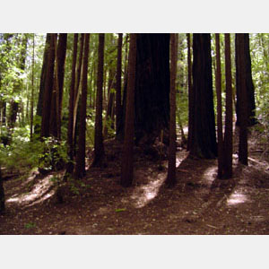
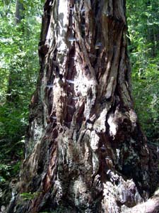
These pictures are just a couple of
interesting
things.
On the left is a "circle." We saw a lot of these - sometimes the
center, original tree, was gone but the younger ones were in the circle
format. Here you can
see the parent tree is still there. On the right is a tree whose bark
is very gnarly. Spiders have used the indentations and it's covered
with cobwebs!
  After
leaving
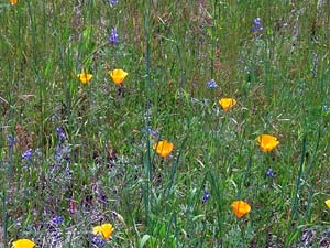
Big Basin, we continued on 236 to Castle Rock State Park. We stopped
and took a very short walk through a meadow that provided very
different
views than any other area we've been in all week! (pictures left and
right) But other than this, there didn't seem to be anything here we
hadn't already seen. So we continued on the way towards San Jose. We
stopped in Saratoga - a delightful little "village" - similar to Carmel
in some ways. Lots of shops, antiques, an appear of wealth (the cars
tended to be Audis, BMS's and even Rolls!) We had some snacks (gelato
and smoothie) and continued on to Los Gatos, where we stopped at a
Whole Foods Market (got food for the plane tomorrow) and Trade Joe's
(just to look). We spent the night in Campbell at a Motel 6 just off
the interstate. Ate at an Indian restaurant just a block or so away. After
leaving
Big Basin, we continued on 236 to Castle Rock State Park. We stopped
and took a very short walk through a meadow that provided very
different
views than any other area we've been in all week! (pictures left and
right) But other than this, there didn't seem to be anything here we
hadn't already seen. So we continued on the way towards San Jose. We
stopped in Saratoga - a delightful little "village" - similar to Carmel
in some ways. Lots of shops, antiques, an appear of wealth (the cars
tended to be Audis, BMS's and even Rolls!) We had some snacks (gelato
and smoothie) and continued on to Los Gatos, where we stopped at a
Whole Foods Market (got food for the plane tomorrow) and Trade Joe's
(just to look). We spent the night in Campbell at a Motel 6 just off
the interstate. Ate at an Indian restaurant just a block or so away.
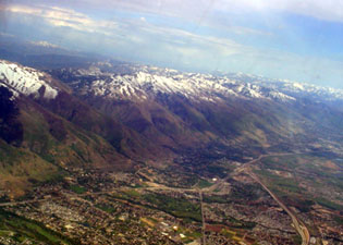
The trip home was relatively uneventful. For
some
odd
reason we were routed through Salt Lake City, so the last two pictures
are of the snow-capped rockies at the Salt Lake City airport and then
in the air above the city. We had a good week - got lots of exercise
but also some relaxation and saw an area of the
country that was new to us.
Click here
to go
back to Part 1. . . .
Click here
to go
back to Part 2. . . .
Click here
to
return to the Big Sur index
Click here to
return to
Barb's Index
Click here to return to Fotos 'n Stuff Home Page
|