 We
left off (at the end of Part II) after lunch, having climbed back up to
the Pine Creek
Trailhead in Curecanti National Recreation Area. Next we headed south
on Hwy 149 (known as the Silver Thread Scenic
Byway) to
Creede.
We
left off (at the end of Part II) after lunch, having climbed back up to
the Pine Creek
Trailhead in Curecanti National Recreation Area. Next we headed south
on Hwy 149 (known as the Silver Thread Scenic
Byway) to
Creede.  We stopped at a lot of places along the way - it was, indeed, scenic.
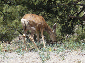
At one stop we were thoroughly ignored
by the mule deer on
the left. In Lake City we
turned on County Route 20, part of the Alpine Loop. Though it
is
primarily a jeep road, passenger cars can get down parts of it.
We
were hunting a waterfall that was supposed
to be on Henson Creek, just
past the Alpine Gulch. We could hear
it, but we couldn't get
a
view of it without going onto "Private Property, No Trespassing," so we
gave up on that. We did, however, stop at the ghost town of
Henson (above, right) and then walked a half mile or so down the Alpine
Gulch
trail (below left is Henson Creek from that walk). We saw
some lovely overlooks of Lake San
Cristobel with snow-capped
mountains in the background (center). We also had to stop and
admire North Clear River Falls (below, right)
– allegedly the
most photographed waterfall in the state. While it's very
scenic,
I think the main reason it is so popular is that it's right on the
highway so quite easy to get
to!
We stopped at a lot of places along the way - it was, indeed, scenic.
At one stop we were thoroughly ignored
by the mule deer on
the left. In Lake City we
turned on County Route 20, part of the Alpine Loop. Though it
is
primarily a jeep road, passenger cars can get down parts of it.
We
were hunting a waterfall that was supposed
to be on Henson Creek, just
past the Alpine Gulch. We could hear
it, but we couldn't get
a
view of it without going onto "Private Property, No Trespassing," so we
gave up on that. We did, however, stop at the ghost town of
Henson (above, right) and then walked a half mile or so down the Alpine
Gulch
trail (below left is Henson Creek from that walk). We saw
some lovely overlooks of Lake San
Cristobel with snow-capped
mountains in the background (center). We also had to stop and
admire North Clear River Falls (below, right)
– allegedly the
most photographed waterfall in the state. While it's very
scenic,
I think the main reason it is so popular is that it's right on the
highway so quite easy to get
to! 


We checked into the RC Guest Ranch in the mid-afternoon. We were in a 2-bedroom cabin for just the first night because that's all that was available.
 To make room for
the second bedroom, the rest of the living space was somewhat cramped
and, while it was okay, we were not very enthusiastic.
The next day we moved to Cabin 9 which
we liked a lot better!
To make room for
the second bedroom, the rest of the living space was somewhat cramped
and, while it was okay, we were not very enthusiastic.
The next day we moved to Cabin 9 which
we liked a lot better! 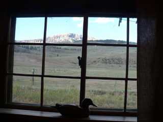 The
layout was nicer, we had a couch to sit on, the bed was very
comfortable, there were more available electric outlets (they are
2-pronged outlets, though, so bring an adapter), the lighting
was
better; the kitchen was fully-equipped, including a microwave which we
didn't expect. The cabins are very clean, nary a bug (which
surprised me out on a horse ranch), plenty of linens available.
We liked the taste of the water so much we filled all of our
containers
before we left. The whole ranch is "rustic" but that was part
of its charm to us - the cabins really fit their environment; they are
decorated nicely
in tune with their age (this one was built in 1925
according to the
date etched on the front) and location, and the views are just
gorgeous!
The
layout was nicer, we had a couch to sit on, the bed was very
comfortable, there were more available electric outlets (they are
2-pronged outlets, though, so bring an adapter), the lighting
was
better; the kitchen was fully-equipped, including a microwave which we
didn't expect. The cabins are very clean, nary a bug (which
surprised me out on a horse ranch), plenty of linens available.
We liked the taste of the water so much we filled all of our
containers
before we left. The whole ranch is "rustic" but that was part
of its charm to us - the cabins really fit their environment; they are
decorated nicely
in tune with their age (this one was built in 1925
according to the
date etched on the front) and location, and the views are just
gorgeous! 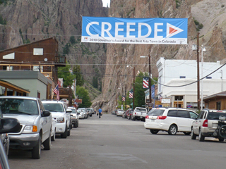 On
the left is John sitting on the front porch and
to the right is the view of Bristol Head out the living room window.
A delightful place to spend 5 days!
On
the left is John sitting on the front porch and
to the right is the view of Bristol Head out the living room window.
A delightful place to spend 5 days!We drove into Creede, about a
 20 minute drive, a
delightful town (in the
summer) that snuggles up to the mountains, as you can see in the
picture at the left. The picture of Main Street to the right
was taken later in the week from the gallery at the theatre.
We stopped first at the
Forest Service office to get information about
hikes in the area. We wandered town a
bit, saw the setup for the big festivities for the holiday
weekend. Then
we had supper at the Old Firehouse Restaurant and it
was great!
(It really is
an old firehouse.) John
had a chicken/ walnut/ cranberry salad and I had avocado stuffed with
chicken salad (I only ate half and had the rest for lunch the next
day). Our waiter, Svetoslav,
was one of a number of exchange students
that
come for the tourist season. He was from
Bulgaria and was
very efficient as well as fun to banter with. Very
good food
and service.
20 minute drive, a
delightful town (in the
summer) that snuggles up to the mountains, as you can see in the
picture at the left. The picture of Main Street to the right
was taken later in the week from the gallery at the theatre.
We stopped first at the
Forest Service office to get information about
hikes in the area. We wandered town a
bit, saw the setup for the big festivities for the holiday
weekend. Then
we had supper at the Old Firehouse Restaurant and it
was great!
(It really is
an old firehouse.) John
had a chicken/ walnut/ cranberry salad and I had avocado stuffed with
chicken salad (I only ate half and had the rest for lunch the next
day). Our waiter, Svetoslav,
was one of a number of exchange students
that
come for the tourist season. He was from
Bulgaria and was
very efficient as well as fun to banter with. Very
good food
and service. 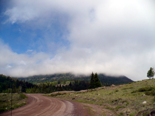
Saturday July 3
The
morning started "fogged in." It
reminded us a lot of mornings in Ireland – you
couldn't see the tops of any of the mountains!
(Picture at left.) But we set off to go hiking, confident
that it would burn off (it did). We
went down Rio Grande Reservoir Road (FR 520). It is gravel,
somewhat corrugated in places, but our minivan didn't have any
trouble with it; it was also wide enough for Barb to not have anxiety
about
it and there was some beautiful scenery!

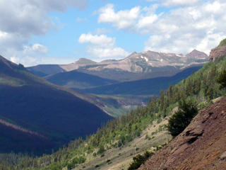
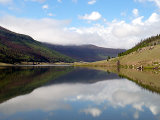 We drove about
10 miles, past the Road Canyon Reservoir
(pictured at left) and a couple of campgrounds
to 30 Mile campground where we found the "hiker and fisher"
parking lot (once in the campground, follow the signs that say "Horse
Trail").
We drove about
10 miles, past the Road Canyon Reservoir
(pictured at left) and a couple of campgrounds
to 30 Mile campground where we found the "hiker and fisher"
parking lot (once in the campground, follow the signs that say "Horse
Trail"). 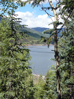 Two
trails leave from the same trailhead – Squaw Creek
Trail (#814) and Weminuche (#818). The Weminuche
trail reaches Weminuche pass in 5.5 miles but our goal was just the
first couple of miles to the creek crossing. It was very
pleasant and just right for us (it starts at an elevation of 9400 feet
so we have continued to climb in altitude.) Just beyond the
old, demolished
miner's shack is the
Two
trails leave from the same trailhead – Squaw Creek
Trail (#814) and Weminuche (#818). The Weminuche
trail reaches Weminuche pass in 5.5 miles but our goal was just the
first couple of miles to the creek crossing. It was very
pleasant and just right for us (it starts at an elevation of 9400 feet
so we have continued to climb in altitude.) Just beyond the
old, demolished
miner's shack is the 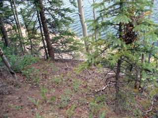 only
place there was any confusion about which way
to go – stay to the left and go up the rocky trail.
The one to the right looks easier but it doesn't go anywhere.
only
place there was any confusion about which way
to go – stay to the left and go up the rocky trail.
The one to the right looks easier but it doesn't go anywhere.
The early part of the trail is on a bluff above the picturesque Rio Grande Reservoir (right). You get a better idea of the perspective in the picture at left. It reminded us a bit of the Na Pali trail on the coast of Kauai, except that the vegetation was totally different!
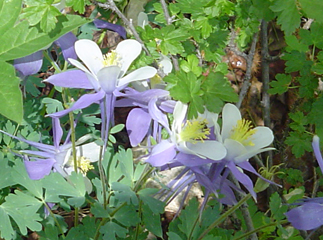
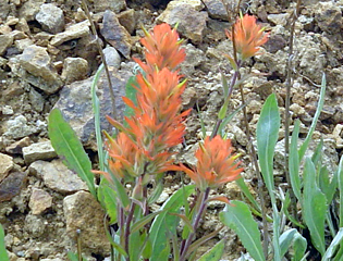
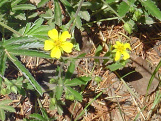
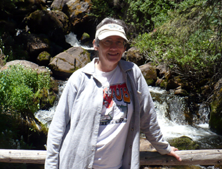
The hike was cool and shady most of the time. Until the last half mile or so it wasn't too steep – a very pleasant walk. It was one of our favorite hikes of the whole trip - the wildflowers were just fantastic. Here are some samples - John took all of the closeups. Imagine a hillside with a variety of these sprinkled about and you understand why we linger and take so many pictures!!



 Then
we came to the last half mile which is very steep with no break at
all. About the time I was sure I was going to have to bail
out, I
heard the falls. That was motivation to keep me plugging away
at
it. If you're doing this hike, when you come to the big rock
slide you're almost there! There is a bridge over Weminuche
Creek
and a long, very nice, falls there. (Falls at left, and Barb
on
the bridge on the right.) We took some pictures then found a
nice
pine-needle soft and shady spot for lunch. It took us about
1.75
hours to get there including lots of breaks for picture taking and,
towards the end, deep breathing! Below left is a
"side"
falls that was running into the creek - it was quite different from the
main falls and, in some ways, more photogenic.
Then
we came to the last half mile which is very steep with no break at
all. About the time I was sure I was going to have to bail
out, I
heard the falls. That was motivation to keep me plugging away
at
it. If you're doing this hike, when you come to the big rock
slide you're almost there! There is a bridge over Weminuche
Creek
and a long, very nice, falls there. (Falls at left, and Barb
on
the bridge on the right.) We took some pictures then found a
nice
pine-needle soft and shady spot for lunch. It took us about
1.75
hours to get there including lots of breaks for picture taking and,
towards the end, deep breathing! Below left is a
"side"
falls that was running into the creek - it was quite different from the
main falls and, in some ways, more photogenic.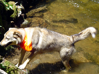
 Right
before we packed up to head back, a couple with a dog came
along.
She was a very friendly dog, wearing an orange bandanna, and we watched
in amusement as she climbed down to the creek and brought up rocks for
her people to throw back for her. They said she was a
'rockhound'
and that made John laugh!
Right
before we packed up to head back, a couple with a dog came
along.
She was a very friendly dog, wearing an orange bandanna, and we watched
in amusement as she climbed down to the creek and brought up rocks for
her people to throw back for her. They said she was a
'rockhound'
and that made John laugh!About half way down, as we got close enough to see the reservoir, John felt the pull of driftwood and found a place that he could scramble down to the reservoir without too much trouble. He spent 20 minutes or so scavenging until his bag was full. If you ignore the time he spent on the beach, it took about an hour coming back.
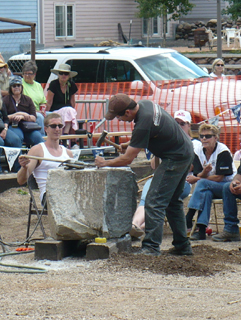
 After
we cleaned up and changed back at the cabin, we went off to Creede to
check out the "festivities." There was a flea market so we
wandered
and talked to people; I bought a pair of earrings, John got some
honey (right). Then we watched the "Days of 92" state Mining
Competition
for a while. They were doing hand-drilling. The
competitors
had 5 minutes, a 4 pound maul and chisels to get as far down into a
huge piece of granite as they could. One competitor is at the
left. We were
impressed with the first one we saw that got down about 3.5"; the last
one before we left was over 7".
After
we cleaned up and changed back at the cabin, we went off to Creede to
check out the "festivities." There was a flea market so we
wandered
and talked to people; I bought a pair of earrings, John got some
honey (right). Then we watched the "Days of 92" state Mining
Competition
for a while. They were doing hand-drilling. The
competitors
had 5 minutes, a 4 pound maul and chisels to get as far down into a
huge piece of granite as they could. One competitor is at the
left. We were
impressed with the first one we saw that got down about 3.5"; the last
one before we left was over 7".  Wow!
There are other events, like mucking, that we didn't see.
John
took the picture at the right of a hot, tired dog! The Finals
are
tomorrow. We made a grocery store stop, then back to the
cabin.
Wow!
There are other events, like mucking, that we didn't see.
John
took the picture at the right of a hot, tired dog! The Finals
are
tomorrow. We made a grocery store stop, then back to the
cabin.
 Back
at home base, John did some organizing (of his rocks and
driftwood) while
I fixed chicken cacciatore for supper. The one bit of bad
news
for today was that I apparently didn't have enough sunblock on some
parts of my hands, or, more likely, the sunblock was rubbed
off
from using the hiking poles - it was primarily my two thumbs and
pointer fingers. Anyway, they, plus some knuckles, particularly on the right hand, are now
severely burned and very painful. I used aloe on
them and
added antibiotic ointment overnight, wrapping them in gauze.
Apparently I am one of those people who are super sun
sensitive
when taking doxycycline.
Back
at home base, John did some organizing (of his rocks and
driftwood) while
I fixed chicken cacciatore for supper. The one bit of bad
news
for today was that I apparently didn't have enough sunblock on some
parts of my hands, or, more likely, the sunblock was rubbed
off
from using the hiking poles - it was primarily my two thumbs and
pointer fingers. Anyway, they, plus some knuckles, particularly on the right hand, are now
severely burned and very painful. I used aloe on
them and
added antibiotic ointment overnight, wrapping them in gauze.
Apparently I am one of those people who are super sun
sensitive
when taking doxycycline.  It did get me out of
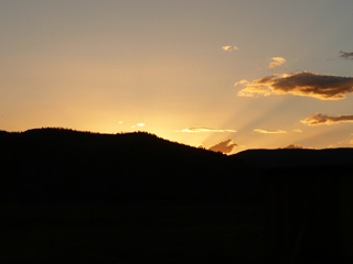
doing the dishes, though! Sunset at the left above.
It did get me out of
doing the dishes, though! Sunset at the left above.Sunday, July 4
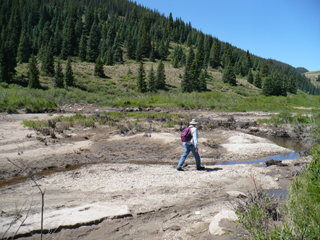 John made pancakes this morning (we slept til
almost 8) and then we packed lunch and headed off to explore, not
having a specific destination in mind. We started out at
Brown Lakes – a state wildlife area. There was no
shade anywhere around, though, and the only trail just went alongside
the lakes in the bright sun. We drove on down the road to
Hermit's Rest which is now a private resort, so we couldn't
get any further there either. We stopped for a few minutes
by Mason Creek at the intersection of FR 515 and FR 516 so John could
check it out but he didn't find anything very profound there.
John made pancakes this morning (we slept til
almost 8) and then we packed lunch and headed off to explore, not
having a specific destination in mind. We started out at
Brown Lakes – a state wildlife area. There was no
shade anywhere around, though, and the only trail just went alongside
the lakes in the bright sun. We drove on down the road to
Hermit's Rest which is now a private resort, so we couldn't
get any further there either. We stopped for a few minutes
by Mason Creek at the intersection of FR 515 and FR 516 so John could
check it out but he didn't find anything very profound there.  Next we went on further north on CO 149 to FR 513
and tried the Rito Hondo Reservoir – there was a campground
there but again, no shade at all and the added "downer" of a bunch of
young kids driving around on ATV's. We walked to the end of
the reservoir to see if we could continue along the creek but there
really wasn't any access. Similarly, at the Continental
Reservoir gaging station there was barbed wire fence keeping us from
being able to walk along the feeder creek.
Next we went on further north on CO 149 to FR 513
and tried the Rito Hondo Reservoir – there was a campground
there but again, no shade at all and the added "downer" of a bunch of
young kids driving around on ATV's. We walked to the end of
the reservoir to see if we could continue along the creek but there
really wasn't any access. Similarly, at the Continental
Reservoir gaging station there was barbed wire fence keeping us from
being able to walk along the feeder creek. Finally, as we drove back along FR513 we pulled off onto a 4WD road and walked through the brush down to a marshy part of North Clear Creek. Still no shade to speak of, but John played around finding driftwood (above, left) for half an hour or so while I found a rock and a small square of shade to sit and read.
 The picture above, right, was taken at the
"Headwaters of the Rio Grande" viewpoint where we next stopped briefly.
The small pointed peak in the background is the Rio Grande
Pyramid (13,821 ft).
The picture above, right, was taken at the
"Headwaters of the Rio Grande" viewpoint where we next stopped briefly.
The small pointed peak in the background is the Rio Grande
Pyramid (13,821 ft). Finally, it
was lunch time so I suggested we stop at a Silver Thread campground on
our way back south on 149 – just to find a shady place to
eat. Lo and behold, there was a sign that said
“Trail to Falls!” It was a
steep climb down and again back up but we ended up having lunch in the
shade next to the delightful South Clear Creek Falls. Then we
climbed around on rocks taking pictures, talking to two ladies who had
been catching rainbow trout right there at the base of the falls and
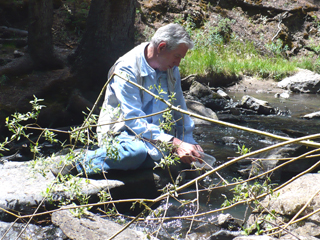
admired a dog who brought two kids by. Below right, John is
"getting into the spirit of Creede" by playing at panning for gold.
A successful, serendipitous lunch stop!
Finally, it
was lunch time so I suggested we stop at a Silver Thread campground on
our way back south on 149 – just to find a shady place to
eat. Lo and behold, there was a sign that said
“Trail to Falls!” It was a
steep climb down and again back up but we ended up having lunch in the
shade next to the delightful South Clear Creek Falls. Then we
climbed around on rocks taking pictures, talking to two ladies who had
been catching rainbow trout right there at the base of the falls and
admired a dog who brought two kids by. Below right, John is
"getting into the spirit of Creede" by playing at panning for gold.
A successful, serendipitous lunch stop!
 Back at the cabin we both showered then headed
back out to town.
Back at the cabin we both showered then headed
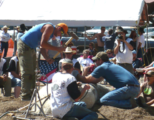
back out to town. 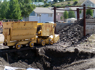 We watched some of the
finals of the mining competitions – the double jack steeling
(left) where one holds/turns the chisel and the other one pounds and
they trade off. We agreed we wouldn't want to be the "turner"
but they were getting down 20” in 10 minutes.
The mucking had been earlier in the day but we saw the
results (right); and one of the drilled rocks (below).
We watched some of the
finals of the mining competitions – the double jack steeling
(left) where one holds/turns the chisel and the other one pounds and
they trade off. We agreed we wouldn't want to be the "turner"
but they were getting down 20” in 10 minutes.
The mucking had been earlier in the day but we saw the
results (right); and one of the drilled rocks (below). 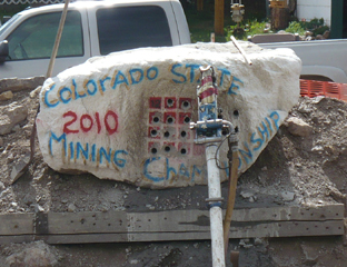 We wandered around and talked to various
interesting people; had "fair food" for supper then ice cream at the
Old Firehouse for dessert before the show. Creede
has a very well-known repertory theatre group so before we left we had
ordered tickets for the musical The 25th
Annual Putnam County Spelling Bee.
We enjoyed it so much that we stopped at the Box Office during intermission and got tickets for
Tuesday night's show The
Ladies Man. We leave Wednesday morning
so we'll have to take some packing time Tuesday afternoon!
We wandered around and talked to various
interesting people; had "fair food" for supper then ice cream at the
Old Firehouse for dessert before the show. Creede
has a very well-known repertory theatre group so before we left we had
ordered tickets for the musical The 25th
Annual Putnam County Spelling Bee.
We enjoyed it so much that we stopped at the Box Office during intermission and got tickets for
Tuesday night's show The
Ladies Man. We leave Wednesday morning
so we'll have to take some packing time Tuesday afternoon!We decided to skip the fireworks, though they were highly recommended, and went back to the cabin to read a little before bed.
Monday July 5
 We slept in this morning and took our time
getting going (yay for vacation). My burned hand bothered me
enough yesterday that today we stopped in town and I bought some silk
glove liners to help protect them from further sun as well as holding
the gauze and bandaids in place. (Yes, I have liners at home,
but who would have thought of bringing them in July?) They
helped a lot and they were thin enough that I could still work the
camera with the glove on.
We slept in this morning and took our time
getting going (yay for vacation). My burned hand bothered me
enough yesterday that today we stopped in town and I bought some silk
glove liners to help protect them from further sun as well as holding
the gauze and bandaids in place. (Yes, I have liners at home,
but who would have thought of bringing them in July?) They
helped a lot and they were thin enough that I could still work the
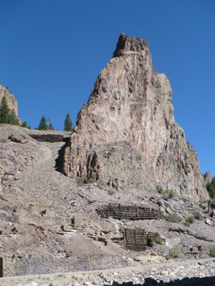
camera with the glove on.So we then started out on the Bachelor Historic Tour. This 17-mile loop goes up above Creed on FR 503 and returns via FR 504, both gravel roads that are quite steep in places, narrow, twisty. But they are accessible by passenger cars if you're careful so we took the full tour, which includes some spectacular scenery and also explores much of the mining history of the area. We bought a guide for $1 that shows the route and has interpretive information about each of the 16 stops, plus some of the sites in between; it was definitely worth it even though the stops are labelled and there is some signage along the route. Pictured at the right is the site of the old Humphrey Mill, and, behind it, the Commodore Mine. Ore from the Commodore was actually shipped by rail to south of town for processing.
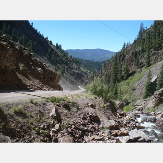
Below left is a view along FR 503 as it runs along West Willow Creek; in the center is the livery at the old town site of Weaver. In the picture at the right you can see the ore house and other buildings of the 5th level of the Amethyst Mine in the foreground and on the right side; up on the hill at the left you can barely make out several buildings from the Last Chance Mine. These were the two richest producing mines in the area in the 1890's.


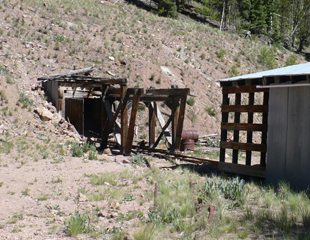
The next batch of pictures below includes an adit (opening) of the Midwest Mine (left) from which no ore was ever produced, a view near Allen's Crossing and some of the buildings of the Equity Mine (right) that produced between 1912 and 1970. I include all of these various mines, not because the pictures are so significant but that the presence of so many of them really helped us to appreciate the impact that mining has had on the history, even the existence, of many of these communities.
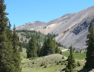
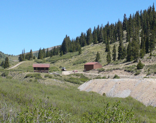
To the left below are the remnants of some of the Park Regent Mine, once a major silver producer - you can see John wandering in the back looking for interesting rocks. Just south of here (not pictured) was the Happy Thought Mine that was the only significant gold producing mine during the boom years. In the center is Nelson Mountain and to the right the La Garita Mountains - some of the "spectacular scenery" that was promised!

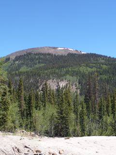

 Pictured at left is about all that's left of the site of the town of Bachelor.
 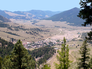 In the mid-1890's up to about 1908, this was a flourishing town that was home to about 1200 people. It
included a dozen saloons, four hotels, five grocery stores, a meat
market, two barber shops, two bakeries, several restaurants, a school,
a jail, city hall, a church and parsonage, a newspaper, a doctor and
dentist. The city quite literally died with the mines.
About a mile further down the road is this (right) view looking
down on the town of Creede.
In the mid-1890's up to about 1908, this was a flourishing town that was home to about 1200 people. It
included a dozen saloons, four hotels, five grocery stores, a meat
market, two barber shops, two bakeries, several restaurants, a school,
a jail, city hall, a church and parsonage, a newspaper, a doctor and
dentist. The city quite literally died with the mines.
About a mile further down the road is this (right) view looking
down on the town of Creede.  At
left is the historic Creede Catholic Church with the cemetery behind
it. We were disappointed that we couldn't find rosebushes in the
cemetery. At the mining competition the other day one of
the men was telling us about a man who won several championships.
He said that when his wife died, he hauled buckets of water
up to the cemetery every day "for her rosebushes." And our
story teller said that those bushes thrived and now covered both her
grave and his. But we didn't see them. There were both
very old and very new graves there. Bob Ford (who killed Jesse
James) was originally buried nearby, but then his widow moved the body
to his old home in Missouri.
At
left is the historic Creede Catholic Church with the cemetery behind
it. We were disappointed that we couldn't find rosebushes in the
cemetery. At the mining competition the other day one of
the men was telling us about a man who won several championships.
He said that when his wife died, he hauled buckets of water
up to the cemetery every day "for her rosebushes." And our
story teller said that those bushes thrived and now covered both her
grave and his. But we didn't see them. There were both
very old and very new graves there. Bob Ford (who killed Jesse
James) was originally buried nearby, but then his widow moved the body
to his old home in Missouri.  We
had picnic lunch in the (very nice) downtown park and then visited the
Creede Museum housed in the old depot right by the park. A
lot of what was there would apply to anywhere – old medical
equipment, e.g. But some of the pictures and history was
specific to the Creede area. It was interesting to see many of
the old pictures - Creede and Bachelor were established at about the
same time. There was mining in Creede up to 1985 when the last
mine - Homestake - was closed.
We
had picnic lunch in the (very nice) downtown park and then visited the
Creede Museum housed in the old depot right by the park. A
lot of what was there would apply to anywhere – old medical
equipment, e.g. But some of the pictures and history was
specific to the Creede area. It was interesting to see many of
the old pictures - Creede and Bachelor were established at about the
same time. There was mining in Creede up to 1985 when the last
mine - Homestake - was closed.We then drove up past the Underground Mining Museum and Fire station (picture at right) cut into the side of the mountain. John spent a half an hour or so rummaging in the big rock piles near the parking lot. He had many successes – found some pieces with nice amethyst, some silver, and more. He said he had been bitten by the "prospector bug" but restrained himself from continuing on up the road to examine all the piles we passed this morning!
 On
the way back to the ranch, we went down Middle Creek Road looking for
river access; though there
are several campgrounds and trails down there, we didn't go very far
because the road was so corrugated. Another aspect of this area
that reminded us of Ireland is the "open range."
On
the way back to the ranch, we went down Middle Creek Road looking for
river access; though there
are several campgrounds and trails down there, we didn't go very far
because the road was so corrugated. Another aspect of this area
that reminded us of Ireland is the "open range." 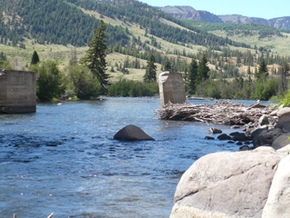 Though
it's not so green as Ireland, it does have cloud covers in the early
morning, lots of flat ranch land leading up to the mountains, small
narrow roads, yellow wildflowers (as opposed to the Irish gorse) all
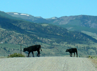
around. And now, the
open range concept - cows meandering across the road instead of sheep.
Though
it's not so green as Ireland, it does have cloud covers in the early
morning, lots of flat ranch land leading up to the mountains, small
narrow roads, yellow wildflowers (as opposed to the Irish gorse) all
around. And now, the
open range concept - cows meandering across the road instead of sheep.
 We stopped just beyond the intersection of Middle Creek and Hwy 149
where the Rio Grande is close to the road (right) – John played in
the driftwood for a little bit (picture at left); there was a pile of rocks, too, but he
had one more stop on his agenda so he passed up the rocks.
We stopped just beyond the intersection of Middle Creek and Hwy 149
where the Rio Grande is close to the road (right) – John played in
the driftwood for a little bit (picture at left); there was a pile of rocks, too, but he
had one more stop on his agenda so he passed up the rocks.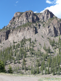 The
last little field trip of the day was up Seepage Road. There's
a big sign there about Big Horned Sheep but we didn't see any
(though it certainly looked like their habitat - pictured at
right). It may have been just a bit too early; I'm guessing they
emerge closer to dusk. Mostly he
wanted to see where and how far it went; it turned into a very rough
4W drive road after a few miles so we came on back out.
The
last little field trip of the day was up Seepage Road. There's
a big sign there about Big Horned Sheep but we didn't see any
(though it certainly looked like their habitat - pictured at
right). It may have been just a bit too early; I'm guessing they
emerge closer to dusk. Mostly he
wanted to see where and how far it went; it turned into a very rough
4W drive road after a few miles so we came on back out.Supper was yummy chicken curry tonight that John created from leftovers (he's a culinary genius). Then he spent some time cracking open some of his rocks and sorting both rocks and wood for tomorrow's triage. One more day here before we move on.
Tuesday July 6
 Pancakes
again this morning thanks to John. We drove back to 30mile
Campground (off of FR 520) and separated this time. I went up
Squaw Creek Trail and John used Weminuche Trail as access to the
reservoir because he wanted some more beach collecting time.
Pancakes
again this morning thanks to John. We drove back to 30mile
Campground (off of FR 520) and separated this time. I went up
Squaw Creek Trail and John used Weminuche Trail as access to the
reservoir because he wanted some more beach collecting time.My hand is still bandaged and gloved but that helps a lot and it doesn't bother me. I walked probably ¾ mile up the trail to the bridge over Squaw Creek. It was a nice half hour walk; I sat there a bit communing with nature, had a snack, took pictures then hiked back down. I won't repeat all the wildflower pictures again - but they were plentiful. As I came back to the campground, I chatted a bit with someone who'd been there a while who told me about seeing a bear on the Weminuche trail last week. He said it just looked around and then ambled off into the woods – I said "better you than me!"
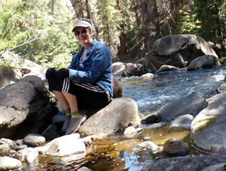
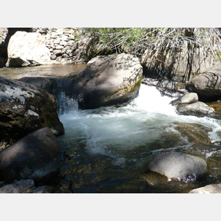
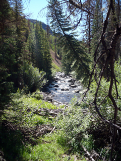
Above, I'm sitting on a rock in the middle of the creek. Below are the bridge; as close as I got to a "waterfall" on this hike;
and another view of the creek that I liked.
John collected as much driftwood as he could carry. After lunch back at the cabin, he went off to town to get some boxes to pack up his collections and then to go back up FR 503 a little way and hunt for more amethysts. The nice specimens he found yesterday have him hooked.
While we were eating lunch he looked up and saw a mule outside the cabin. Further inspection showed that 2 of them had gotten out of the fence. All the horses were still fenced and were not at all happy about not being able to get to the, presumably better, grass on the other side! Nobody is home to get them back in
 (I
don’t see a break in the fence so don’t even know how they
got out) but they don’t seem to be going anywhere – just
hanging out and eating.
(I
don’t see a break in the fence so don’t even know how they
got out) but they don’t seem to be going anywhere – just
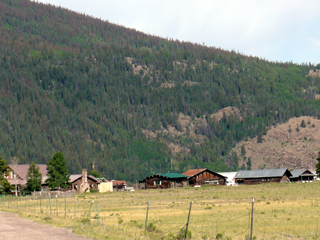
hanging out and eating.I started sorting and packing my clothes and some of the kitchen stuff. Tonight we had beef stew with dumplings for supper (my turn to cook) then went to the theater for Ladies Man. It was a wonderfully funny French farce that was performed very well. If you ever visit the area, do go to a Creede Repertory performance! You won't be sorry. The last picture to the right is the RC Guest Ranch from the road (taken as we were leaving) - you get the perspective of the cluster of buildings and the mountain rising behind.
Perhaps I should mention here that our cell phones worked fine in Creede. The ranch was about 5 miles too far but it was easy to check for messages or make calls when we were in town. The Chamber of Commerce information center offered free WiFi. Some of the businesses in town (e.g. The Old Firehouse) also have WiFi, but we didn't check in online until we were leaving Wednesday morning and heading for a campground where we expected to have no contact opportunities for a few days.