 We
got up around 8 AM, not in any hurry. Had breakfast, sorted,
packed, broke camp and loaded up the car, leaving by around
10. One of our friendly mule deer was along the campground
road to bid us
farewell! We drove into Cortez to get gas and get some air in
our tire. John was unable to get it to accept any air so we
went
over to the local WalMart expecting to have to replace the stem, but
they filled it up for us and it appears to be holding it.
Crossed fingers.
We
got up around 8 AM, not in any hurry. Had breakfast, sorted,
packed, broke camp and loaded up the car, leaving by around
10. One of our friendly mule deer was along the campground
road to bid us
farewell! We drove into Cortez to get gas and get some air in
our tire. John was unable to get it to accept any air so we
went
over to the local WalMart expecting to have to replace the stem, but
they filled it up for us and it appears to be holding it.
Crossed fingers.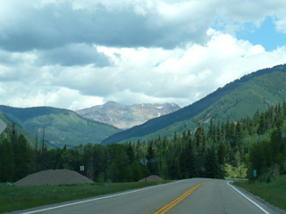 We stopped at a rock shop
outside of Cortez for John to browse. We had read in one of
the freebie magazines about
Galloping Goose Days in Delores; there were also signs in Cortez
welcoming people to GGD. But when we got to Delores, nobody
there knew anything about it (including the Visitor Information center
and the grocery store). We stopped at the grocery and bought
some sandwiches – very good ones for $4.95 - then drove on up
to Rico. You can tell from the picture at the right that we
are moving up out of the desert now and it's very green again.
We stopped at a rock shop
outside of Cortez for John to browse. We had read in one of
the freebie magazines about
Galloping Goose Days in Delores; there were also signs in Cortez
welcoming people to GGD. But when we got to Delores, nobody
there knew anything about it (including the Visitor Information center
and the grocery store). We stopped at the grocery and bought
some sandwiches – very good ones for $4.95 - then drove on up
to Rico. You can tell from the picture at the right that we
are moving up out of the desert now and it's very green again.
 I
see why
Rico was listed as a "ghost town" a few years back. There are
very few businesses; sadly, most of the town is for
sale. The story is much like that of Bachelor and other
former
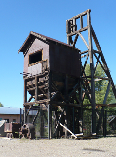
mining towns. According to the "historic marker" at the north
edge of town (pictured to the right), in 1879 silver was
found in
the area and the mining boom began. By 1892 Rico's population
was
about 5000; it had 23 saloons, 2 churches, 2 newspapers, a bank, a
theater, a general store, a courthouse and a red light district.
I
see why
Rico was listed as a "ghost town" a few years back. There are
very few businesses; sadly, most of the town is for
sale. The story is much like that of Bachelor and other
former
mining towns. According to the "historic marker" at the north
edge of town (pictured to the right), in 1879 silver was
found in
the area and the mining boom began. By 1892 Rico's population
was
about 5000; it had 23 saloons, 2 churches, 2 newspapers, a bank, a
theater, a general store, a courthouse and a red light district.
The Mine Shaft Inn, however, is delightful. I can't imagine the time and energy that went into restoring this old (1880's) home. I sure hope they attract enough business to survive – it's quite lovely and this weekend we are the only ones in residence. We checked in (early) then went to the San Juan Forest info center a mile or so up Highway 145 and the nice volunteer there gave us all sorts of information and lots of handouts; then we bought a detailed map of the forest which proved quite helpful.
 At his suggestion, we went back south
on Hwy 145 to Bear
Creek Trail. We probably should have stopped and eaten sooner
but we had forgotten how far back it was that we had passed the
trailhead! There were a number of families
picnicking there, though there are no tables or water, just a vault
toilet; lots of kids playing in the creek and having a
wonderful time.
At his suggestion, we went back south
on Hwy 145 to Bear
Creek Trail. We probably should have stopped and eaten sooner
but we had forgotten how far back it was that we had passed the
trailhead! There were a number of families
picnicking there, though there are no tables or water, just a vault
toilet; lots of kids playing in the creek and having a
wonderful time. 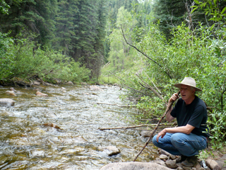 It
was about 1:30 by
then so we just ate lunch in the parking lot and then
went on up the trail... and I do mean UP. The first half mile
was a killer but then it leveled off and was pretty easy for as far as
we went. I'm guessing it was about 1-1.5 miles to the point
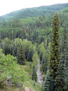
where the trail meets the creek again (mostly the trail is way above
the creek - as in the picture at left). There's a nice open
area
there for sitting,
watching the water, even cooling off your toes. See John,
taking
a break, at the right. We hung
around for 10-15 minutes then started back. We only got
rained on for about 10 minutes which wasn't
bad since the sky
was totally dark and it had been thundering all afternoon.
(We
did have ponchos with us.)
The views were quite varied as you can see from the pictures below.
I liked the rock formation John took (on the left) and was
impressed by the stand of aspens (center). The whole hike in
and
out took about 2.5 hours.
It
was about 1:30 by
then so we just ate lunch in the parking lot and then
went on up the trail... and I do mean UP. The first half mile
was a killer but then it leveled off and was pretty easy for as far as
we went. I'm guessing it was about 1-1.5 miles to the point
where the trail meets the creek again (mostly the trail is way above
the creek - as in the picture at left). There's a nice open
area
there for sitting,
watching the water, even cooling off your toes. See John,
taking
a break, at the right. We hung
around for 10-15 minutes then started back. We only got
rained on for about 10 minutes which wasn't
bad since the sky
was totally dark and it had been thundering all afternoon.
(We
did have ponchos with us.)
The views were quite varied as you can see from the pictures below.
I liked the rock formation John took (on the left) and was
impressed by the stand of aspens (center). The whole hike in
and
out took about 2.5 hours.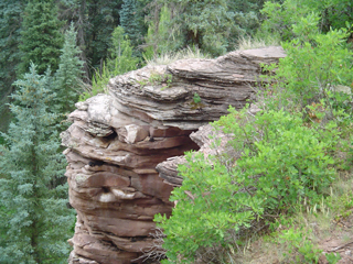


 We
came back to the Inn to shower and change. Rain
notwithstanding, I was covered with dust!
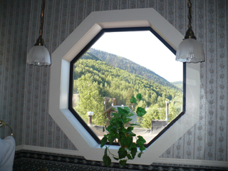
(To the right is a window and view from the bathroom. Notice
the
light fixtures and wallpaper - the decor is really exceptional!)
We checked out the Rico Hotel's restaurant (the Argentine Grill)
– we had been told that the food was good but it was very
pricey. Yep,
the cheapest entrée was chicken and that was $18.
So we
went
to the little Enterprise Bar and Grill about a block from the Inn
and had a wonderful
pizza. John also had a piece of dutch apple pie that he said
was very good. Great service and very nice people, too.
Besides bar and booth
seating inside, they have a couple of tables out in front along the
street and then several more out back on a deck - we were in the back
and it was a very pleasant evening. We chatted with a
man from Grand
Junction, who was in the area coaching
a youth softball team playing in a regional tournament in Telluride.
We
came back to the Inn to shower and change. Rain
notwithstanding, I was covered with dust!
(To the right is a window and view from the bathroom. Notice
the
light fixtures and wallpaper - the decor is really exceptional!)
We checked out the Rico Hotel's restaurant (the Argentine Grill)
– we had been told that the food was good but it was very
pricey. Yep,
the cheapest entrée was chicken and that was $18.
So we
went
to the little Enterprise Bar and Grill about a block from the Inn
and had a wonderful
pizza. John also had a piece of dutch apple pie that he said
was very good. Great service and very nice people, too.
Besides bar and booth
seating inside, they have a couple of tables out in front along the
street and then several more out back on a deck - we were in the back
and it was a very pleasant evening. We chatted with a
man from Grand
Junction, who was in the area coaching
a youth softball team playing in a regional tournament in Telluride.
 We
sat down in the kitchen/dining area and plotted out what we will do
tomorrow, in theory at least! Now John is off
exploring for rock piles, and I'm lounging in a delightful
little
sitting area overlooking the kitchen, perfect for relaxing and catching
up with journaling and email (picture at left).
Looking
forward to sleeping
in a real bed. Though our air mattress is perfectly
comfortable, there's something about not having to get
out of the tent and walk across the street to the bathroom.....
We
sat down in the kitchen/dining area and plotted out what we will do
tomorrow, in theory at least! Now John is off
exploring for rock piles, and I'm lounging in a delightful
little
sitting area overlooking the kitchen, perfect for relaxing and catching
up with journaling and email (picture at left).
Looking
forward to sleeping
in a real bed. Though our air mattress is perfectly
comfortable, there's something about not having to get
out of the tent and walk across the street to the bathroom.....Sunday July 11
We had breakfast at the Inn in the dining area. They have a selection of all sorts of baked goods, yogurt and other breakfast items. John had pastry, yogurt, coffee; I just had juice and ate the rest of our own yogurt.

 We left
around 9:30 AM and headed north on CO 145 to just past Cayton
Campground where we turned west on Dunton Road (FR535).
Gravel, narrow and quite steep in places but still fairly comfortable
for passenger vehicles, it
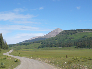
offered some gorgeous scenery. John snapped the
picture on the left; to the right we are passing through what is known
as "The Meadows" with Delores Peak (13,290 ft) in the background.
We left
around 9:30 AM and headed north on CO 145 to just past Cayton
Campground where we turned west on Dunton Road (FR535).
Gravel, narrow and quite steep in places but still fairly comfortable
for passenger vehicles, it
offered some gorgeous scenery. John snapped the
picture on the left; to the right we are passing through what is known
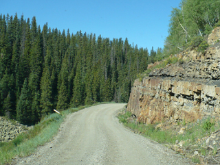
as "The Meadows" with Delores Peak (13,290 ft) in the background.Below left may, or may not, be a site where some of True Grit was filmed. Most of the movie was shot near Ridgway (which we will go through tomorrow) but some of the rural scenes were from along Dunton Road.


 A couple of miles past Dunton
(an old mining ghost town which is now a gated, exclusive
resort
– go figure!)
A couple of miles past Dunton
(an old mining ghost town which is now a gated, exclusive
resort
– go figure!)  we easily found the
well-marked Geyser Springs
Trailhead (#648). One of the things we didn't know when we
picked this
trail was
that it starts with a crossing of the Dolores River – about
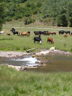
20 feet across, with no bridge. See the picture at left,
taken after
the crossing. Yes, we had to say "Hello" to the cattle, too,
but
they seemed to be used to people and just ignored us. There
are
some rocks to help break the flow
but it still required getting our feet wet. John used his
Crocs,
I
used tennies, then we both changed to hiking shoes and socks
on
the other
side; another couple who started right after us did it in bare feet,
but the rocks were way too slippery for me to try that!
we easily found the
well-marked Geyser Springs
Trailhead (#648). One of the things we didn't know when we
picked this
trail was
that it starts with a crossing of the Dolores River – about
20 feet across, with no bridge. See the picture at left,
taken after
the crossing. Yes, we had to say "Hello" to the cattle, too,
but
they seemed to be used to people and just ignored us. There
are
some rocks to help break the flow
but it still required getting our feet wet. John used his
Crocs,
I
used tennies, then we both changed to hiking shoes and socks
on
the other
side; another couple who started right after us did it in bare feet,
but the rocks were way too slippery for me to try that!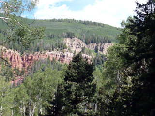 After that it was fairly easy
to follow – a couple other
small run-off creeks to cross but nothing
major. The whole
trail was uphill (elevation gain 520 feet). I started
smelling the sulfur after only about a quarter of a mile. I
associated it with fire (matches) and was a bit worried until
John
mentioned the sulfur odor and I realized what I was smelling!
We
passed a
tiny little pool on the right; then came a very rocky
switchback. When you come to the “Sensitive
area ahead” sign you're almost there! We didn't
realize
until after the fact that the trail actually leads to Colorado's only
known geyser.
After that it was fairly easy
to follow – a couple other
small run-off creeks to cross but nothing
major. The whole
trail was uphill (elevation gain 520 feet). I started
smelling the sulfur after only about a quarter of a mile. I
associated it with fire (matches) and was a bit worried until
John
mentioned the sulfur odor and I realized what I was smelling!
We
passed a
tiny little pool on the right; then came a very rocky
switchback. When you come to the “Sensitive
area ahead” sign you're almost there! We didn't
realize
until after the fact that the trail actually leads to Colorado's only
known geyser. 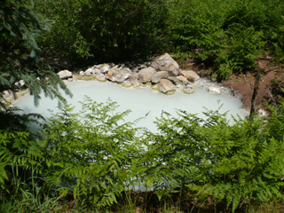 It
is a roughly 12 foot diameter pool of very
sulfuric water bubbling away (picture at right). Apparently
the
bubbling is all
that it does - no true "eruption" so we just thought it was a
"hot springs" pool until we read about it later. It's also
not
very hot since the temp is about 82°, but definitely
sulfuric and warmer than the surrounding air.
It
is a roughly 12 foot diameter pool of very
sulfuric water bubbling away (picture at right). Apparently
the
bubbling is all
that it does - no true "eruption" so we just thought it was a
"hot springs" pool until we read about it later. It's also
not
very hot since the temp is about 82°, but definitely
sulfuric and warmer than the surrounding air. There are a huge number of various kinds of flies (evidently this is a constant since they are mentioned even in the National Forest description of the trail) but other than that, the river crossing and the fact that it is uphill for a mile, it was a relatively easy trail. (No, really, that wasn't sarcasm! It WAS pretty easy!) It took us about 75 minutes to get to the pool; then 45 minutes to get back down.
Much to our amazement, as we then continued driving west on FR535, just after the Willow Divide trailhead, it became paved!! Wow. I think that's what happens when wealthy people start building elaborate homes up in the mountains - they then demand better access. We stopped at the West Dolores Campground for lunch and negotiated with a cute little chipmunk who thought he should share. Then we went off in search of Mavreeso Trail (#204) - named for the friendly Ute war chief Ma-ver-e-so.
 It
SEEMED like it should be easy to find, but without the forest service
map we
never would have located it. From FR535 (West Dolores Road)
you take FR532 (Cottonwood Road) north for about 3
miles. The problem is that the spur to the trailhead is not
signed. The road goes up steeply to the right and you can see
a
“Dead End” sign on it, but it is
marked "209." We went on up anyway since it was at
approximately the right place, and at the dead end is a
locked gate but a trail sign on the left clearly says "Mavreeso Trail
204," pictured at left. You can park there, then
walk around to the left of the gate and there is a gap
in the fence to let you onto the gravel road.
It
SEEMED like it should be easy to find, but without the forest service
map we
never would have located it. From FR535 (West Dolores Road)
you take FR532 (Cottonwood Road) north for about 3
miles. The problem is that the spur to the trailhead is not
signed. The road goes up steeply to the right and you can see
a
“Dead End” sign on it, but it is
marked "209." We went on up anyway since it was at
approximately the right place, and at the dead end is a
locked gate but a trail sign on the left clearly says "Mavreeso Trail
204," pictured at left. You can park there, then
walk around to the left of the gate and there is a gap
in the fence to let you onto the gravel road. 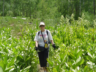 The
trail follows the road for about 100 yards then another wooden
sign points you to the left onto a hiking trail. The
first
part reminded me a bit of the game of Candyland with all of its
obstacles... there was a big, black, muddy place; then a huge
field of what I believe is known as Corn Lily or False
Hellebore -
see me wading through it at the right; then a stock pond within a
quarter of a
mile. After that we
The
trail follows the road for about 100 yards then another wooden
sign points you to the left onto a hiking trail. The
first
part reminded me a bit of the game of Candyland with all of its
obstacles... there was a big, black, muddy place; then a huge
field of what I believe is known as Corn Lily or False
Hellebore -
see me wading through it at the right; then a stock pond within a
quarter of a
mile. After that we 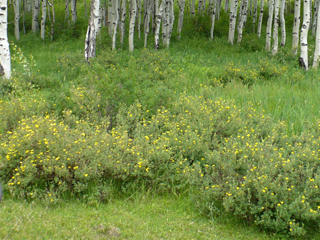 passed through fields,
aspen stands,
meadows and woods - beautiful wildflowers abound. But the
trail is all uphill. Again. At one point
it joins the road again for about 200 yards, but where it goes back
off-road is clearly labeled.
passed through fields,
aspen stands,
meadows and woods - beautiful wildflowers abound. But the
trail is all uphill. Again. At one point
it joins the road again for about 200 yards, but where it goes back
off-road is clearly labeled. We went through a second gate and stopped shortly after that at a second stock pond (picture below right).
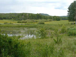 There was a lovely view, a
huge meadow
full of sunflowers, many birds and stands of aspen nearby.
The trail evidently continued but I was worn out from all the
climbing. The total elevation gain is 930 feet but we
didn't go the whole way – I estimated we went about
1.5 of the 2.5 miles but John thinks it may have been closer to 2
miles.
There was a lovely view, a
huge meadow
full of sunflowers, many birds and stands of aspen nearby.
The trail evidently continued but I was worn out from all the
climbing. The total elevation gain is 930 feet but we
didn't go the whole way – I estimated we went about
1.5 of the 2.5 miles but John thinks it may have been closer to 2
miles.
It rained about 15 minutes or so but never got hard enough for me to even take out my poncho.
 Because
of the loose rocks and poor
footing, we took an hour going back down as well as climbing
up, but coming down was far less strenuous – we
just kept a
slow pace to avoid sliding. I asked John to stand by the rock
at the left just to show its size!
Because
of the loose rocks and poor
footing, we took an hour going back down as well as climbing
up, but coming down was far less strenuous – we
just kept a
slow pace to avoid sliding. I asked John to stand by the rock
at the left just to show its size!We drove on down to Dolores and stopped at the riverside park there for a little break. I read, John checked out the river then napped briefly under a tree. Using the handi-wipes that live in the car, we tried to make ourselves a little more presentable, then went to the Ponderosa for supper. It is pretty classic "diner" food. I had grilled chicken breast and fries; John had chicken-fried steak, potato salad, roll and salad bar. The food was not remarkable but certainly acceptable and filling; the teenaged staff was not very busy so their conversation provided live entertainment for us!

We got back to the Inn shortly after 7; John took a long soak in the tub and I played on the computer, trying to find a good description of Mavreeso trail to figure out how far we actually went. No luck - I found directions to get there and just a very brief overview of the trail, but no details. That surprised me since there are so many hiking trail sites on the internet and this is in a National Forest.
Monday July 12
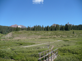
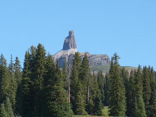 We had muffins and yogurt at the Inn for
breakfast and then took off
around 9:30 AM – we weren't in any kind of
hurry. We headed north and stopped at several viewpoints
along the highway; we said "Wow" over and over. At
the left is a view from Cross Mountain trailhead: Lizard Head peak on
the right and Cross Mountain on the left. To the right is a
closer view of Lizard Head peak.
We had muffins and yogurt at the Inn for
breakfast and then took off
around 9:30 AM – we weren't in any kind of
hurry. We headed north and stopped at several viewpoints
along the highway; we said "Wow" over and over. At
the left is a view from Cross Mountain trailhead: Lizard Head peak on
the right and Cross Mountain on the left. To the right is a
closer view of Lizard Head peak.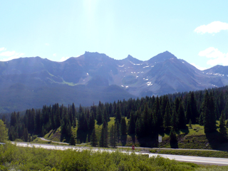
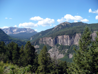
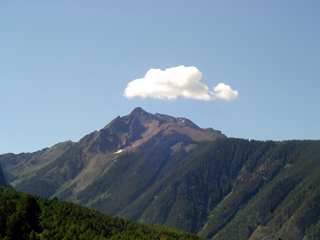
The picture at the left was taken at Lizard Head trailhead facing east; the one at the right is from another viewpoint near the Ophir Loop. Below are two pictures that John took from that same viewpoint but clearly different perspectives.

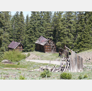
A few miles later we turned onto Alta Road and drove the 4 miles up to the 'ghost town' of Alta... and I do mean UP! It is a narrow road in places and very steep. While it's not really intended for passenger vehicles, we didn't have any trouble negotiating it and even passed several vehicles on our way back down. The picture below on the left is one of the milder segments with a nice view! In the center is a current-day resident of Alta checking us out and on the right, some of the old buildings.


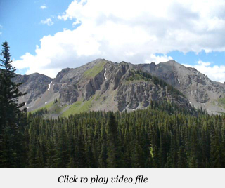
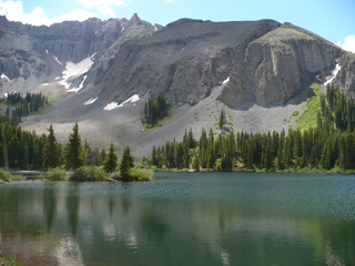 We
decided not to try to drive the last mile up to Alta
Lakes (over 11,000 ft) - while we did see others driving passenger
cars, including a
Honda Civic going about 2 mph, there were so many large rocks and big
holes, we thought it was safer to just walk than to risk significant
damage! I was surprised at how
many people were up there camping since it's rather hard to
reach over a rugged road. But the scenery
was
awesome and we
took loads of pictures. As we started back down the road I
was so struck by the stunning views, I took a panoramic video - click
the picture on the right above to see the full panorama. It
may take a minute to load but gives you a better feeling of why we kept
saying "oh wow!"
We
decided not to try to drive the last mile up to Alta
Lakes (over 11,000 ft) - while we did see others driving passenger
cars, including a
Honda Civic going about 2 mph, there were so many large rocks and big
holes, we thought it was safer to just walk than to risk significant
damage! I was surprised at how
many people were up there camping since it's rather hard to
reach over a rugged road. But the scenery
was
awesome and we
took loads of pictures. As we started back down the road I
was so struck by the stunning views, I took a panoramic video - click
the picture on the right above to see the full panorama. It
may take a minute to load but gives you a better feeling of why we kept
saying "oh wow!"


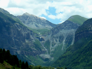 On
the left is a view of Ingram Falls on the way to Telluride - the town
is nestled down in the valley. We got there around 12:30 PM
and
were not very
impressed.
The town is really crowded; you have to pay to park and
it's still hard to
find a place. We drove to the east end
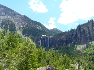
of Colorado Ave and saw Bridal
Veil Falls, on the right, but decided not to do any hiking (it
was
lunch time and hot). The pictures
below show a wider view of Bridal Veil Falls (the
tallest free falling falls in Colorado) and the area around it, and
Telluride's main street, Colorado Avenue. The
building at the top of the falls is an old hydroelectric power plant
that used to
power the Smuggler-Union Mine;
it is now a private residence but the generator has been restored and
still provides about 25 percent of
Telluride's demand for electricity.
We had lunch at
Maggie’s Bakery
and Deli – the food was very good but service was
slow. All in all,
we were quite happy to wave goodbye to Telluride and move on to Ouray!
On
the left is a view of Ingram Falls on the way to Telluride - the town
is nestled down in the valley. We got there around 12:30 PM
and
were not very
impressed.
The town is really crowded; you have to pay to park and
it's still hard to
find a place. We drove to the east end
of Colorado Ave and saw Bridal
Veil Falls, on the right, but decided not to do any hiking (it
was
lunch time and hot). The pictures
below show a wider view of Bridal Veil Falls (the
tallest free falling falls in Colorado) and the area around it, and
Telluride's main street, Colorado Avenue. The
building at the top of the falls is an old hydroelectric power plant
that used to
power the Smuggler-Union Mine;
it is now a private residence but the generator has been restored and
still provides about 25 percent of
Telluride's demand for electricity.
We had lunch at
Maggie’s Bakery
and Deli – the food was very good but service was
slow. All in all,
we were quite happy to wave goodbye to Telluride and move on to Ouray!


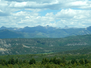 We
kept on driving, resisting taking hundreds of pictures (see the ones on
each side), and checked in at the KOA Ouray
which is between Ridgway and Ouray. Very nice
place! We set up the tent, then went
into town. We visited Switzerland of America and
signed up for a Yankee Boy Basin Jeep tour tomorrow afternoon, then
went across
the street to Ourayle House (Mr Grumpy Pants Brewing Co) where John had
the
very best beer he has ever had in his life. I don't drink
beer at all so I am not one to ask, but he has explored many different
types and he kept saying "This is the very best beer in the whole
world!" It was Uncompahgre Ayle, one of the 3 varieties on
tap
that afternoon. Hutch, owner and brewmaster, just sells beer,
no
food, and doesn't bottle it; he has 3 kinds on tap and
it's apparently all very
good. After that break, we stopped at the
grocery and then at Timberline Deli (an awesome place we
remembered from 2002) for
avocado delight sandwiches for
tomorrow's lunch.
We
kept on driving, resisting taking hundreds of pictures (see the ones on
each side), and checked in at the KOA Ouray
which is between Ridgway and Ouray. Very nice
place! We set up the tent, then went
into town. We visited Switzerland of America and
signed up for a Yankee Boy Basin Jeep tour tomorrow afternoon, then
went across
the street to Ourayle House (Mr Grumpy Pants Brewing Co) where John had
the
very best beer he has ever had in his life. I don't drink
beer at all so I am not one to ask, but he has explored many different
types and he kept saying "This is the very best beer in the whole
world!" It was Uncompahgre Ayle, one of the 3 varieties on
tap
that afternoon. Hutch, owner and brewmaster, just sells beer,
no
food, and doesn't bottle it; he has 3 kinds on tap and
it's apparently all very
good. After that break, we stopped at the
grocery and then at Timberline Deli (an awesome place we
remembered from 2002) for
avocado delight sandwiches for
tomorrow's lunch.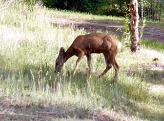
Back at camp, John made a pasta/ buffalo meat/ green pepper, marinara sauce supper (which we did NOT share with the deer). This is pretty cushy camping - they have individual "bathrooms" with toilet, sink, shower; and double sinks available for washing dishes! Next was laundry time – we both brought too many jeans and long-sleeved shirts and forgot that, even though we're in the mountains, it's HOT here in July! (My only complaint about KOA-Ouray was the laundry costs; you have to pay for 45 minutes on the driers, there are no smaller increments.)
Tuesday July 13
We started out today with a quick yogurt and fruit breakfast then went to Cascade Falls where we played around a bit (pictured on both sides) then walked the
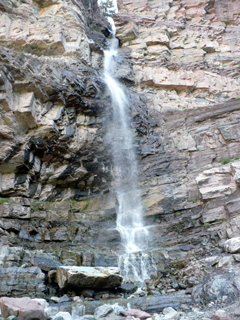 Ouray
Ouray 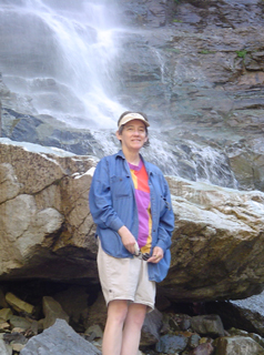 Perimeter
trail, that runs above the town, for about a mile. It was
steep
to get up and down but there were great views of the town and mountains
surrounding it.
Perimeter
trail, that runs above the town, for about a mile. It was
steep
to get up and down but there were great views of the town and mountains
surrounding it. 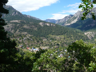
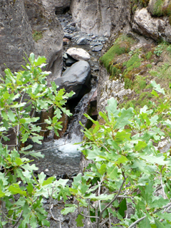
We had to hike back to the falls where we had left the car, and then we drove down to the Baby Bath Tub trail and walked about two miles round trip there. The trail follows a stream most of the way; there are interesting rock formations, several small waterfalls and a variety of plants.


We stopped at Box Canyon Falls for lunch but did not go up to see them. (We saw the falls in 2002 and were more interested in being on time for our tour.) After lunch we made a short pass through the Amphitheater Campground just to see what was there - it's very high up. I've heard it's a nice campground but it's still fairly primitive (it looked comparable to the North Rim campground at Black Canyon of the Gunnison).
Then we were off with our tour guide and driver, Dave, on the Yankee Boy Basin Jeep tour. Wow - what a great combination of lovely wildflowers, lots of history, waterfalls and stunning vistas. I know this is a lot of pictures but it's really just a small fraction of what we saw!
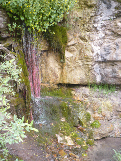
 One of the first photo ops along Camp Bird Road
was "Drinking Cup Springs" (on the left). I don't know what
the plants are that make it so colorful but it is a spring coming out
of the rocks. Legend has it that the old miners would leave a
drinking cup hanging here on a rope so anybody coming along could
quench their thirst with the cool water. A little further
along the road we passed what our guide called the "Indiana Jones rock
slide" (on the right).
One of the first photo ops along Camp Bird Road
was "Drinking Cup Springs" (on the left). I don't know what
the plants are that make it so colorful but it is a spring coming out
of the rocks. Legend has it that the old miners would leave a
drinking cup hanging here on a rope so anybody coming along could
quench their thirst with the cool water. A little further
along the road we passed what our guide called the "Indiana Jones rock
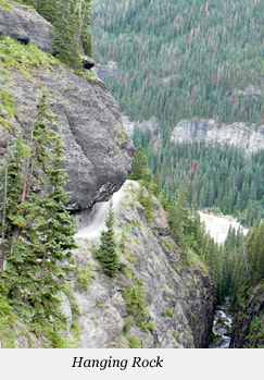
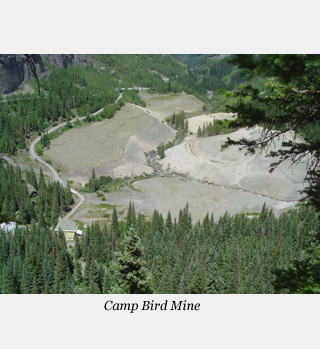
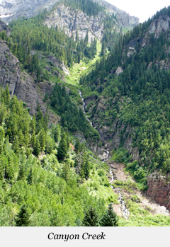
slide" (on the right). We're driving along a "shelf road." In case you aren't sure what that means exactly, check out the picture to the left below. That was taken looking back at where we had been from Imogene Pass Road. That particular spot is called "Hanging Rock" - no further explanation necessary - and yes, we did drive under it! The creek below us is Canyon Creek; a better view of it, looking down into the basin, is on the right. The center picture is Camp Bird Mine - one of the largest of the many old mines in the area. It produced gold, zinc, silver, lead and copper for almost 100 years: 1896 to 1990. The mill itself was disassembled and shipped to Mongolia by its new owner (a Canadian company) where, apparently, it is still producing!

 One of the other mine sites that we visited was
the Tornado Eclipse mine. On the left are the ruins of the
old chute and mill house. For safety reasons, the
owners wanted to secure the entrance (adit) to the mine, but
environmentalists were concerned about the large colony of bats that
lived there. So what you see on the right keeps people out,
but lets the bats come and go freely!
One of the other mine sites that we visited was
the Tornado Eclipse mine. On the left are the ruins of the
old chute and mill house. For safety reasons, the
owners wanted to secure the entrance (adit) to the mine, but
environmentalists were concerned about the large colony of bats that
lived there. So what you see on the right keeps people out,
but lets the bats come and go freely!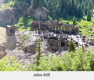
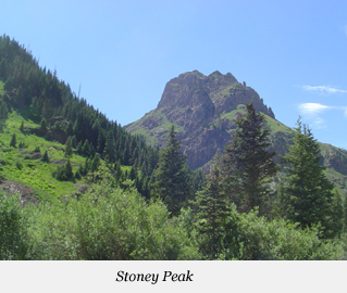 Another
old mine site includes the ruins of the Atlas Mill (left), which we
were told is the oldest structure still standing in the canyon - it was
built in 1893. Stoney Peak (right) looks over the Atlas Mill
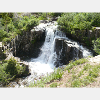
site. Continuing on up to the end of the Yankee Boy Basin, we
came to the Twin Falls that may be recognizable by some as the old
Coors Beer logo (from around the mid-80's up to about 2000). I think
that just the mountain peaks in the background (as in the picture on the
left below) appear now. We spent some time here wandering
around and enjoying the wildflowers as well as the falls.
Another
old mine site includes the ruins of the Atlas Mill (left), which we
were told is the oldest structure still standing in the canyon - it was
built in 1893. Stoney Peak (right) looks over the Atlas Mill
site. Continuing on up to the end of the Yankee Boy Basin, we
came to the Twin Falls that may be recognizable by some as the old
Coors Beer logo (from around the mid-80's up to about 2000). I think
that just the mountain peaks in the background (as in the picture on the
left below) appear now. We spent some time here wandering
around and enjoying the wildflowers as well as the falls. 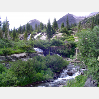


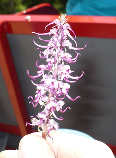
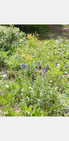
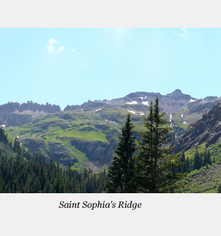
The flower in the middle above was new to us - it's called Elephantella, presumably because they look like a series of small elephant heads! Of course, the basin is also surrounded by mountains. On the right, below, Saint Sophia's Ridge is the "toothy" looking part, the peak to the right of it is Mount Emma. See the gap in the teeth (about a third of the way over from the left)? Telluride is on the other side - each fall about 1200 runners go through that gap to get from Ouray to Telluride during the Imogene Pass run. Shaking head in awe....
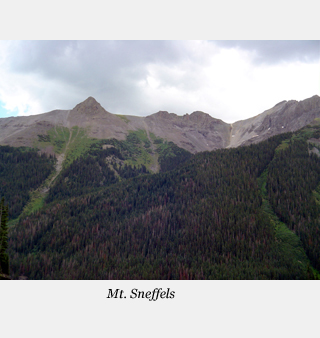

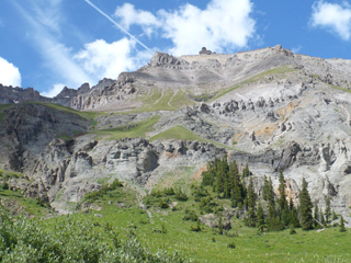
 These
are just two more views that I had to share! We experienced many
different types of beauty this afternoon. And by the time we got back,
we were pretty exhausted! We had
supper at the Saloon, a restaurant connected to the Historic Western
Hotel down on 7th street. John had trout and
I had lasagna, both of which were very good. They have a nice
outdoor terrace and prices were quite reasonable.
These
are just two more views that I had to share! We experienced many
different types of beauty this afternoon. And by the time we got back,
we were pretty exhausted! We had
supper at the Saloon, a restaurant connected to the Historic Western
Hotel down on 7th street. John had trout and
I had lasagna, both of which were very good. They have a nice
outdoor terrace and prices were quite reasonable. We are somewhat sorry to have to leave in the morning - we could easily have spent a couple of weeks in this area and not run out of things to do or see!