Friday,
September 14
 We
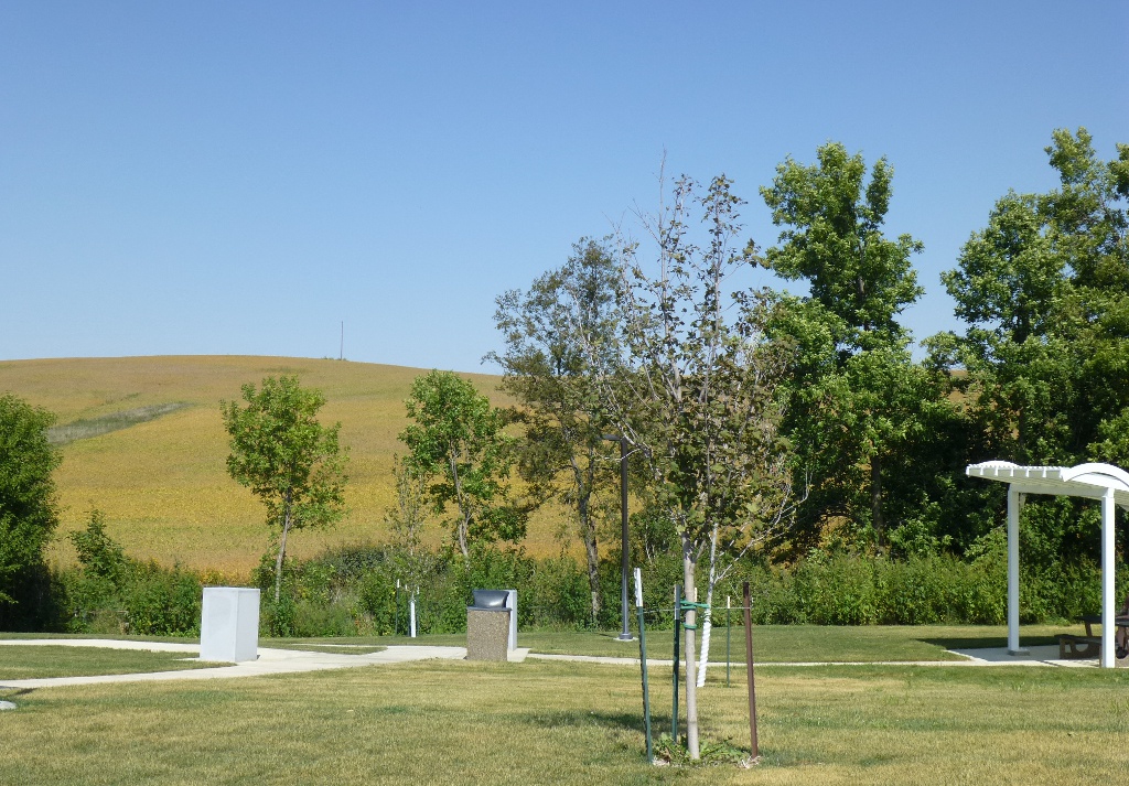
left home around 9:30 Friday morning, stopped in western Iowa at a nice
rest
stop for lunch (at right) and got to Kearney, Nebraska around 5 PM. We went to the Cabelas Outlet Store there - John was
looking for some good
hiking boots, but didn’t find any that fit right. We spent the night at Midtown
Western Inn:
a family-owned motel that was a great value for low cost!
It's
about 1.5 miles from I-80 on 2nd Ave (the main "strip"). Had
good
(secure) WiFi, nice climate control system, very comfortable rooms. Had
supper just across the street at the
Gourmet House – Japanese Cuisine. That was also a serendipitous find!
John
had Pork Yaki Udon plus a
sushi roll and I had Coconut Chicken. In fact, we liked it so
much, we went back for dinner on our way home even though we didn't
stay in Kearney overnight on the return trip.
We
left home around 9:30 Friday morning, stopped in western Iowa at a nice
rest
stop for lunch (at right) and got to Kearney, Nebraska around 5 PM. We went to the Cabelas Outlet Store there - John was
looking for some good
hiking boots, but didn’t find any that fit right. We spent the night at Midtown
Western Inn:
a family-owned motel that was a great value for low cost!
It's
about 1.5 miles from I-80 on 2nd Ave (the main "strip"). Had
good
(secure) WiFi, nice climate control system, very comfortable rooms. Had
supper just across the street at the
Gourmet House – Japanese Cuisine. That was also a serendipitous find!
John
had Pork Yaki Udon plus a
sushi roll and I had Coconut Chicken. In fact, we liked it so
much, we went back for dinner on our way home even though we didn't
stay in Kearney overnight on the return trip.
Saturday September
15
 We
had breakfast in our room and left around 9 AM, heading for Denver
where we stayed with friends for a couple of days. We
stopped in Sterling, Colorado because it was time for lunch and they
were having a Sugar
Beet festival! You know the drill
- a community party of sorts with lots of vendors, activities, music,
food. We
saw some inflatable activities that made me wish I was a kid
again
- see them crawling on water at the left. We wandered through
the
flea market and watched some fun and games for a little while. John
saw this as an opportunity to have a corn dog since he (surprisingly)
hadn't found one in Iowa all summer long. He also couldn't
resist
a smothered enchilada.
We
had breakfast in our room and left around 9 AM, heading for Denver
where we stayed with friends for a couple of days. We
stopped in Sterling, Colorado because it was time for lunch and they
were having a Sugar
Beet festival! You know the drill
- a community party of sorts with lots of vendors, activities, music,
food. We
saw some inflatable activities that made me wish I was a kid
again
- see them crawling on water at the left. We wandered through
the
flea market and watched some fun and games for a little while. John
saw this as an opportunity to have a corn dog since he (surprisingly)
hadn't found one in Iowa all summer long. He also couldn't
resist
a smothered enchilada.
So we were a little later than
we had thought getting to Denver, but we arrived about 3 PM.
I have known Wendy for about 7 years but had never
met any of her family - they are just delightful!
She and her husband, Kevin, have 3 boys ranging in age from 16 down to
4. What fun! We so enjoyed getting to know them.
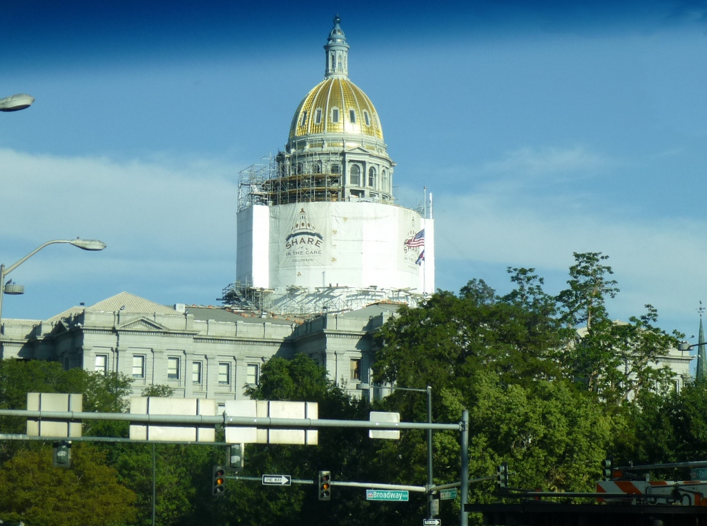 Kevin
took us for a short driving tour of Denver. We got a little
feel for the city, saw the Capitol (evidently undergoing some sort of
maintenance at the moment), city hall and various urban art; went into
the Brown Palace Hotel for a few minutes and were wowed by the lobby
and ceiling. It was
a very pleasant
afternoon, yummy chicken dinner and delightful company.
Kevin
took us for a short driving tour of Denver. We got a little
feel for the city, saw the Capitol (evidently undergoing some sort of
maintenance at the moment), city hall and various urban art; went into
the Brown Palace Hotel for a few minutes and were wowed by the lobby
and ceiling. It was
a very pleasant
afternoon, yummy chicken dinner and delightful company.
Sunday September 16
We started by joining the family at Church in the
morning; then after
lunch the adults and 2 younger boys went to the Denver
Botanical
Garden. Such a delightful place!
It costs $12.50 for adult
admission but was definitely worth it - very
nicely laid out and everything was well-labelled. The temporary exhibit
was
bonsai which is one of John's favorite things. Before we
left,
we spent a few minutes
in the children’s garden which is amazing - there were lots of
activities
including a "water and sand" place
where they can wade and built sand architecture.
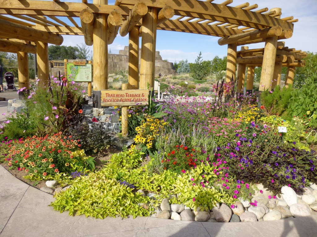
Below
on the left is the "Birds and Bees" walk - full of colorful flowers
that also attracted butterflies! In the center is a pool with
grasses on the left, water lilies in the pool and some interesting
kinetic bamboo art on the right. We also saw a short video
about
how some of the large bamboo pieces were constructed - fascinating.
Finally, on the right is one section of the rooftop
children's
garden. Definitely a place I'd return to!
Sunday evening, the adults went
to dinner at Domo
– a very nice
Japanese
"country foods" restaurant. The weather was
so pleasant that we sat
on the outdoor terrace, which is a lovely garden. The food was
excellent and plentiful. They
started by bringing out six different, what they termed, side dishes,
though they served as appetizers.
What a great idea! We got to sample a lot of
different
things we'd never find anywhere else! The entrees we ordered
arrived
just as we were finishing up the sides. We
all ate our fill and took home a
couple of quarts of leftovers. Recommend it.
Monday September 17
 Though
we thoroughly enjoyed our visit, it was time for them to get back to a
work week and for us to move on to the mountains! Besides the
wonderful visit, I think it
was a good idea for us to have had a couple of days at around 5,000
feet before
moving up to Rocky Mountain National Park and trying to hike in higher
altitudes! After breakfast, we went to Big
5 Sporting Goods where
John found a great buy on hiking shoes and we both bought some quality
hiking
socks. The prices were so amazing that I tried on some shoes,
too, but none felt just right. Then we made a Safeway stop
for a few days' worth of food and headed west on I-70 out of Denver!
Though
we thoroughly enjoyed our visit, it was time for them to get back to a
work week and for us to move on to the mountains! Besides the
wonderful visit, I think it
was a good idea for us to have had a couple of days at around 5,000
feet before
moving up to Rocky Mountain National Park and trying to hike in higher
altitudes! After breakfast, we went to Big
5 Sporting Goods where
John found a great buy on hiking shoes and we both bought some quality
hiking
socks. The prices were so amazing that I tried on some shoes,
too, but none felt just right. Then we made a Safeway stop
for a few days' worth of food and headed west on I-70 out of Denver!
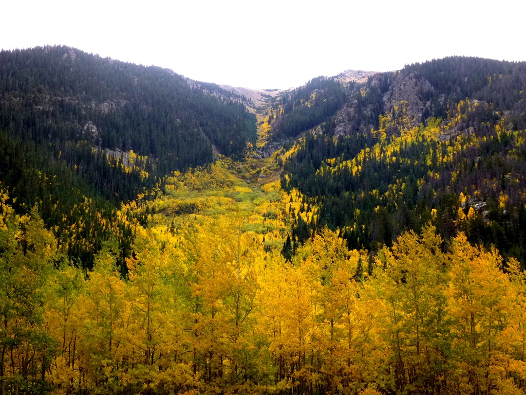
It was an interesting drive! 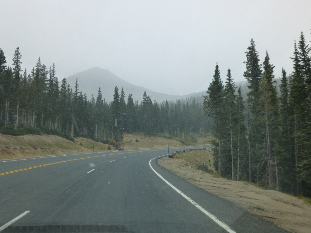 First
we encountered views like the one at the left above, on Highway 40
heading
towards Granby. The colors just stopped us in our tracks.
You
can tell even from that picture, though, that the sky was overcast and
cloudy. Then, as we got closer to Grand Lake, it started to
SNOW (at right)! Since we were planning to tent camp about
half of the time, I really started to second guess this whole idea!
But it changed to just rain around Grand Lake. We
stopped at the Kawuneeche Visitor Center, bought a
Colorado bird book and got some more specific information about hiking
trails in that area, then went on into Rocky
Mountain National Park (RMNP) to Timber Creek
Campground.
First
we encountered views like the one at the left above, on Highway 40
heading
towards Granby. The colors just stopped us in our tracks.
You
can tell even from that picture, though, that the sky was overcast and
cloudy. Then, as we got closer to Grand Lake, it started to
SNOW (at right)! Since we were planning to tent camp about
half of the time, I really started to second guess this whole idea!
But it changed to just rain around Grand Lake. We
stopped at the Kawuneeche Visitor Center, bought a
Colorado bird book and got some more specific information about hiking
trails in that area, then went on into Rocky
Mountain National Park (RMNP) to Timber Creek
Campground.
Besides the park map and information from the visitor centers, we had
brought with us
Rocky
Mountain National Park: The Complete Hiking Guide by Lisa Foster.
This was a great resource for us. Some reviewers
have
complained about the organization and I admit it could have probably
been more user-friendly. But she includes some helpful maps
and
descriptions of every single hiking trail in the park, sorted by
location, and also indicated those that are "Family friendly" which I
found helpful. In an Appendix, each trail is listed along
with
its Trailhead, length, type of route, altitude (and gain) and, for
serious hikes, difficulty ratings. I found that, flipping
back
and forth between the Appendix and the section listings we were able to
sort out which hikes would be within our reach - geographically and
physically! The book was available widely in the area (Park
gift
stores, book store in Estes Park) and also through Amazon or Barnes
& Noble.
By the time we got to the
campground the rain had stopped. We got the tent set up at site 23 - right across
from a nice, running water, flush toilet
restroom. And it
rained again as soon as
we got the fly on! I
went ahead and set
up the mattress and bedding inside and by then the sun was back out. We set up the "shade
shelter" over the table
– for its mild rain protection, not shade.  There actually isn't any shade in the campground
any more because so many dead trees had to be removed due to
the pine
beetle, but it was COLD, so
the
sun was actually appreciated. It
was about 55° when we got there and once
we cleaned up from our chili supper the sun had gone down and we were
ready to burrow into the
tent until morning! We
knew it was
supposed to go down to freezing overnight, but the forecast calls for
70's during the day. We can
hope!
There actually isn't any shade in the campground
any more because so many dead trees had to be removed due to
the pine
beetle, but it was COLD, so
the
sun was actually appreciated. It
was about 55° when we got there and once
we cleaned up from our chili supper the sun had gone down and we were
ready to burrow into the
tent until morning! We
knew it was
supposed to go down to freezing overnight, but the forecast calls for
70's during the day. We can
hope!
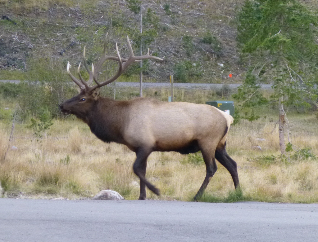
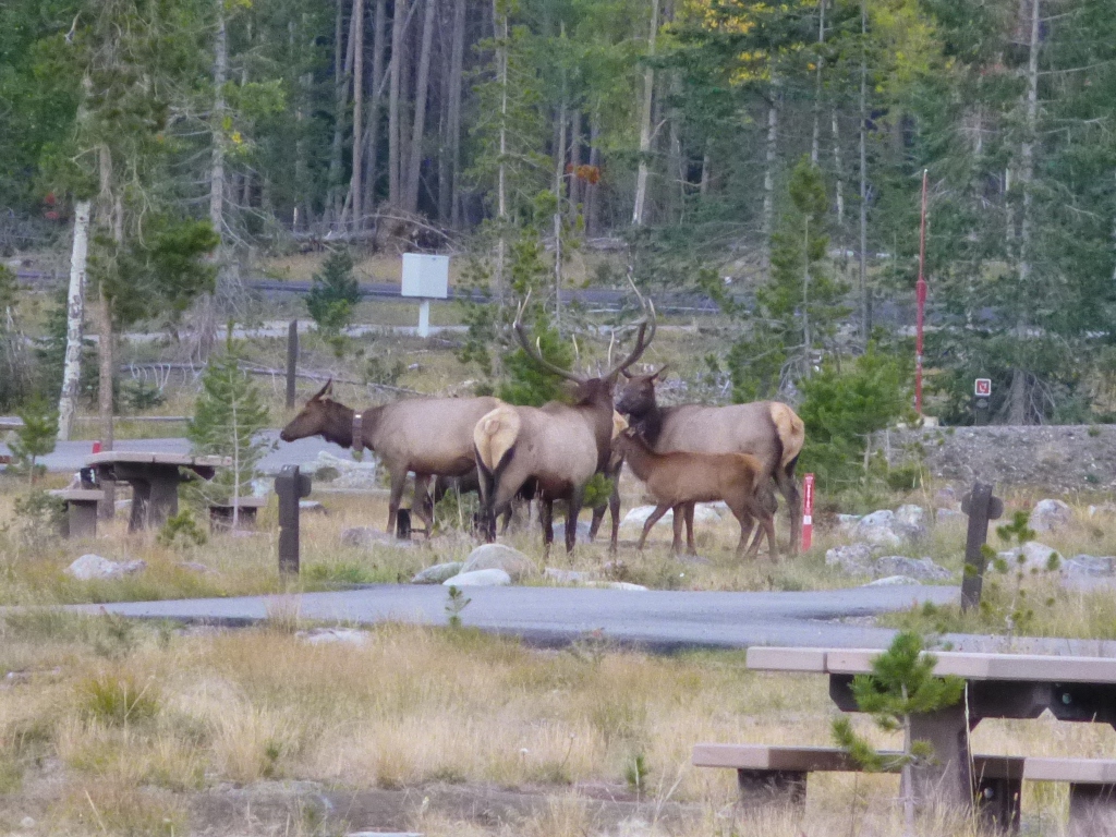
Before it actually got dark, though, we were in for another treat.
Papa Elk brought his family through the campground for
evening snack! He tried to keep them together but
mostly they just did what they wanted to. He
trumpets/bugles at them
and they ignore him. Apparently
they really enjoy the grass or weeds in the campground
because they come back every morning and every evening.
Later we noticed them going around to all of the fire pits
but I'm not sure what they are finding there that is of interest to
them. The youngsters (calves) scream at night
and
sound like someone is torturing a small child. Fortunately it doesn’t last too long and they didn't
really disturb our rest.
Tuesday September 18
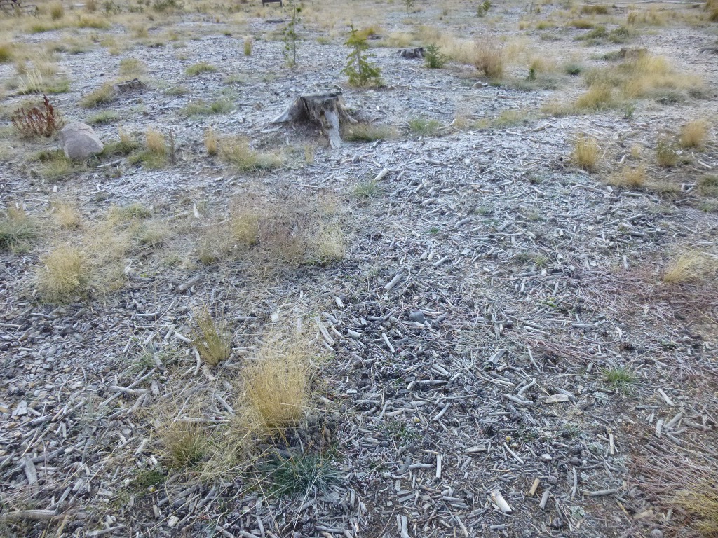
Last
night it got plenty cold and everything was frosted (right)
when I got up this morning. I couldn’t
bring myself to do anything in the cold, so I crawled back into bed
until 8 AM when
the sun finally peeked
over the
mountain. But once the sun does get up, the air warms
up
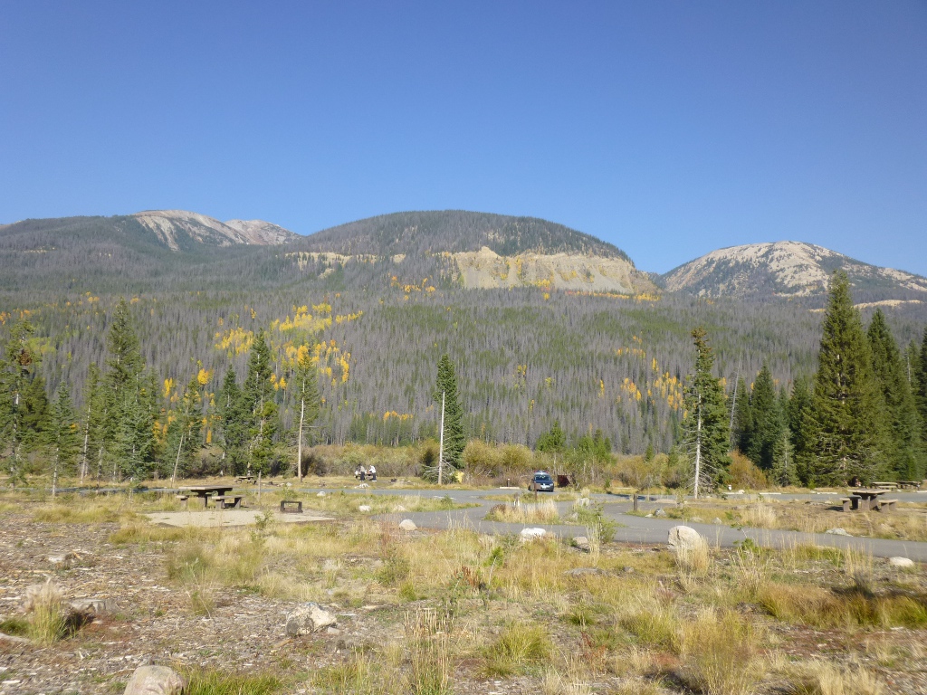
nicely and the views are wonderful! At left is the "Grand
Ditch" as seen from our campsite - and notice the nice blue sky.
You can tell the campground is nearly empty in
midweek in mid-September, though this side of the park
never gets as crowded as the Estes Park side does.
We had oatmeal,
bread, peanut butter and a
couple of muffins for
breakfast, then went off to the Holzwarth Historic Site. It’s
close so we just walked – part of the Colorado River Trail
runs through the campground and goes right to the site.
Walking there and back and around the site a little was only
about
2 miles
total. 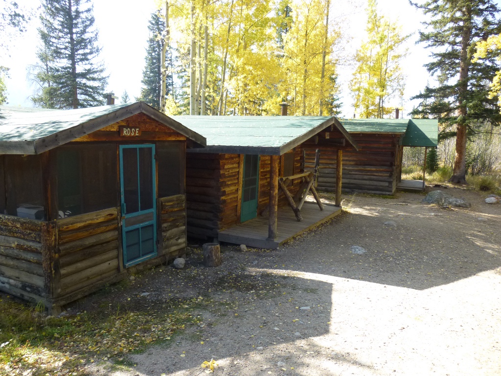
 It was flat
and a good beginning
for us to get used to being at 9,000 feet. This was an old
"guest
lodge" from the 1920's. The cabins were closed up so we
couldn't get in but it was a nice walk; John stopped and looked at rocks
by the river for a while - the first of many "rock stops!"
It was flat
and a good beginning
for us to get used to being at 9,000 feet. This was an old
"guest
lodge" from the 1920's. The cabins were closed up so we
couldn't get in but it was a nice walk; John stopped and looked at rocks
by the river for a while - the first of many "rock stops!"
We walked back to camp for
lunch and then went off to the south to East Shore Trail that runs
along the east side (duh) of
Shadow
Mountain Lake. Very
nice. A few
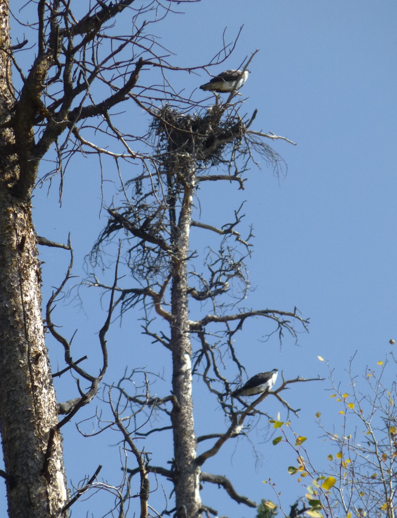
pictures below. We saw a pair of ospreys that we would have
missed except that they were very unhappy about us walking near their
nest so they squawked at us. We
went
about 2 miles down the trail, then
back – we’re still getting used to the altitude and wow – we are
gasping after
any sort of grade at all.


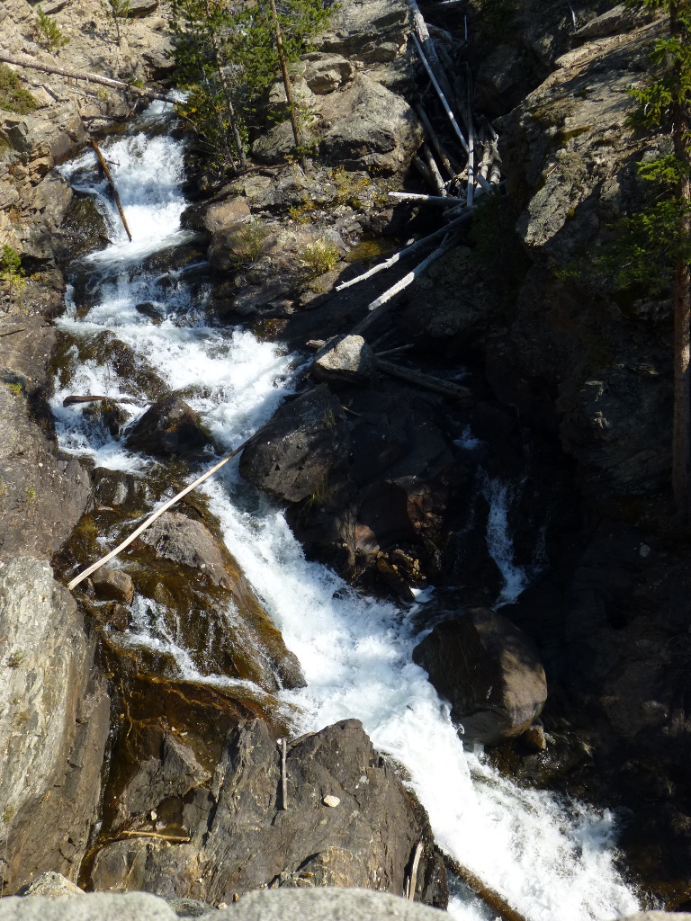
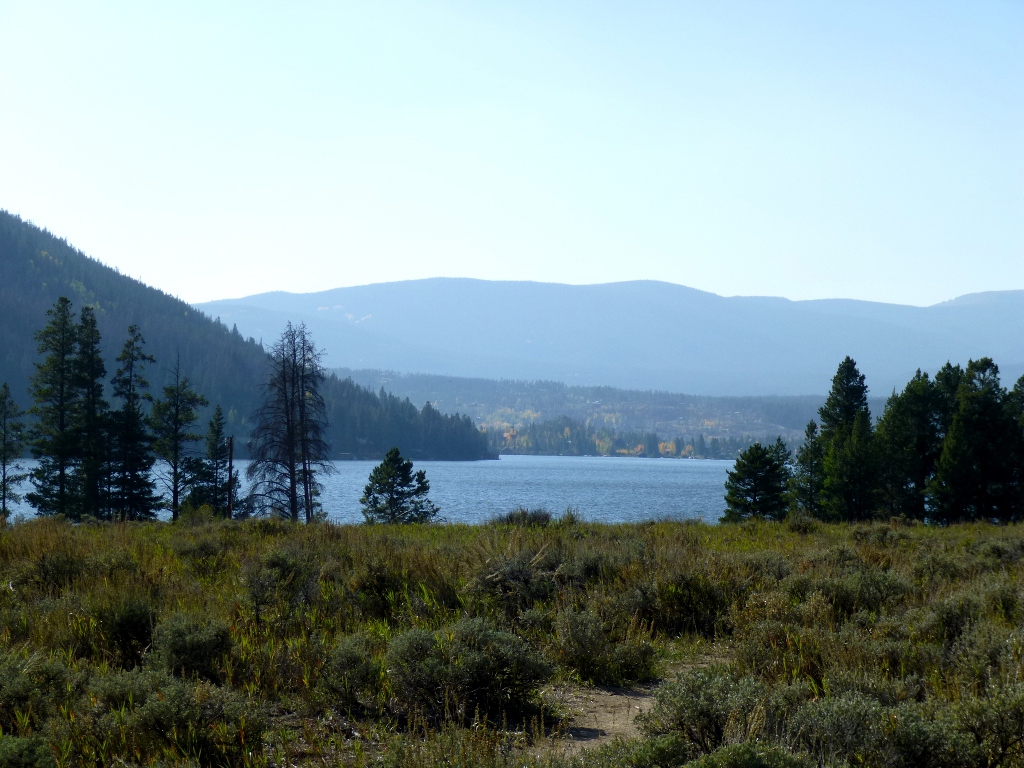
Finally we drove
down to East Inlet Trailhead and
walked to
Adams Falls. That's less than a mile but it is "uphill" and
we had to stop several times! That was another mile,
making about 7 miles total for today. Not a bad start and our
first
waterfall of the trip, too. Below is Adams Falls in the
center, a view from the falls on the left and Grand Lake, which is near
the trailhead, on the right.
We
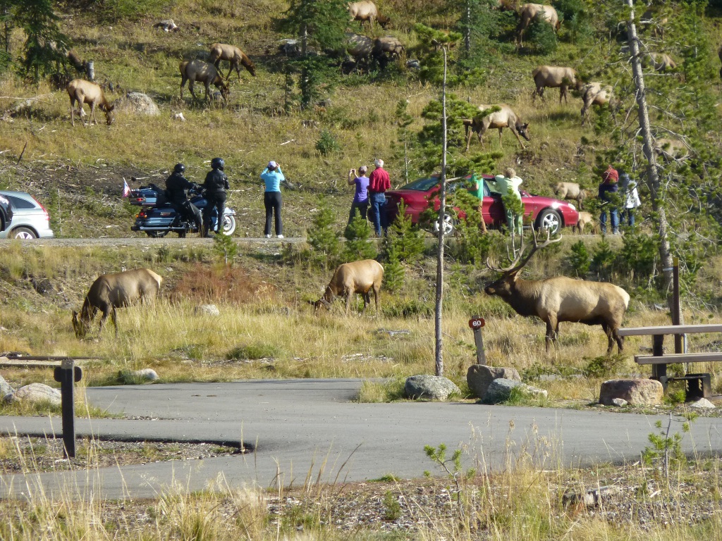
got back to the campground and discovered that this evening the bull
elk brought the whole darned herd! They were on both sides of
the
road, scattered all over the hillside, and causing somewhat of a
traffic jam. After snapping a few pictures, I fixed chicken
breasts and brocolli for supper (using a sauce
"packet" - quick and easy). John built a fire, hoping it
would keep us warm enough to stay up past 8 PM! It was
beautiful
today and we were hiking in t-shirts, but it's supposed to go down to
26° tonight. That does make it rather uncomfortable to go to
the
bathroom at 3 AM.

After we got tucked in tonight, I had the brilliant idea that I
could read with my Nook Color in the dark, since it is backlit.
So I turned it on. I don't know whether it was the
cold,
the altitude or just a fussy Nook, but it went into "format" mode and I
couldn't stop it! So it totally reformatted itself, going
back to
original factory settings and then came to a grinding halt when it
couldn't find a network to attach to. Very frustrating.
All
I could do was turn it off and put it away until such time we are near
WiFi again.
Wednesday September 19
I had a headache overnight which I
think may have
been from altitude. Interesting that it didn't bother me at
all during the day, but some ibuprofen cleared it up. Last
night wasn't as cold as the night before but there was still some frost
sprinkled around when I got up.
We got our day-hiking packs
together, had breakfast, signed in for one more
night at that campground then drove up to the Colorado River Trailhead
that’s not
too far
north from here. We
hiked up to the Lulu
City site and back – about 7 miles, but a lot steeper than the walks we
did
yesterday. We got
on the trail at around
10:20 AM or so, reached the 2 mile mark about 11:30,
then the Lulu City site at 12:30.
 That's
actually a very good time for us - 3.5 miles mostly uphill
and stopping for a lot of pictures! My general rule for
hiking in
the mountains is to allow an hour for each mile. I started
out
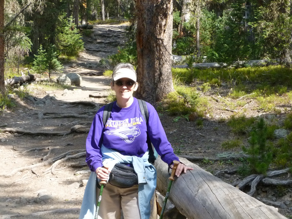
wearing 3 layers - in the picture above, you can see that I had already
shed the denim shirt. By the time we got to our destination,
I
was down to just a light short sleeved t-shirt for the rest of the day.
That's
actually a very good time for us - 3.5 miles mostly uphill
and stopping for a lot of pictures! My general rule for
hiking in
the mountains is to allow an hour for each mile. I started
out
wearing 3 layers - in the picture above, you can see that I had already
shed the denim shirt. By the time we got to our destination,
I
was down to just a light short sleeved t-shirt for the rest of the day.
 The trail started out very
steeply for a short distance so I
brought my hiking sticks, though John thought he could do without them. Only that first part was
VERY steep,
but it was pretty much uphill the whole way and
the last quarter of a mile was very steep
DOWNhill into the
river valley and the Lulu
City site. I was
glad to have the poles to help me down that. There were
several rock
slides along the
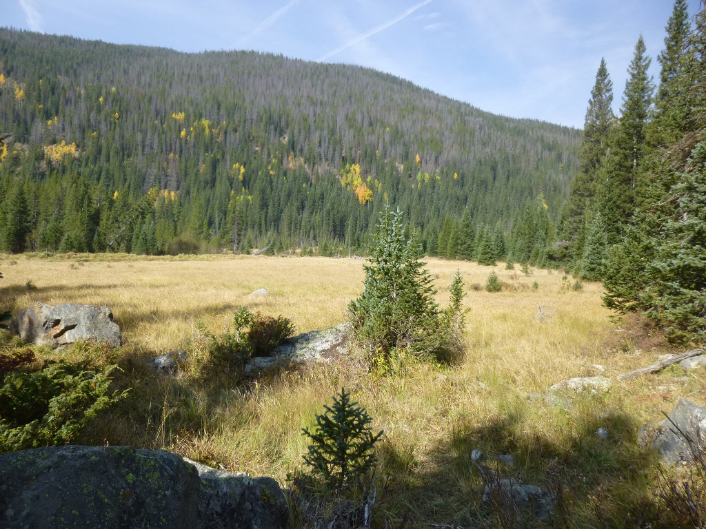
trail and some nice views (above right and a meadow at left).
The trail started out very
steeply for a short distance so I
brought my hiking sticks, though John thought he could do without them. Only that first part was
VERY steep,
but it was pretty much uphill the whole way and
the last quarter of a mile was very steep
DOWNhill into the
river valley and the Lulu
City site. I was
glad to have the poles to help me down that. There were
several rock
slides along the
trail and some nice views (above right and a meadow at left).
 There
isn’t much left to indicate a city once existed up there. We
saw what looked like one ruin and I read
back at the trailhead that it was actually a bear trap! The
trail followed the Colorado River but much of the time it was way high
above
the river which is
very shallow this year - they've had a summer of drought as we did here
in
Iowa - so we
didn’t even hear it gurgling much. We
crossed numerous little streams or creeks and they, too, were pretty
low or
totally dried up.
There
isn’t much left to indicate a city once existed up there. We
saw what looked like one ruin and I read
back at the trailhead that it was actually a bear trap! The
trail followed the Colorado River but much of the time it was way high
above
the river which is
very shallow this year - they've had a summer of drought as we did here
in
Iowa - so we
didn’t even hear it gurgling much. We
crossed numerous little streams or creeks and they, too, were pretty
low or
totally dried up.
 We
sat by the
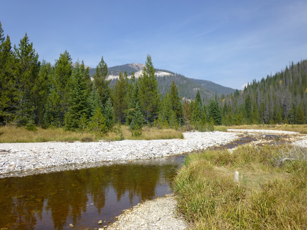
river and had lunch with a lovely view. (Pictured both right
and
left.) We were actually sitting on a log IN the river
bed because
the
river is
so low now. John
scouted
around a little, finding some interesting driftwood and rocks. We
had seen some birds back in Shipler’s Meadow that we thought looked
like a type of jay so
he looked them up in the bird book.
We
sat by the
river and had lunch with a lovely view. (Pictured both right
and
left.) We were actually sitting on a log IN the river
bed because
the
river is
so low now. John
scouted
around a little, finding some interesting driftwood and rocks. We
had seen some birds back in Shipler’s Meadow that we thought looked
like a type of jay so
he looked them up in the bird book. 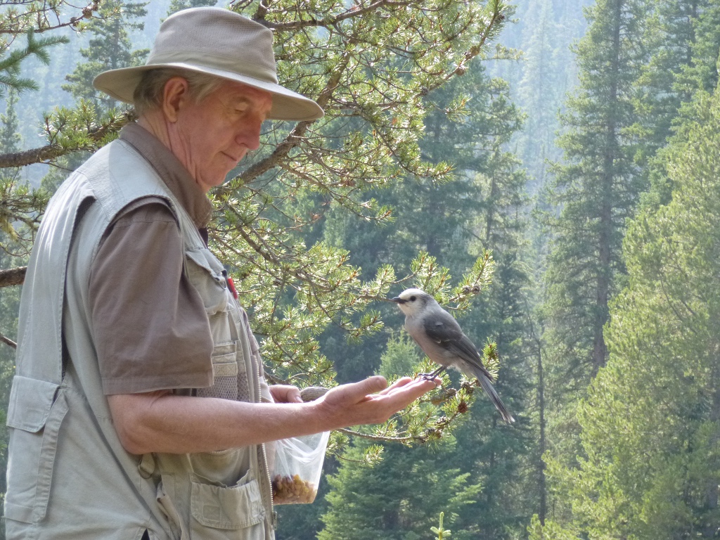 They
are indeed Gray
Jays that only live in high altitudes;
the book said they were easily tamed and loved to snack with
people. So John
got a raisin out of his trail mix, put it
in the palm of his hand and sure enough, a jay miraculously appeared,
came hopping over, grabbed the raisin
and flew away! After
that, every time we
took a break he got out the trail mix and offered some nuts or dried
fruits. At our last
stop - in Shipler’s Meadow on the
way back down - he had them lined up in a tree, taking turns snatching
a bit of fruit or nut!
They
are indeed Gray
Jays that only live in high altitudes;
the book said they were easily tamed and loved to snack with
people. So John
got a raisin out of his trail mix, put it
in the palm of his hand and sure enough, a jay miraculously appeared,
came hopping over, grabbed the raisin
and flew away! After
that, every time we
took a break he got out the trail mix and offered some nuts or dried
fruits. At our last
stop - in Shipler’s Meadow on the
way back down - he had them lined up in a tree, taking turns snatching
a bit of fruit or nut!
 Just
beyond the Shipler’s meadow
(on the way up) there is a
little wooden sign that points to a "PRIVY" off to the left. We passed
it by on the way
up but I went to
check it out on the way back down. It’s
a small log structure that does indeed have a vault toilet, pictured at
left. No paper, no door. But it’s a step above
sitting on a log or
leaning against a tree and probably helps the environment, too!
Just
beyond the Shipler’s meadow
(on the way up) there is a
little wooden sign that points to a "PRIVY" off to the left. We passed
it by on the way
up but I went to
check it out on the way back down. It’s
a small log structure that does indeed have a vault toilet, pictured at
left. No paper, no door. But it’s a step above
sitting on a log or
leaning against a tree and probably helps the environment, too!
We sat by the river and relaxed
for an hour so started back
down (well, actually UP that first steep part coming out of the valley)
about
1:30. I was
astonished that we got back
at 3:40, meaning it took us just about as long coming down than going
up, even
though the only “uphill” part coming back was that first quarter of a
mile. John thinks
we were just tired so that we
were setting a slower pace. We
stopped a
couple of times for pictures and to let the jays entertain us but we
stopped way
more frequently
going up. He’s
probably right that we
were just exhausted, but we weren't in a hurry so were not concerned
about the time.
 When we got back to camp, I
heated up some water and went to
the restroom building to wash my face and hair.
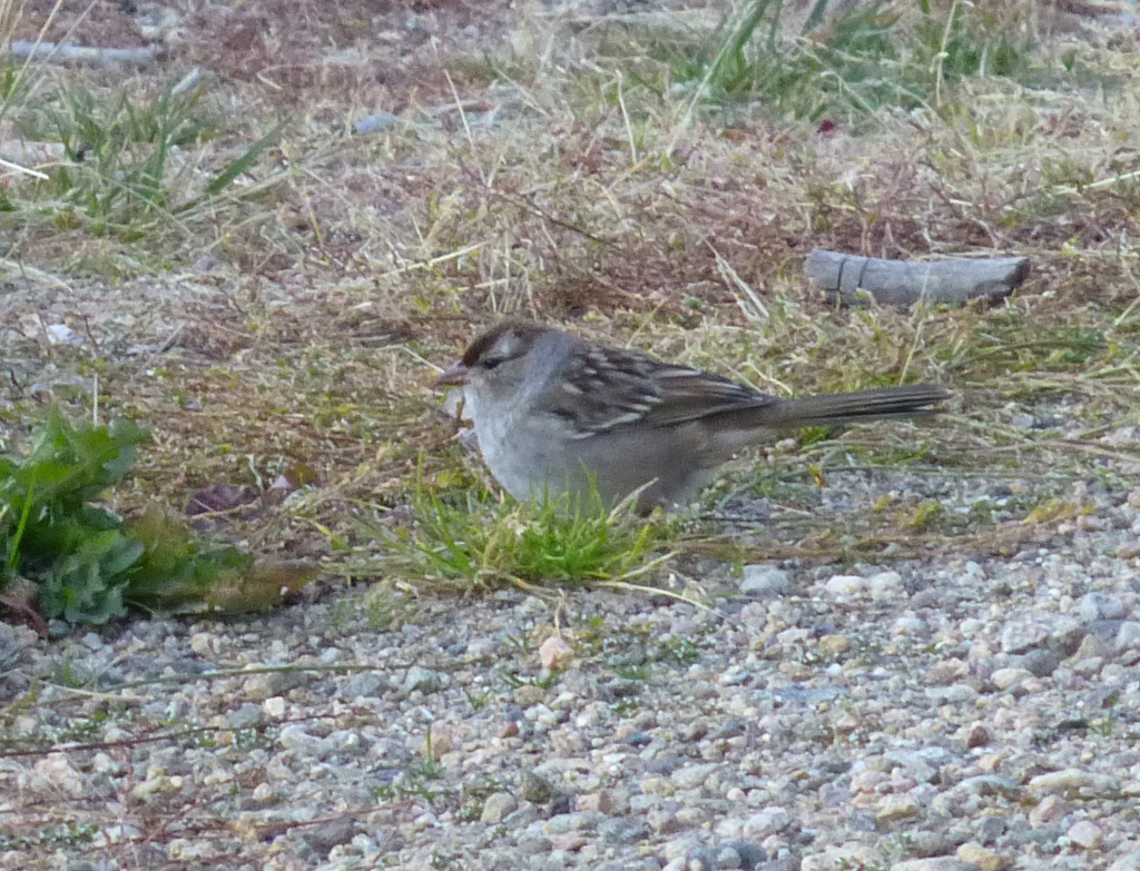
This little white crowned sparrow seems to hang out in a bush
just outside the Women's Room. He's rather skittish but came
out
of his bush long enough for a picture so I could look up what he
is!
When we got back to camp, I
heated up some water and went to
the restroom building to wash my face and hair.
This little white crowned sparrow seems to hang out in a bush
just outside the Women's Room. He's rather skittish but came
out
of his bush long enough for a picture so I could look up what he
is!
Oh my, it was nice to feel a
little cleaner! I also
plugged my camera battery
in to charge – there is one outlet in the bathroom and campers take
turns
using
it for charging various electronics. I have 2 batteries and swapped them up at
Lulu City. That works
nicely as long as we have power available every
couple of days to recharge. But
I also brought my
Kodak “back up” camera that works on AA batteries. I’ve had too many camera crises to go anywhere with
only one camera anymore!
We’re leaving this side
of the park tomorrow morning and heading east. We’re both
tired
enough that our plan is to just drive Trail Ridge Road, stop
at
overlooks and rest areas. Then the hope is to find a
motel for a couple
of nights in Estes Park, get rested up (warmly), do laundry, take baths
and showers, then maybe do
some more
camping at Moraine
Park. We
definitely need ice
tomorrow but we can get some in Estes Park.
Thursday, September
20 -
We broke camp this morning and were on the road by 9:30.
Surprisingly, neither of us felt too achy but we still decided to take
the drive across Trail Ridge
Road slowly: to stop a lot, take pictures, maybe some short walks.
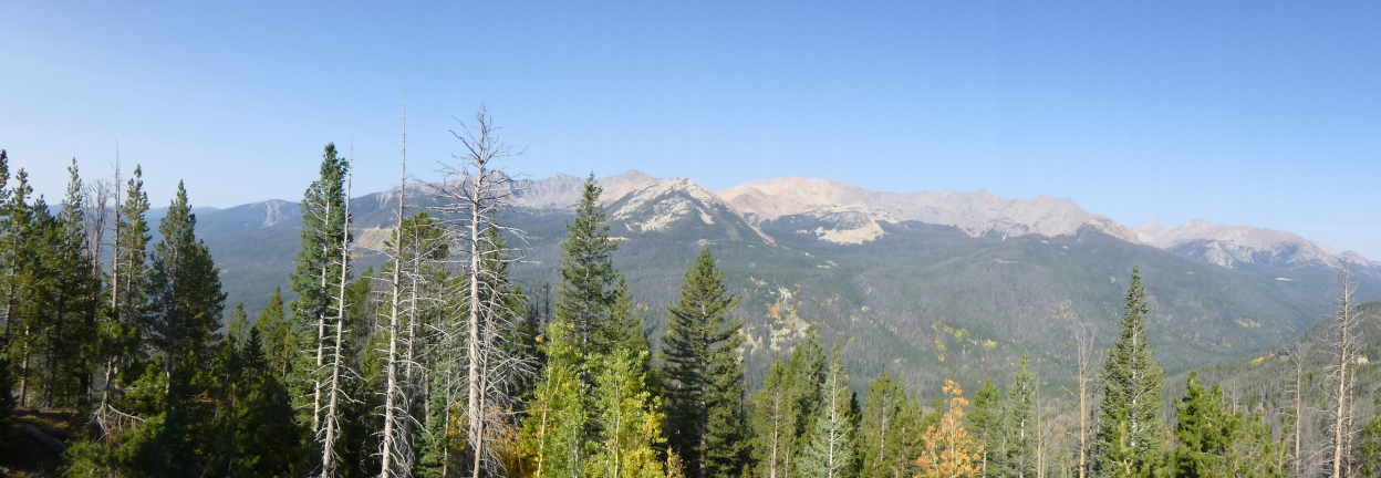
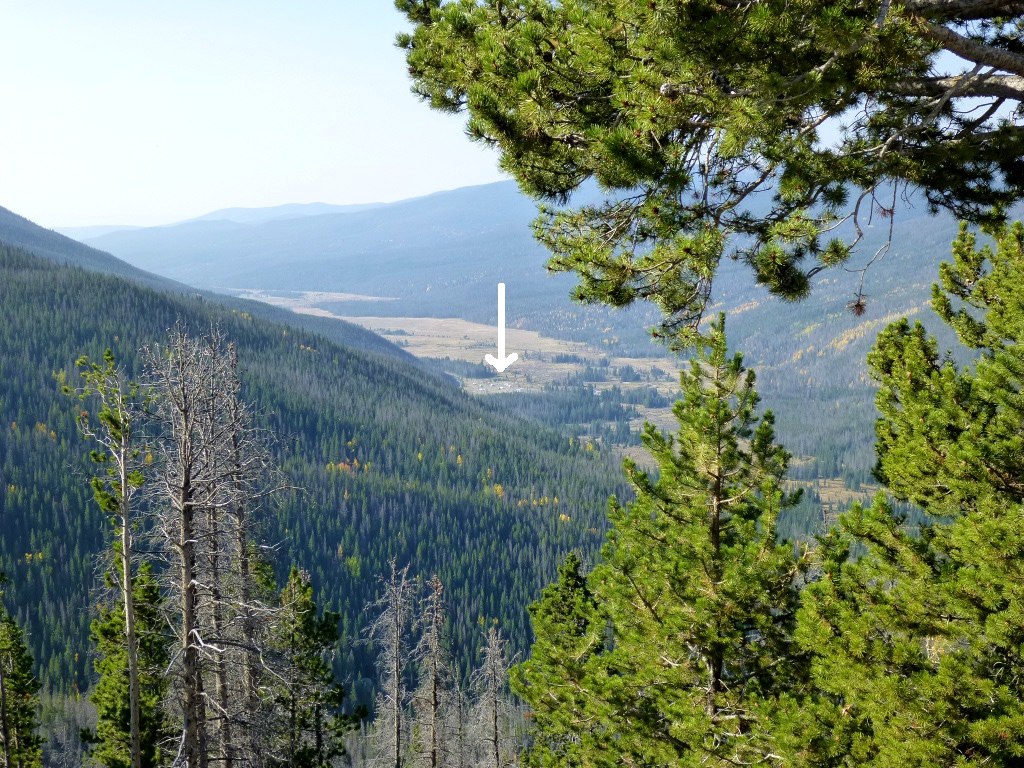 At
the Farview Curve, I took the above panorama of Never
Summer Mountains.
Lots of awesome views. We were surprised to see that we could
see
Timber Creek Campground in the picture at left - way below us.
The white arrow is pointing at it just above the
center of
the picture - we climbed a lot of altitude pretty quickly!
At
the Farview Curve, I took the above panorama of Never
Summer Mountains.
Lots of awesome views. We were surprised to see that we could
see
Timber Creek Campground in the picture at left - way below us.
The white arrow is pointing at it just above the
center of
the picture - we climbed a lot of altitude pretty quickly!
Our next stop was at
Lake Irene (at right). 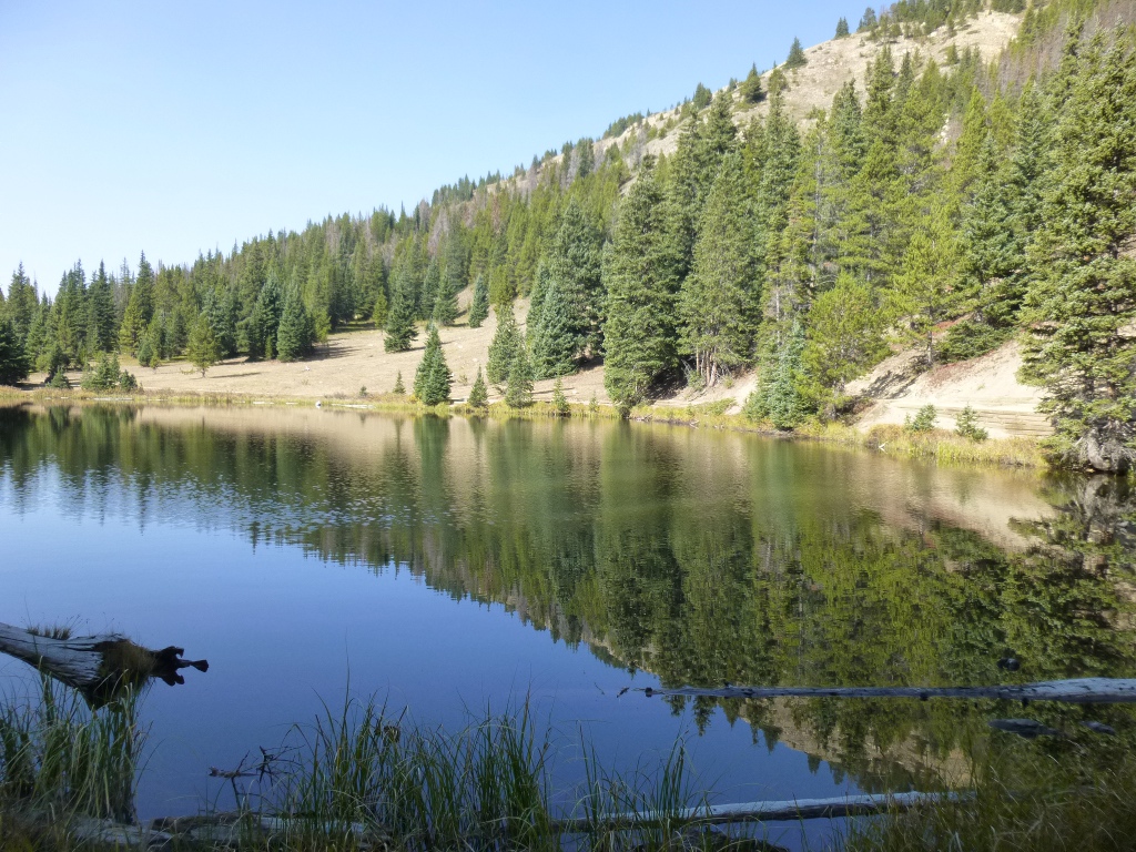 There
is a trail that goes around the lake and it was relatively flat so we
used that to stretch a bit and enjoy the sun. We also saw a robin which
I was a little surprised to see this late in the fall at that altitude.
I didn't include his picture here - you'll just have to
believe
me!
There
is a trail that goes around the lake and it was relatively flat so we
used that to stretch a bit and enjoy the sun. We also saw a robin which
I was a little surprised to see this late in the fall at that altitude.
I didn't include his picture here - you'll just have to
believe
me!
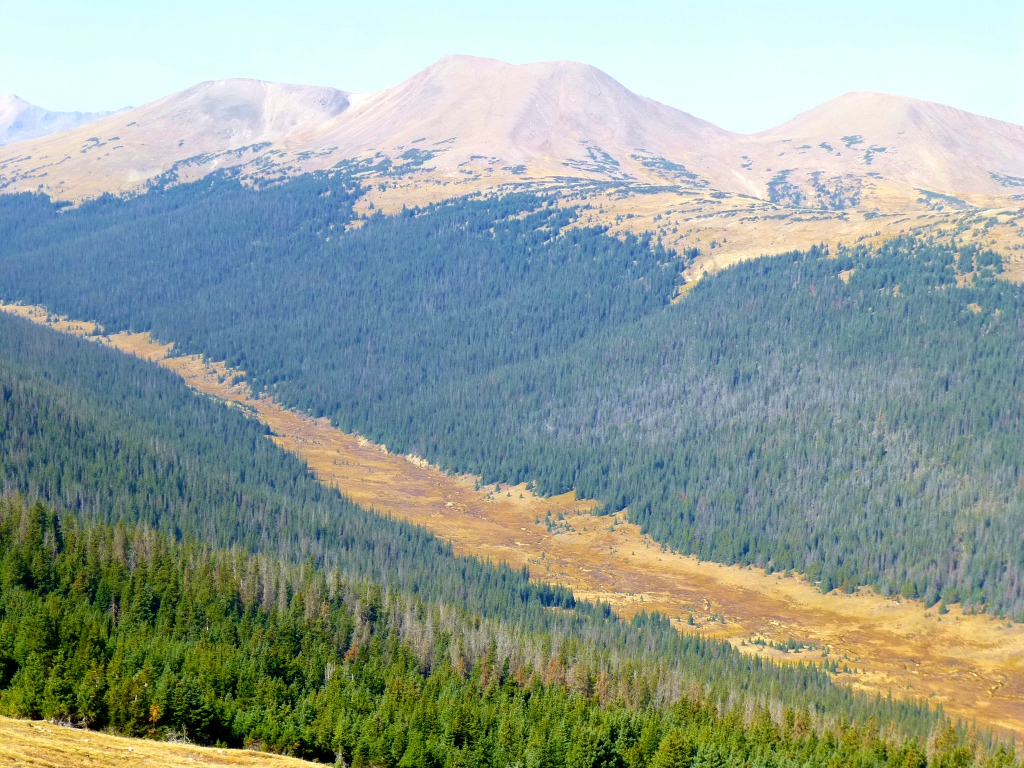 About
3 miles up the road is a hairpin turn known as Medicine Bow Curve.
It looks out on the Medicine Bow Range and the Poudre River
valley. One picture from that overview is at the left.
We
had a brief restroom stop at the Alpine Visitor Center. It's
at 11,796 feet - near the crest of the road.
The highest point of the road is at 12,183 feet but it isn't
labeled as it's at a point where it's not safe for people to be
stopping to take pictures of a sign!
About
3 miles up the road is a hairpin turn known as Medicine Bow Curve.
It looks out on the Medicine Bow Range and the Poudre River
valley. One picture from that overview is at the left.
We
had a brief restroom stop at the Alpine Visitor Center. It's
at 11,796 feet - near the crest of the road.
The highest point of the road is at 12,183 feet but it isn't
labeled as it's at a point where it's not safe for people to be
stopping to take pictures of a sign!
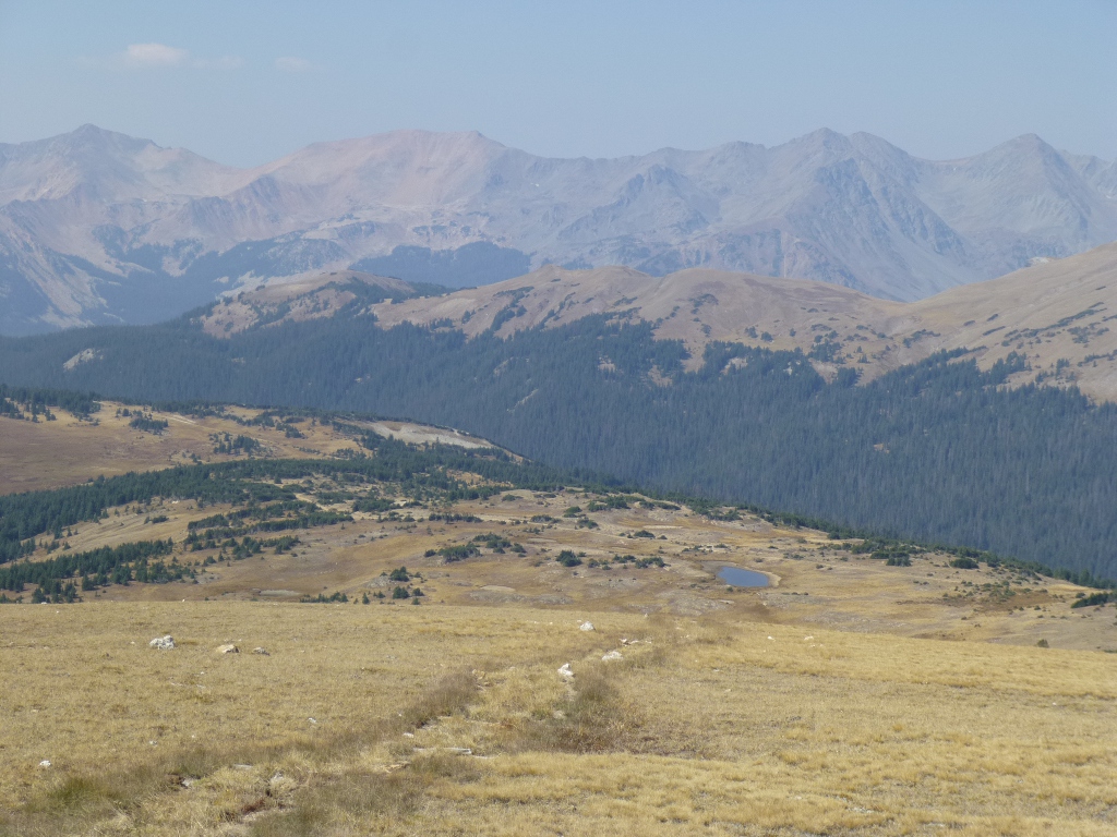 At
the Gore Range overlook, we could see Poudre Lake - to the right of the
center in the picture to the right. I think it is much
smaller
than usual due to the dryness of the summer.
At
the Gore Range overlook, we could see Poudre Lake - to the right of the
center in the picture to the right. I think it is much
smaller
than usual due to the dryness of the summer.
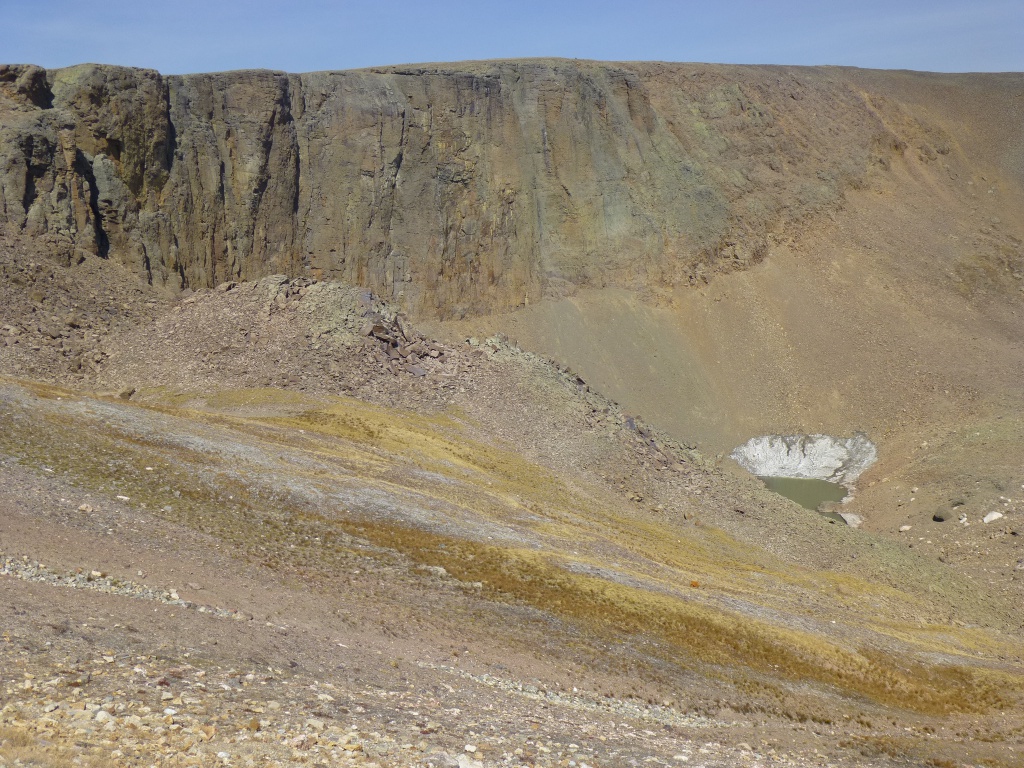 The
Lava
Cliffs are another one of the many facets of RMNP. Formed by
volcanic action long long ago, they have a different texture and
composition than the other rocky areas. It's hard to see in
this
wide picture (left) but on the face of the cliffs are many
ridges
and
indentations used by birds for nesting.
The
Lava
Cliffs are another one of the many facets of RMNP. Formed by
volcanic action long long ago, they have a different texture and
composition than the other rocky areas. It's hard to see in
this
wide picture (left) but on the face of the cliffs are many
ridges
and
indentations used by birds for nesting.
The next pullout is called Rock Cut. There is a fairly short
(half a mile) trail here called Tundra World Nature Trail,
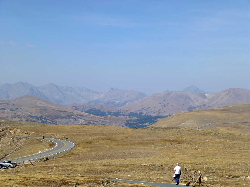
but
it's very steep and we decided about half way up that 1) we were more
worn
out from yesterday's hike than we had thought and 2) we really didn't
need to get to the memorial at the top that badly! John saw a
pika here but it darted back into its rock too quickly for a picture.
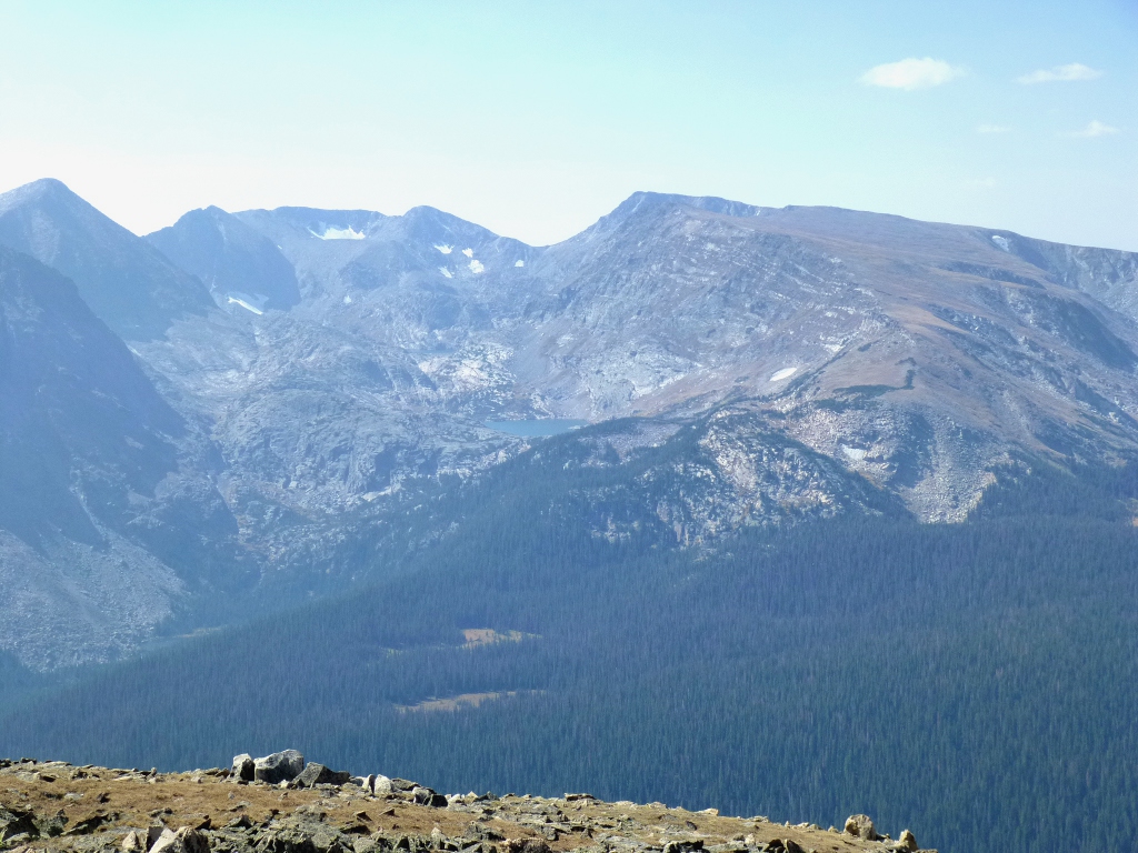
At
the right is a picture from part way up the trail - you get a good idea
of what "tundra" is all about! The one to the left is of a
glacial lake across the road. It's hard to even see the blue
lake among the dark peaks, but it's scooped out right in the middle of
the picture. (The enlargement - click on it - shows it a
little
better.)
We stopped at Forest
Canyon overlook but the
terrain was much like what you see here - both aspects: the tundra in
one direction and the glacial peaks with evergreens below them in the
canyon.
At Rainbow Curve I
was distracted by animals. 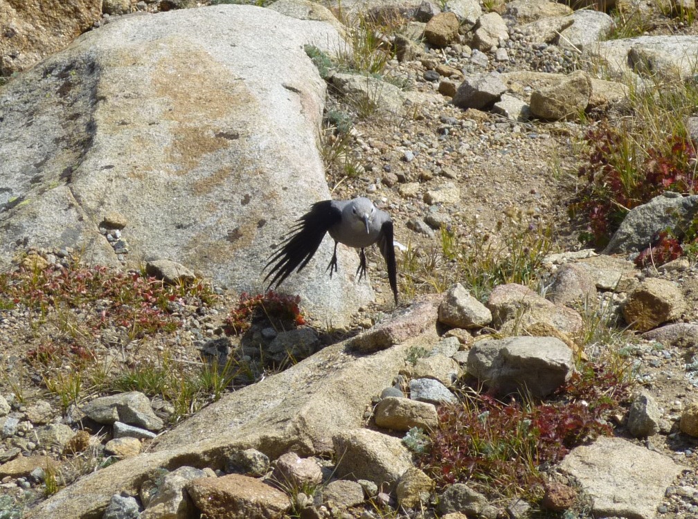 There
were chipmunks running all over and the jays (Gray and Stellars) were
bickering over handouts. The one new bird (to
me) was a
Clark's Nutcracker, shown at left. He was trying hard to
chase away all of
the
jays but without much success. You will see him better in the
enlargement.
There
were chipmunks running all over and the jays (Gray and Stellars) were
bickering over handouts. The one new bird (to
me) was a
Clark's Nutcracker, shown at left. He was trying hard to
chase away all of
the
jays but without much success. You will see him better in the
enlargement.  The
gray head with the white circles around the eyes is very distinctive.
I include one other picture taken from Rainbow Curve (at the
right) because it shows clearly that we are heading back DOWN now and
you can see the road on the right side, weaving its way down the side
of the mountain.
The
gray head with the white circles around the eyes is very distinctive.
I include one other picture taken from Rainbow Curve (at the
right) because it shows clearly that we are heading back DOWN now and
you can see the road on the right side, weaving its way down the side
of the mountain.
We had lunch at the Hidden
Valley picnic area. It's
tucked back off of the road and very nice.
 The photogenic Hidden Valley Creek
(left) runs through it.
While we were standing there looking at the creek and chatting with a
stranger, the left lens quite unexpectedly popped out of my glasses!
Fortunately, it just fell at my feet. I put it
back in but
it wasn’t
staying so I took the superglue to it and that did the trick. (My preparedness extends
to both superglue AND a spare pair of glasses)
The photogenic Hidden Valley Creek
(left) runs through it.
While we were standing there looking at the creek and chatting with a
stranger, the left lens quite unexpectedly popped out of my glasses!
Fortunately, it just fell at my feet. I put it
back in but
it wasn’t
staying so I took the superglue to it and that did the trick. (My preparedness extends
to both superglue AND a spare pair of glasses)
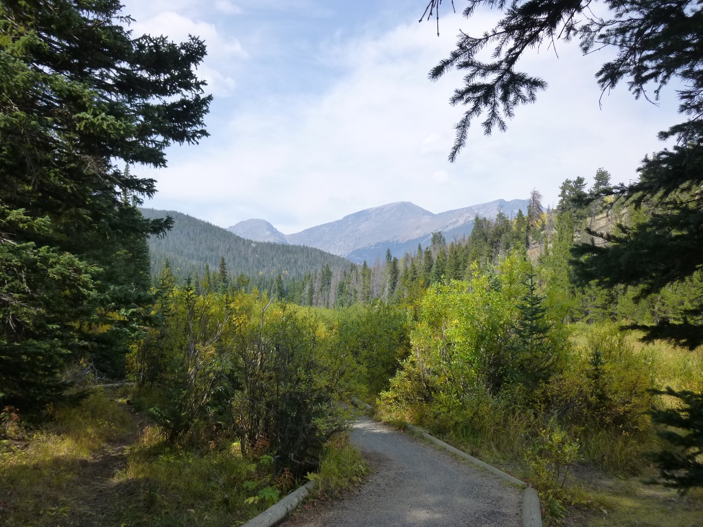 We
continued to meander our way back down the mountain.
We stopped at the Beaver Ponds area (right), walked out
on the boardwalk over the marshy area and took a
couple of pictures but no actual beaver dams are in view now. Then
we drove by Sheep Lakes where the big
horned sheep are frequently seen but there wasn't anything very
interesting today except a magpie who wasn't interested in posing.
(I got good magpie pictures later on at Moraine Park
campground.)
We
continued to meander our way back down the mountain.
We stopped at the Beaver Ponds area (right), walked out
on the boardwalk over the marshy area and took a
couple of pictures but no actual beaver dams are in view now. Then
we drove by Sheep Lakes where the big
horned sheep are frequently seen but there wasn't anything very
interesting today except a magpie who wasn't interested in posing.
(I got good magpie pictures later on at Moraine Park
campground.)
In Estes Park, we got a room at
America’s Best Value Inn
& Suites for about $80 which is WAY cheap for this
area. After
checking in, I got on the computer (they have excellent - secured -
WiFi) and
found there was NO Vacancy at either Moraine Park or KOA for the
weekend, so we decided
to stay here until Sunday. The
cost goes up a little over the weekend but it's still a bargain -
very
comfortable, refrigerator and microwave, guest laundry
facilities and amazingly helpful staff. I got
2 batches of laundry done; John
took a long hot bath while I got caught up on email and Facebook.
We had
dinner at the Big Horn Restaurant (on W. Elkhorn
Rd. on the Bypass
road just outside of main part of town).
John had trout which was very good; I had smothered
chicken which was
fine but nothing too exciting. Staff was friendly and the
price was right.
This
evening, with a Wifi connection, I got my Nook working
again. I had to set it up all over
again and
re-register, but my books were all still available. I
downloaded a few of them for now and I think I will never turn it
off
again! We slept
well - and warmly!