|
(This includes the last 2 weeks
of our trip. Any picture can be enlarged by clicking it and, if you
want to see more, there are many others here.)
Friday March 2 Today we drove down to El Combate, mostly on Highway 2 until we turned onto 103. We stopped at the Mister Special grocery in Cabo Rojo and loaded up for the week. Then, we were still running ahead of our check-in time so we also stopped at a bird refuge (Refugio de Vida Silvestre en Boqueron) that's only a few miles from us. But it closed at 3 PM so we only had a short time to look around today - we'll be back! 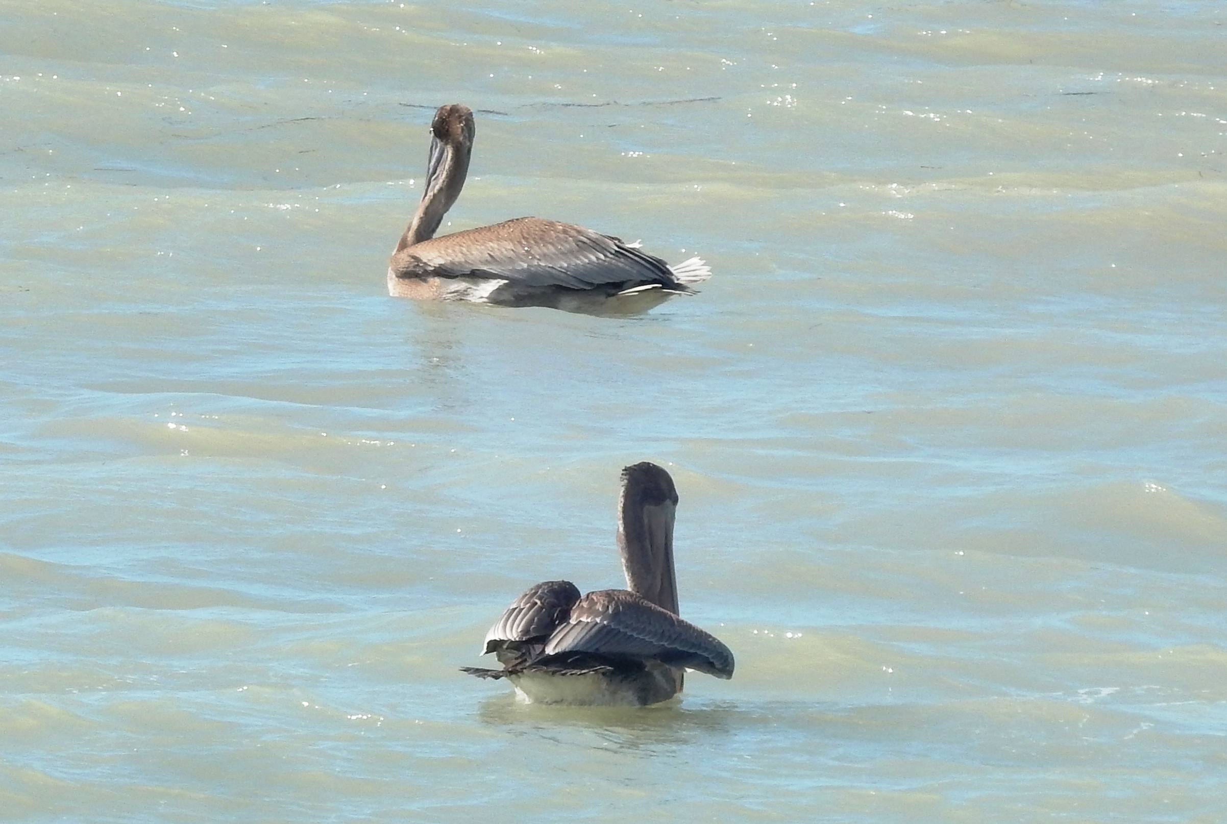  We had no
trouble finding the condo but did have some key issues!
I couldn't get the door opened, though the key went in and turned; and
then when I "accidentally" got it open I couldn't get it to come out. I
eventually learned that all of the keys in the unit have to be turned
in
the expected direction twice.
So, to open the front door, I had to turn it clockwise two full turns,
hearing it click twice. Once I figured that out, it became pretty
easy for the rest of our stay! Nice condo - plenty of room, well
equipped, good location. There were three floors: open kitchen/
living / dining on ground floor, bedrooms on the next and a terrace
with porch furniture on the roof. We walked down to the beach for
the
first pelicans and first "real" sunset of our vacation! We had no
trouble finding the condo but did have some key issues!
I couldn't get the door opened, though the key went in and turned; and
then when I "accidentally" got it open I couldn't get it to come out. I
eventually learned that all of the keys in the unit have to be turned
in
the expected direction twice.
So, to open the front door, I had to turn it clockwise two full turns,
hearing it click twice. Once I figured that out, it became pretty
easy for the rest of our stay! Nice condo - plenty of room, well
equipped, good location. There were three floors: open kitchen/
living / dining on ground floor, bedrooms on the next and a terrace
with porch furniture on the roof. We walked down to the beach for
the
first pelicans and first "real" sunset of our vacation!Saturday Feb 3 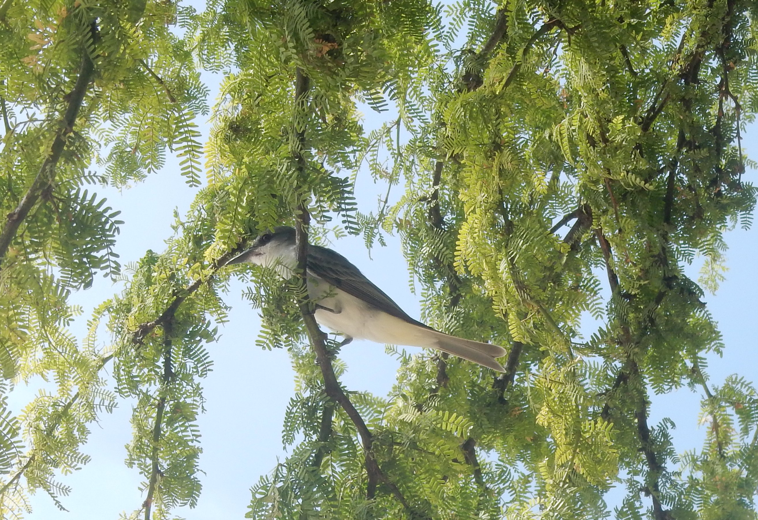  We
took a day "off" today. There was no blender here, though the
listing said there was - I asked Maria about it (as in "Am I
mistaken?")
and an hour later someone brought us a brand new one! Wow - great
service. So I had a smoothie and did 2 batches of laundry; John
had a nap. In the afternoon we walked along El Combate Beach -
walked down on the "path" (gray kingbird) and back on the beach
(tern). We
took a day "off" today. There was no blender here, though the
listing said there was - I asked Maria about it (as in "Am I
mistaken?")
and an hour later someone brought us a brand new one! Wow - great
service. So I had a smoothie and did 2 batches of laundry; John
had a nap. In the afternoon we walked along El Combate Beach -
walked down on the "path" (gray kingbird) and back on the beach
(tern). Sunday Feb 4  Drove
down 5 minutes to the salt flats today. The Interpretive Center
was supposed to be open but wasn't. (We found it open next
Saturday.) But there is a walk-through section in the fence and
we had read that we were welcome to explore the area, so we went on in
and hiked around. Found numerous new plants, ended up at an empty
beach on the Bahia Salinas and had a good
time. On the way back we stopped at the Ritamar panaderia and
grocery in El Combate and brought home some pastries and some (very
expensive) ice cream. My Fire TV stick works fine here so we are
able to keep up with the streaming shows we've been watching in the
evening. The picture at the left is the beach where our path led us -
if you enlarge it, you can barely see the lighthouse across the bay,
way over on the right (we'll get there next week). Below are a
Great Egret keeping watch over the
bay, an upland cotton tree that was totally new to us and a clump of
grass full of (live) snails. Drove
down 5 minutes to the salt flats today. The Interpretive Center
was supposed to be open but wasn't. (We found it open next
Saturday.) But there is a walk-through section in the fence and
we had read that we were welcome to explore the area, so we went on in
and hiked around. Found numerous new plants, ended up at an empty
beach on the Bahia Salinas and had a good
time. On the way back we stopped at the Ritamar panaderia and
grocery in El Combate and brought home some pastries and some (very
expensive) ice cream. My Fire TV stick works fine here so we are
able to keep up with the streaming shows we've been watching in the
evening. The picture at the left is the beach where our path led us -
if you enlarge it, you can barely see the lighthouse across the bay,
way over on the right (we'll get there next week). Below are a
Great Egret keeping watch over the
bay, an upland cotton tree that was totally new to us and a clump of
grass full of (live) snails.    Monday Feb 5
  This
morning we started at the bird sanctuary we had a quick look of last
week. There are two main trails there and plenty to see. In
the lagoon, behind a large thicket, there is an egret nesting
site. We could sort of see dozens of birds moving around but
because of the many bushes we couldn't get a good picture. Aside
fromthe egrets, I did find a tricolored heron (left) and a cute lizard
that was reading (?) the Bird ID poster( right). After lunch we
walked down to the beach again and spent a couple of hours this
time. The condo came with beach chairs so that was nice - we
walked and played a little in the water and then sat with our
books. When our beach neighbors went into the water, their site
was scavenged (left below): the orange bird is a Venezuelan troupial
(type of oriole) and the black birds are Greater Antillean
Grackles - endemic to the island and locally known as "changos".
We went home to shower off
then back to Annie's Beach Restaurant for supper and sunset
watching. It wasn't very crowded since it was early and a Monday,
but by the
time we left it was filling up. John had grouper with aioli sauce
and I had coconut shrimp (the appetizer size was perfect for me). This
morning we started at the bird sanctuary we had a quick look of last
week. There are two main trails there and plenty to see. In
the lagoon, behind a large thicket, there is an egret nesting
site. We could sort of see dozens of birds moving around but
because of the many bushes we couldn't get a good picture. Aside
fromthe egrets, I did find a tricolored heron (left) and a cute lizard
that was reading (?) the Bird ID poster( right). After lunch we
walked down to the beach again and spent a couple of hours this
time. The condo came with beach chairs so that was nice - we
walked and played a little in the water and then sat with our
books. When our beach neighbors went into the water, their site
was scavenged (left below): the orange bird is a Venezuelan troupial
(type of oriole) and the black birds are Greater Antillean
Grackles - endemic to the island and locally known as "changos".
We went home to shower off
then back to Annie's Beach Restaurant for supper and sunset
watching. It wasn't very crowded since it was early and a Monday,
but by the
time we left it was filling up. John had grouper with aioli sauce
and I had coconut shrimp (the appetizer size was perfect for me).  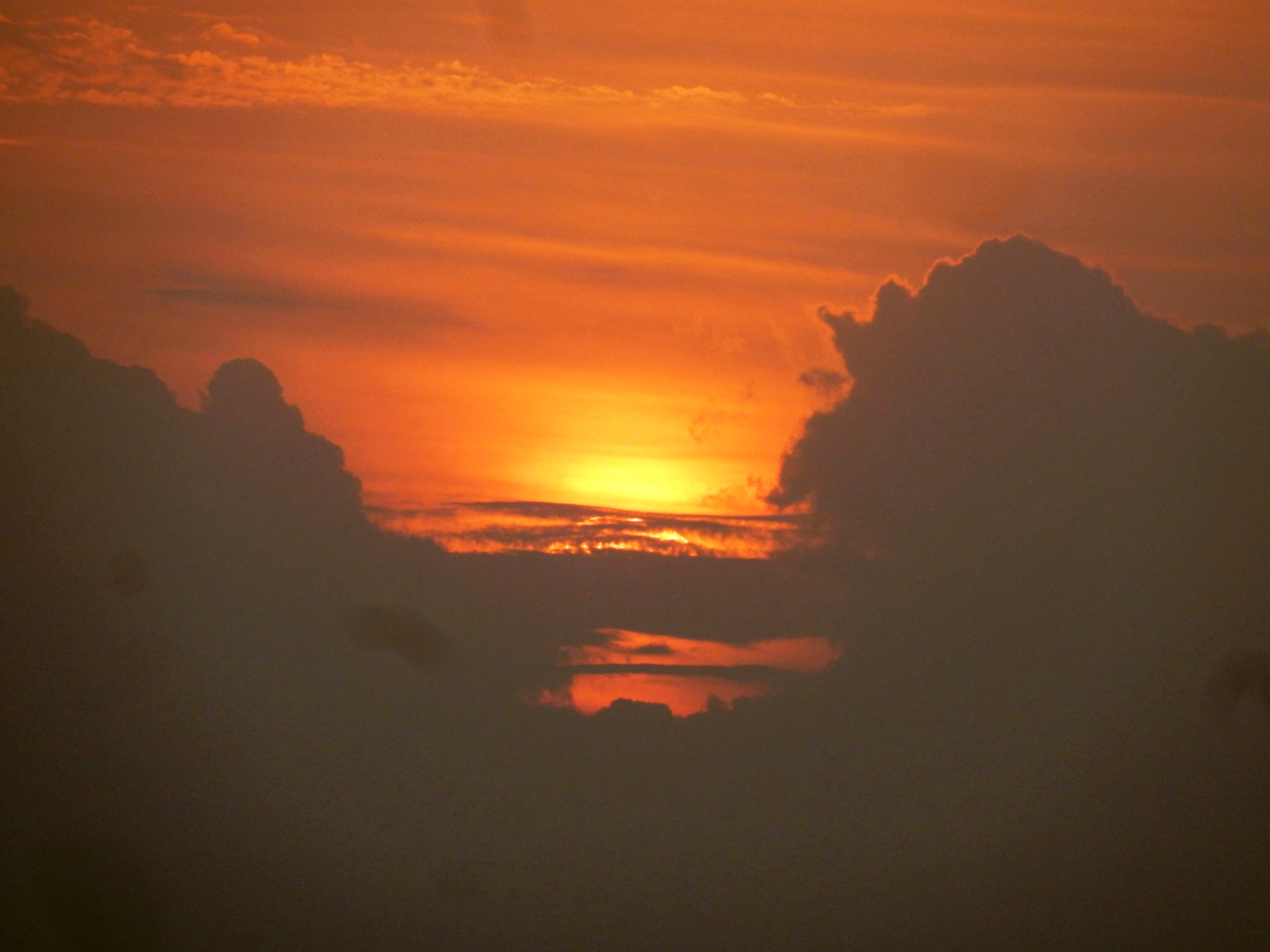  Rainy, windy, stormy all day Tuesday so a good day for us to
mostly hang out and rest. There was very low water pressure this
morning and it went down to a low trickle this afternoon.
Apparently AAA (that's the "aqueduct and sewer authority" - in Spanish
it's 3 A's) was doing maintenance on the water system. They were
supposed to be done today but the rain kept them from finishing.
(Update: tomorrow morning it was all back to normal.) During a
break in the weather this afternoon we went for a walk down to the very
empty beach. Walking by the lagoon, we spied this whole group of
sandpiper type birds. My best guess is yellowlegs, but I can't
tell if they are Greater, Lesser or a combination. There is one
that seems larger than the others, but I can't be sure. Still
stormy on Wednesday but since we have a whole week left we decided to
just take another day off. We read, caught up on correspondence
and talked about what we'd do for the coming days. Rainy, windy, stormy all day Tuesday so a good day for us to
mostly hang out and rest. There was very low water pressure this
morning and it went down to a low trickle this afternoon.
Apparently AAA (that's the "aqueduct and sewer authority" - in Spanish
it's 3 A's) was doing maintenance on the water system. They were
supposed to be done today but the rain kept them from finishing.
(Update: tomorrow morning it was all back to normal.) During a
break in the weather this afternoon we went for a walk down to the very
empty beach. Walking by the lagoon, we spied this whole group of
sandpiper type birds. My best guess is yellowlegs, but I can't
tell if they are Greater, Lesser or a combination. There is one
that seems larger than the others, but I can't be sure. Still
stormy on Wednesday but since we have a whole week left we decided to
just take another day off. We read, caught up on correspondence
and talked about what we'd do for the coming days.Thursday, Feb 8 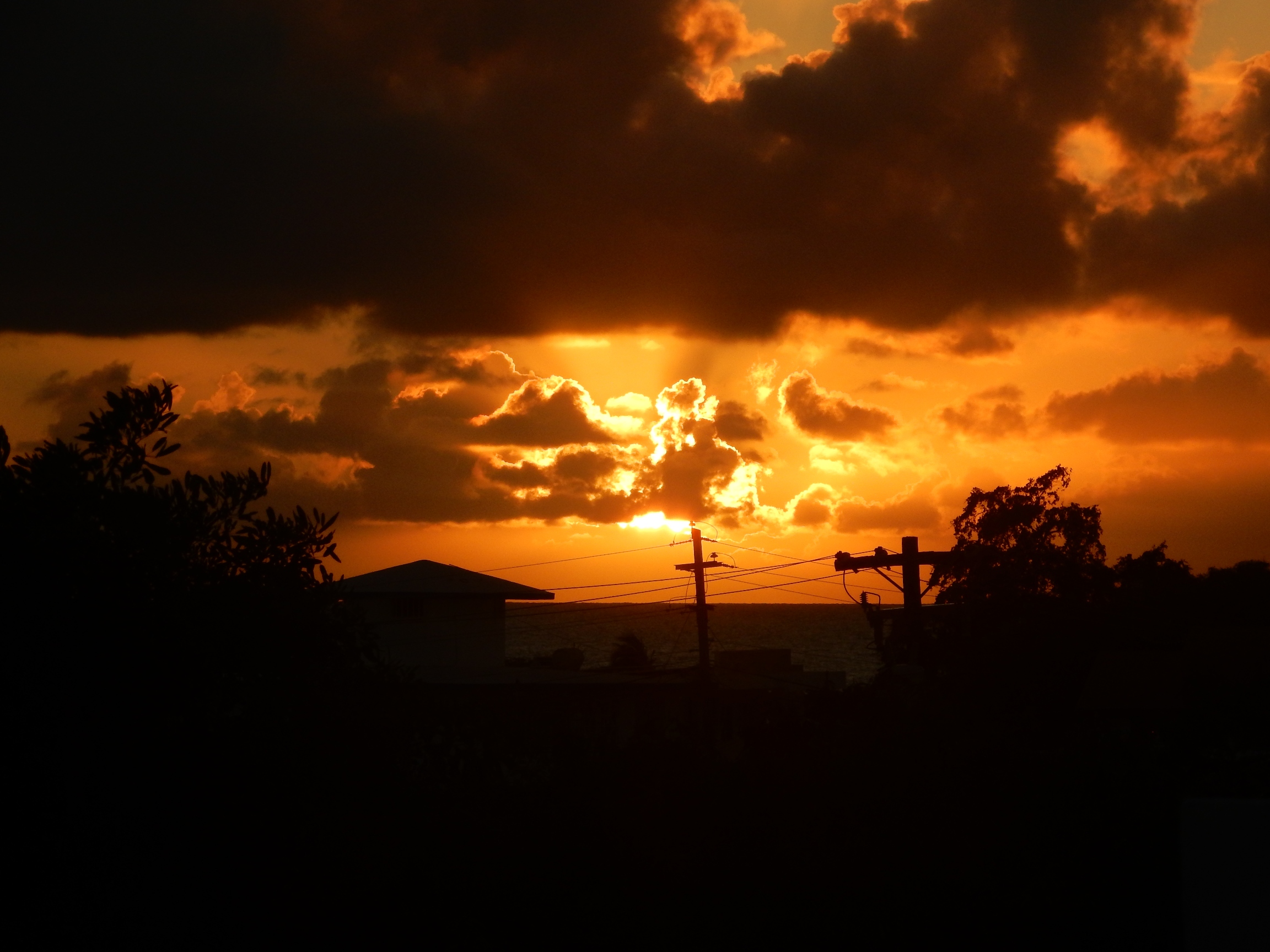 Though it was
cloudy this morning, it was due to clear up around noon so right after
lunch we headed to Balneario de Boquerón, a public beach in Boqueron
and probably the most popular in the area. There is a $4 fee to
park (in a REAL parking lot - after bouncing through the clearings
around the northern beaches, this is a big deal)! A weekday
afternoon when it's been cloudy and rainy, meant it was mostly empty.
The park-like area is nicely landscaped, kept clean and mowed, but the
facilities have not been upgraded since the last hurricane so there are
only portable restrooms, no showers and no vendors - at least not this
early in the season. There were many pigeons of all colors and
some terns around. We also finally saw some iguanas that we had
been missing. Nice afternoon to lounge in our chairs and enjoy
the sun between beach walks. When we got back to the condo, we
were in time to catch the sunset from our rooftop (left). Though it was
cloudy this morning, it was due to clear up around noon so right after
lunch we headed to Balneario de Boquerón, a public beach in Boqueron
and probably the most popular in the area. There is a $4 fee to
park (in a REAL parking lot - after bouncing through the clearings
around the northern beaches, this is a big deal)! A weekday
afternoon when it's been cloudy and rainy, meant it was mostly empty.
The park-like area is nicely landscaped, kept clean and mowed, but the
facilities have not been upgraded since the last hurricane so there are
only portable restrooms, no showers and no vendors - at least not this
early in the season. There were many pigeons of all colors and
some terns around. We also finally saw some iguanas that we had
been missing. Nice afternoon to lounge in our chairs and enjoy
the sun between beach walks. When we got back to the condo, we
were in time to catch the sunset from our rooftop (left).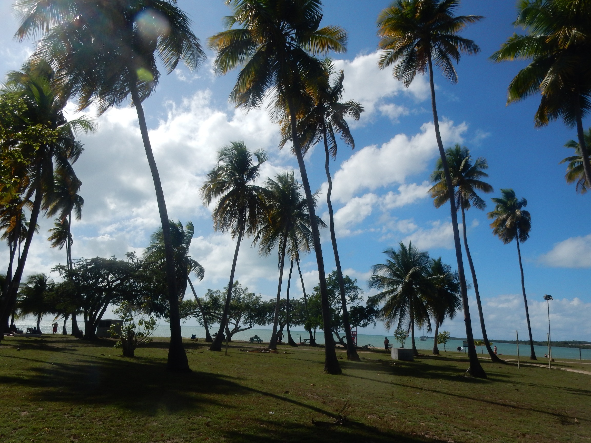     Today was Guánica day - we set off fairly early to the Bosque Seco de Guánica
(aka the dry forest). We started out on PR highways, which are
not really "highways" as we are used to, but at least they are wide
enough for 2 vehicles and have a line down the middle! As we
turned off getting closer to the forest, they became narrower and
twisty, with dogs randomly sunning in the middle, making driving a bit
tricky. Once we arrived, the ranger recommended a wide, pretty
easy, 2-mile loop
trail that started right there at the parking lot. Besides the
information kiosk, they also have several picnic tables and a restroom
- very nice place. At the right is one of the "new to us" plants
- some sort of cactus vine climbing up a tree. After lunch we
drove around to PR333 and the trailhead to Fort Capron. We went
about 3/4 of the way up and then just got burned out - it was very
steep and very hot! The middle picture below was taken part of
the way up overlooking Guánica
Bay; the right one is the top of the Fort which was all we could see
from where we gave up and turned back down the hill! The left
picture is what I call the "giraffe tree" but I'm not really sure what
it is (Google seems to think it's a copperwood or gumbo-limbo tree but
the pictures don't quite match this bark, though it "peels" the same way so may be a relative). We drove on down
to Ballena Bay and Tamarindo Beach but didn't do any more hiking. Today was Guánica day - we set off fairly early to the Bosque Seco de Guánica
(aka the dry forest). We started out on PR highways, which are
not really "highways" as we are used to, but at least they are wide
enough for 2 vehicles and have a line down the middle! As we
turned off getting closer to the forest, they became narrower and
twisty, with dogs randomly sunning in the middle, making driving a bit
tricky. Once we arrived, the ranger recommended a wide, pretty
easy, 2-mile loop
trail that started right there at the parking lot. Besides the
information kiosk, they also have several picnic tables and a restroom
- very nice place. At the right is one of the "new to us" plants
- some sort of cactus vine climbing up a tree. After lunch we
drove around to PR333 and the trailhead to Fort Capron. We went
about 3/4 of the way up and then just got burned out - it was very
steep and very hot! The middle picture below was taken part of
the way up overlooking Guánica
Bay; the right one is the top of the Fort which was all we could see
from where we gave up and turned back down the hill! The left
picture is what I call the "giraffe tree" but I'm not really sure what
it is (Google seems to think it's a copperwood or gumbo-limbo tree but
the pictures don't quite match this bark, though it "peels" the same way so may be a relative). We drove on down
to Ballena Bay and Tamarindo Beach but didn't do any more hiking.   Saturday, Feb 10  This
morning we went to the part of the Cabo Rojo National Wildlife Refuge
that is north of El Combate - it's about a 10 minute drive (Hwy 301
about 5km). There used to be a visitor center there but
apparently it was destroyed in a hurricane and has not been
replaced. But there are 2 loop trails that are maintained, a
paved (!!) parking lot and an observation deck along the (approximately
2 mile) northern trail that we took. At the left are a couple of
pretty large century plants (aka agave americana) we passed along the
trail. Below are two views from the observation deck (using the zoom, and it's not as high
as the afternoon one pictured later). The one to the left is
pretty much straight south and you can see the lighthouse across Bahia
Sucia. (We'll get there next week!) The middle photo is
southwest, towards El Combate, and you can see the church above most of
the rest of the town. Finally, as we continued on the trail, we
passed a farm that included a herd of cows. At first they totally
ignored us, then John started singing to them and they perked right
up! They didn't come over to us but did give him their attention! This
morning we went to the part of the Cabo Rojo National Wildlife Refuge
that is north of El Combate - it's about a 10 minute drive (Hwy 301
about 5km). There used to be a visitor center there but
apparently it was destroyed in a hurricane and has not been
replaced. But there are 2 loop trails that are maintained, a
paved (!!) parking lot and an observation deck along the (approximately
2 mile) northern trail that we took. At the left are a couple of
pretty large century plants (aka agave americana) we passed along the
trail. Below are two views from the observation deck (using the zoom, and it's not as high
as the afternoon one pictured later). The one to the left is
pretty much straight south and you can see the lighthouse across Bahia
Sucia. (We'll get there next week!) The middle photo is
southwest, towards El Combate, and you can see the church above most of
the rest of the town. Finally, as we continued on the trail, we
passed a farm that included a herd of cows. At first they totally
ignored us, then John started singing to them and they perked right
up! They didn't come over to us but did give him their attention!We also met another couple on the trail who were frequent visitors and they told us that the Interpretative Center at the salt flats was open Saturdays until 2 PM. Since it wasn't very far from where we were (6 km south of us) we decided to go check it out. 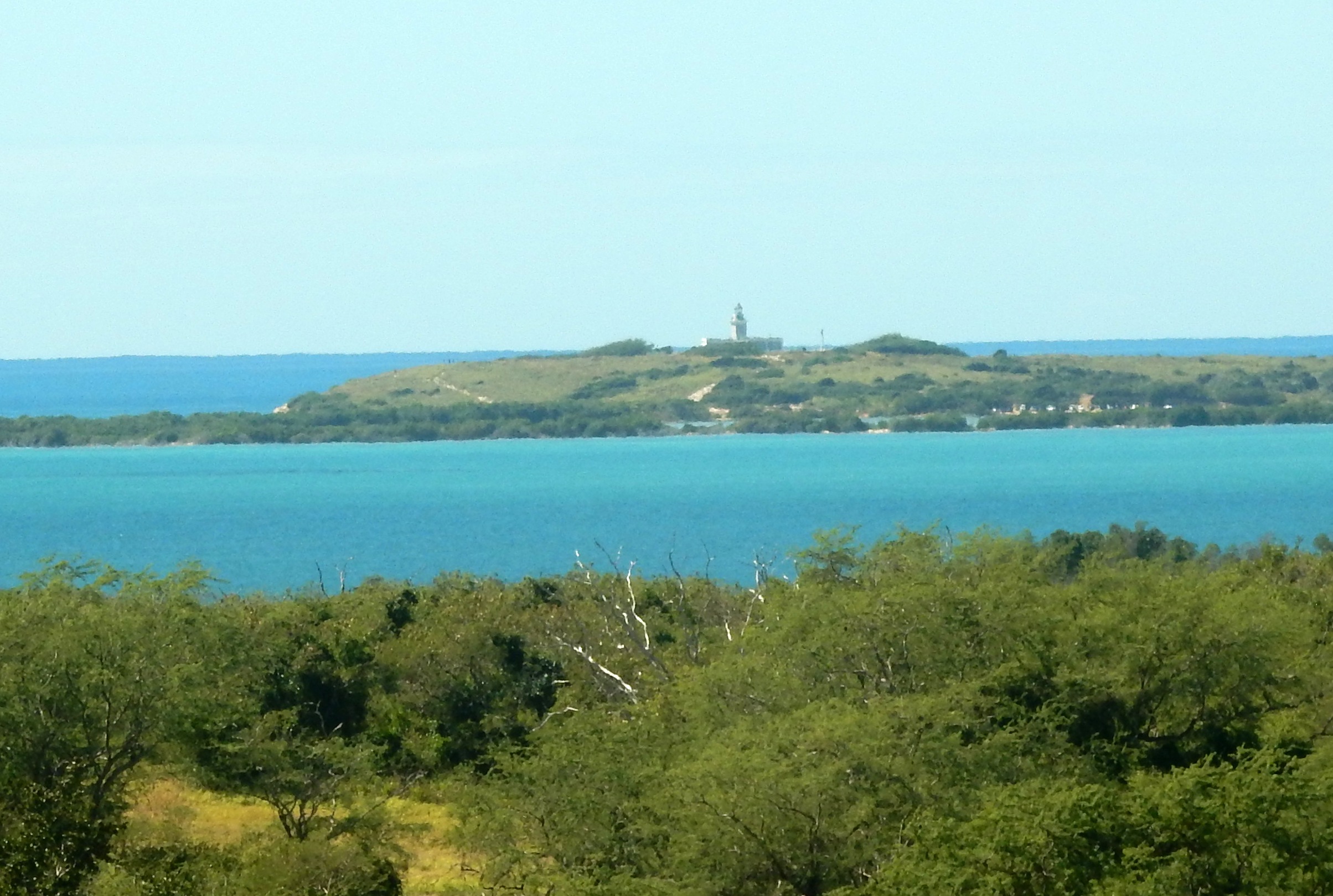 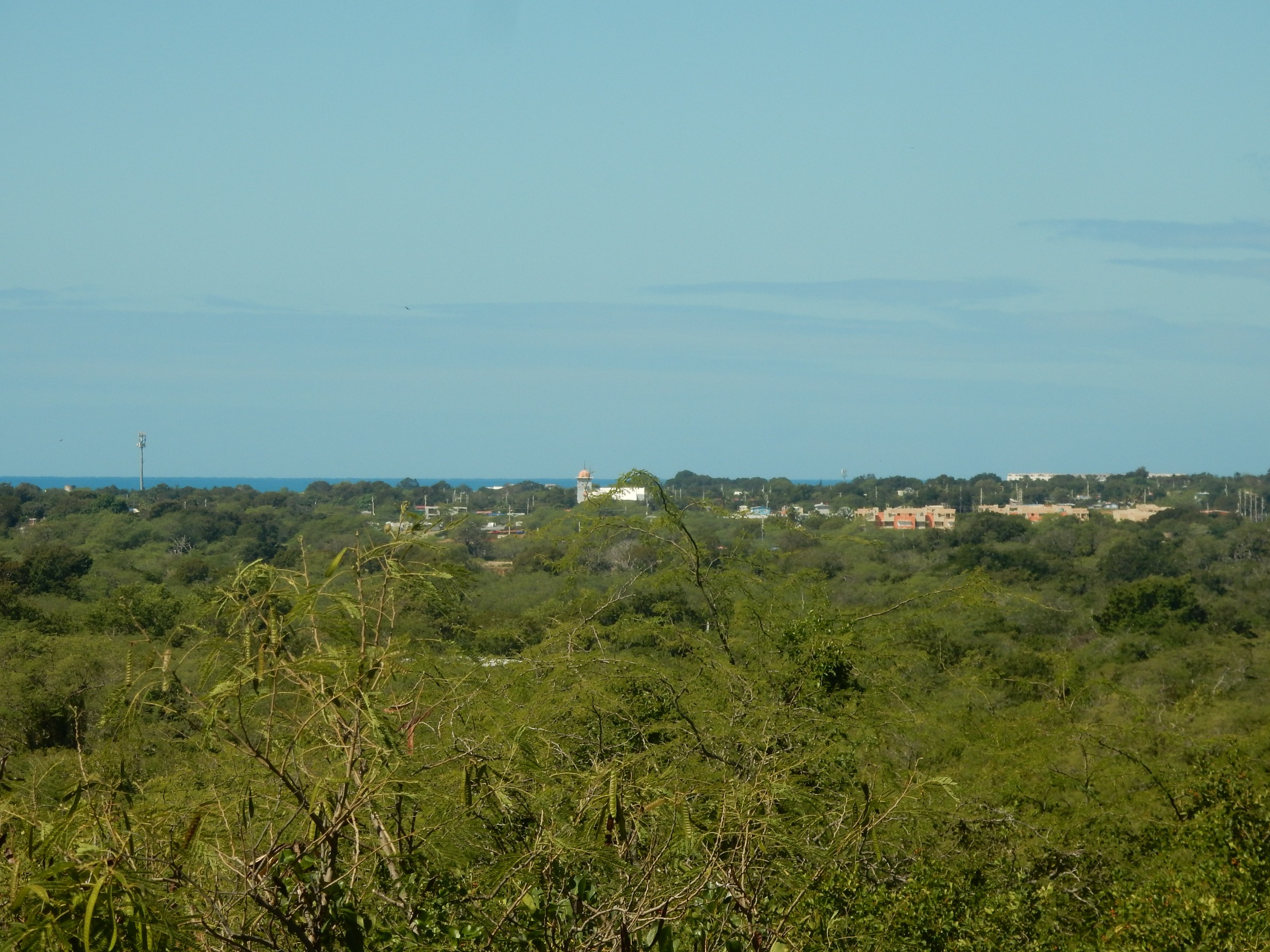  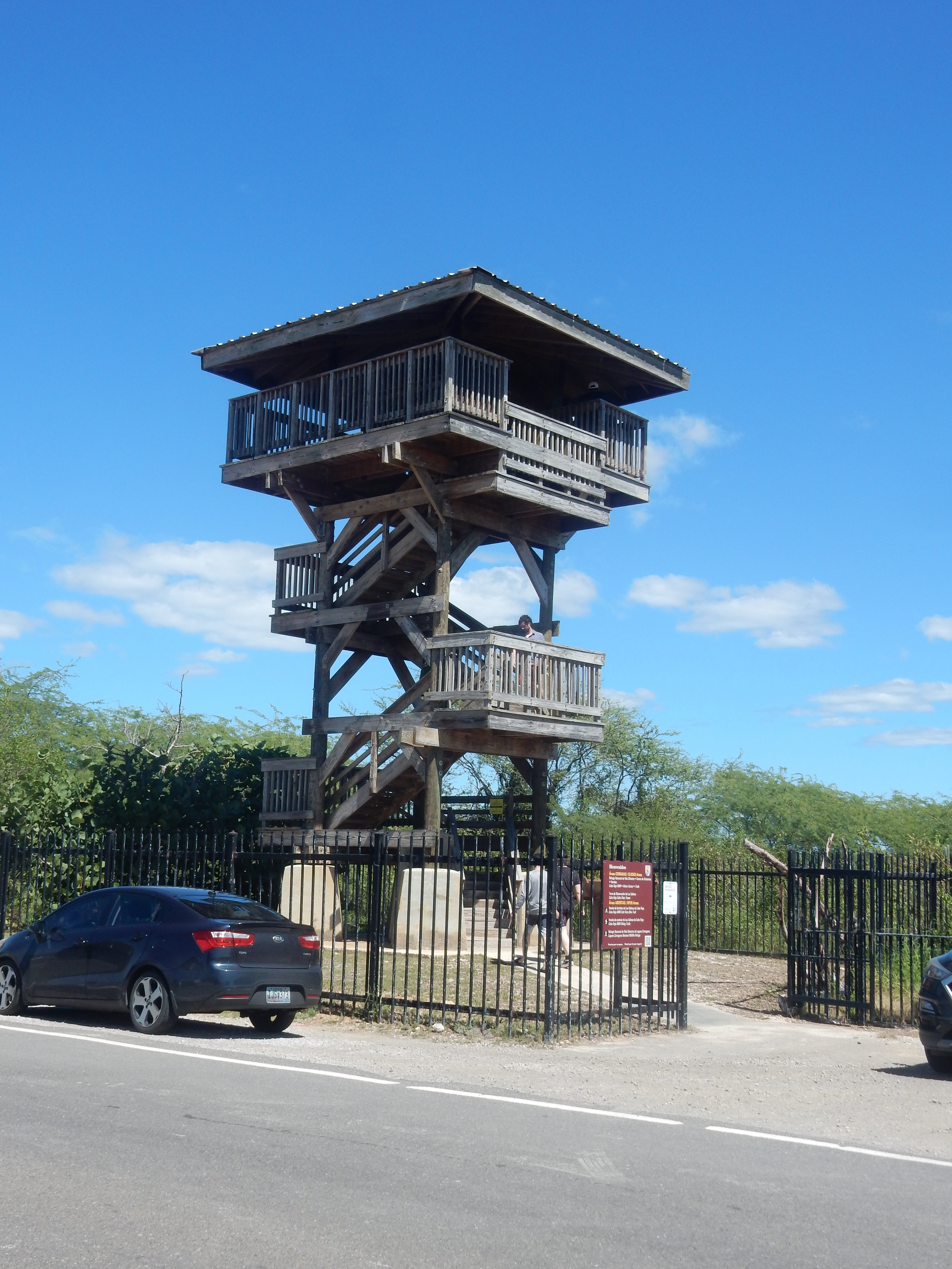  At
the right is the observation tower down at 11 km near the salt
flats. This is about twice as tall as the one along the other
trail this morning. On the left is the view of the
Interpretive Center. When we were here earlier, we went through a
walk gate that's just to the left of the picture. You can see the
road/trail at the back and left that leads further on towards the
bay. That's where we were hiking on Sunday that ended up at a
small beach. Today we went in and visited - it isn't very
profound but
there is a nice 3D model of the area and the staff person spoke
excellent English and could answer questions and point us to the
various locations of trails (most of which we had already found). There
were quite a few informational posters on the walls - for instance, we
found out that the green and blue iguanas that we are used to seeing in
Mexico are not native to Puerto Rico and have been introduced
relatively recently, which is why we didn't see very many of
them. The left picture below is of the salt flats
area - some of the sections are pink, even though they don't show up
real well! It's like a "salt farm" - it was damaged extensively
by Hurricane Maria but they are working on improvements. Finally,
on the right is
the sunset for the evening, taken from our rooftop terrace again. At
the right is the observation tower down at 11 km near the salt
flats. This is about twice as tall as the one along the other
trail this morning. On the left is the view of the
Interpretive Center. When we were here earlier, we went through a
walk gate that's just to the left of the picture. You can see the
road/trail at the back and left that leads further on towards the
bay. That's where we were hiking on Sunday that ended up at a
small beach. Today we went in and visited - it isn't very
profound but
there is a nice 3D model of the area and the staff person spoke
excellent English and could answer questions and point us to the
various locations of trails (most of which we had already found). There
were quite a few informational posters on the walls - for instance, we
found out that the green and blue iguanas that we are used to seeing in
Mexico are not native to Puerto Rico and have been introduced
relatively recently, which is why we didn't see very many of
them. The left picture below is of the salt flats
area - some of the sections are pink, even though they don't show up
real well! It's like a "salt farm" - it was damaged extensively
by Hurricane Maria but they are working on improvements. Finally,
on the right is
the sunset for the evening, taken from our rooftop terrace again.   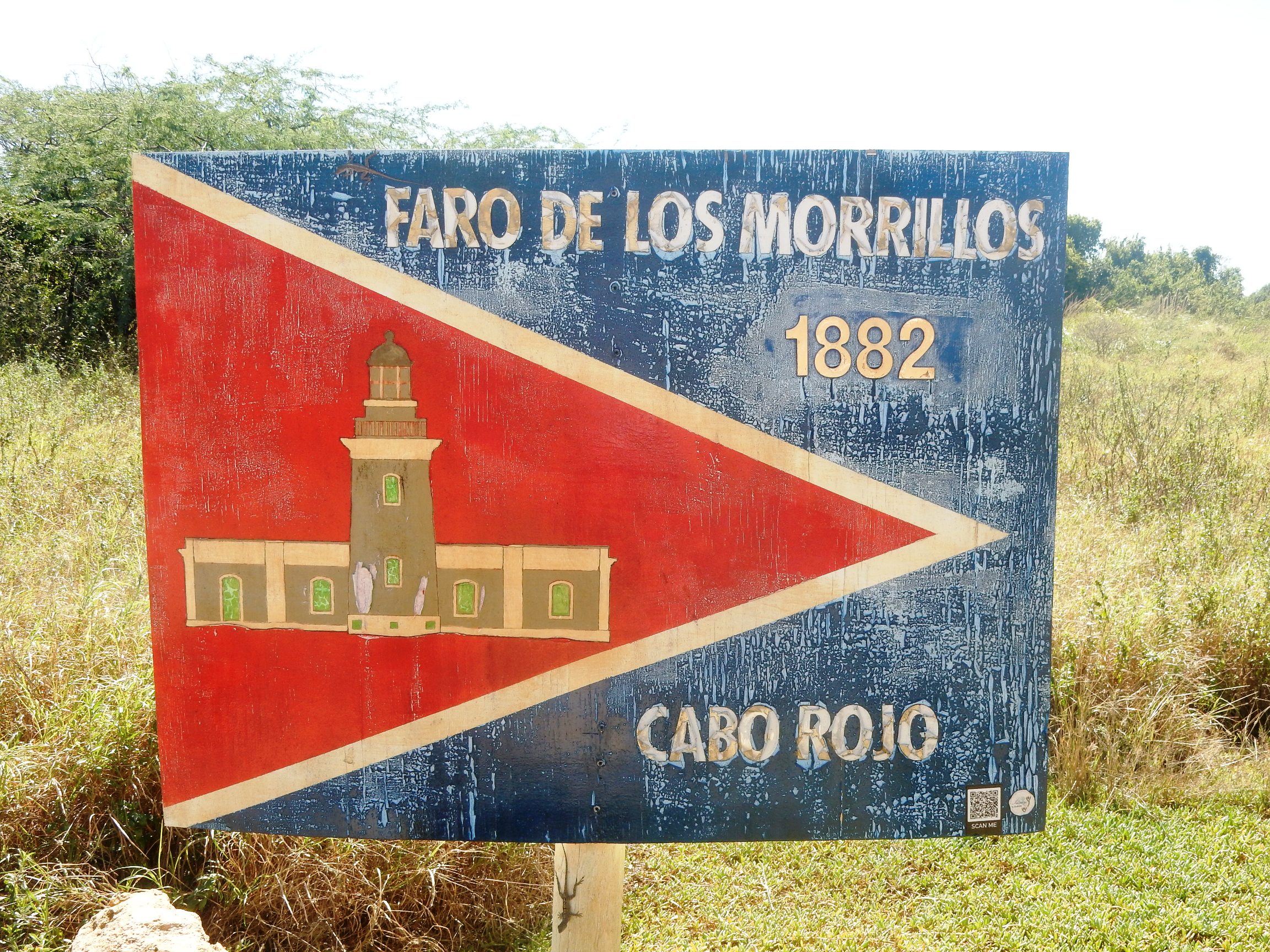 Sunday
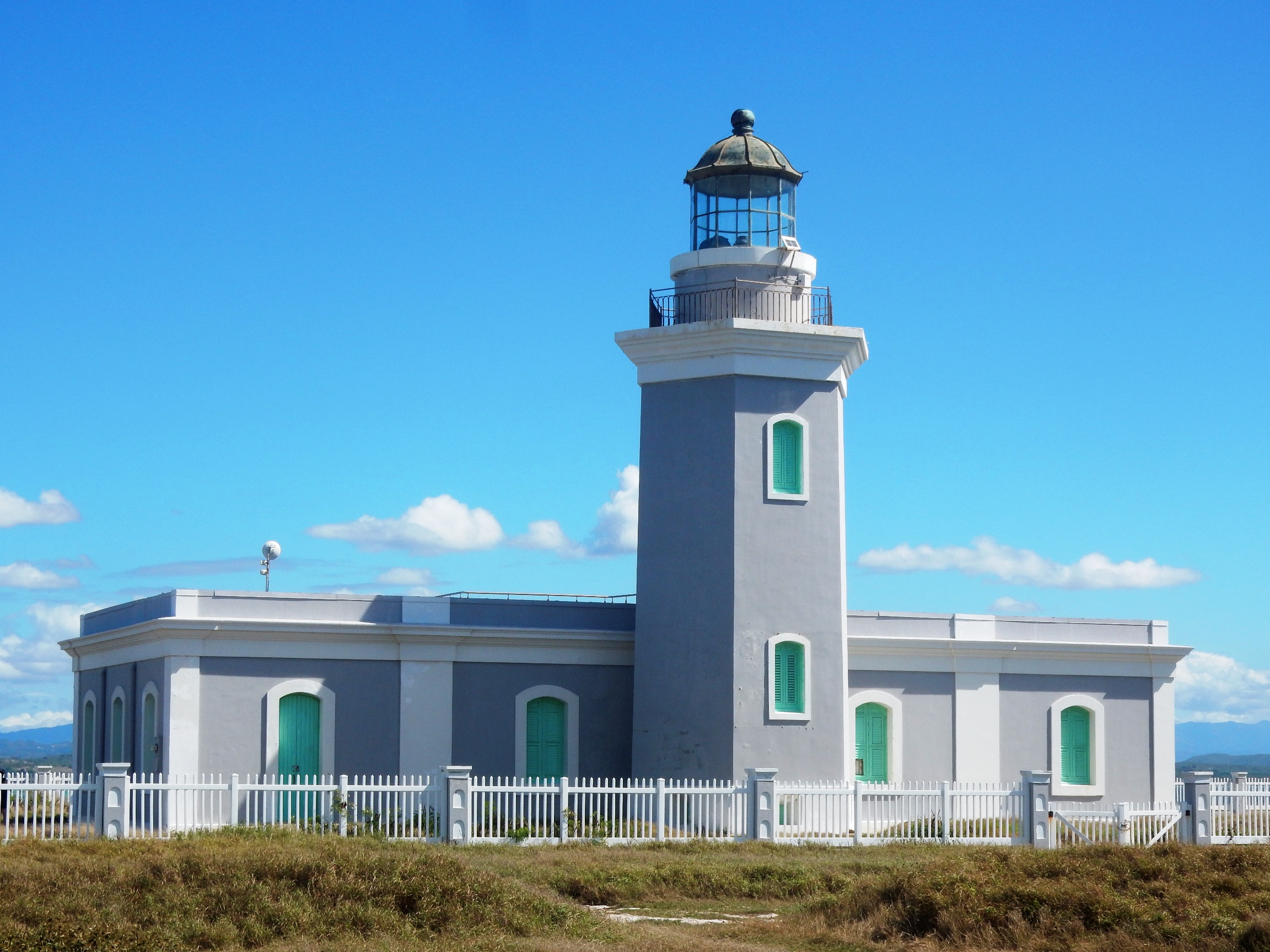
was a "rest" day so we hung out at home and at the beach. Monday was
"Lighthouse Peninsula" day and well worth it! We drove down to
the entrance (not too far beyond the Interpretive Center from
Saturday). We stopped just before the damaged pedestrian bridge
because that's where the road turned really bad - and we had a rented
sedan. The left photo gives you an idea of the extent of the
damage! We did see about a dozen cars parked down by the Playa
Sucia but they were all trucks, jeeps or SUV's. When we left we
saw another dozen or so parked near us. So some people Sunday
was a "rest" day so we hung out at home and at the beach. Monday was
"Lighthouse Peninsula" day and well worth it! We drove down to
the entrance (not too far beyond the Interpretive Center from
Saturday). We stopped just before the damaged pedestrian bridge
because that's where the road turned really bad - and we had a rented
sedan. The left photo gives you an idea of the extent of the
damage! We did see about a dozen cars parked down by the Playa
Sucia but they were all trucks, jeeps or SUV's. When we left we
saw another dozen or so parked near us. So some people  obviously
felt okay pushing on down through the damaged road, others were more
conservative. It only took us 15 minutes to walk down to the
original entrance (sign to the right) so I didn't feel that we made a
poor decision! obviously
felt okay pushing on down through the damaged road, others were more
conservative. It only took us 15 minutes to walk down to the
original entrance (sign to the right) so I didn't feel that we made a
poor decision!  At
that point you can just walk straight (on a wide path) directly to the
lighthouse; you can turn left and go down to the Playa Sucia or you can
walk behind the "Handicapped" parking places and follow a path (you
can't see it until you get out of the parking area but it's easy to
follow) that goes around the outside of the peninsula for marvelous
views of the cliffs and rock formations. We went to the
right! I have many more pictures but here are a few to give you a
hint. Left is a giant milkweed and right are a couple of cactus
plants. Below are 3 views of the rocks and waves at various
points along the coast of the peninsula. At
that point you can just walk straight (on a wide path) directly to the
lighthouse; you can turn left and go down to the Playa Sucia or you can
walk behind the "Handicapped" parking places and follow a path (you
can't see it until you get out of the parking area but it's easy to
follow) that goes around the outside of the peninsula for marvelous
views of the cliffs and rock formations. We went to the
right! I have many more pictures but here are a few to give you a
hint. Left is a giant milkweed and right are a couple of cactus
plants. Below are 3 views of the rocks and waves at various
points along the coast of the peninsula. 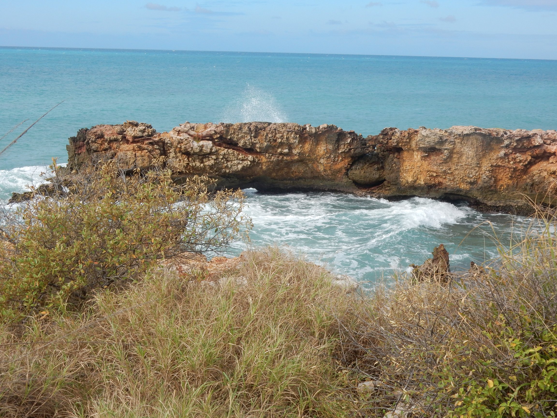 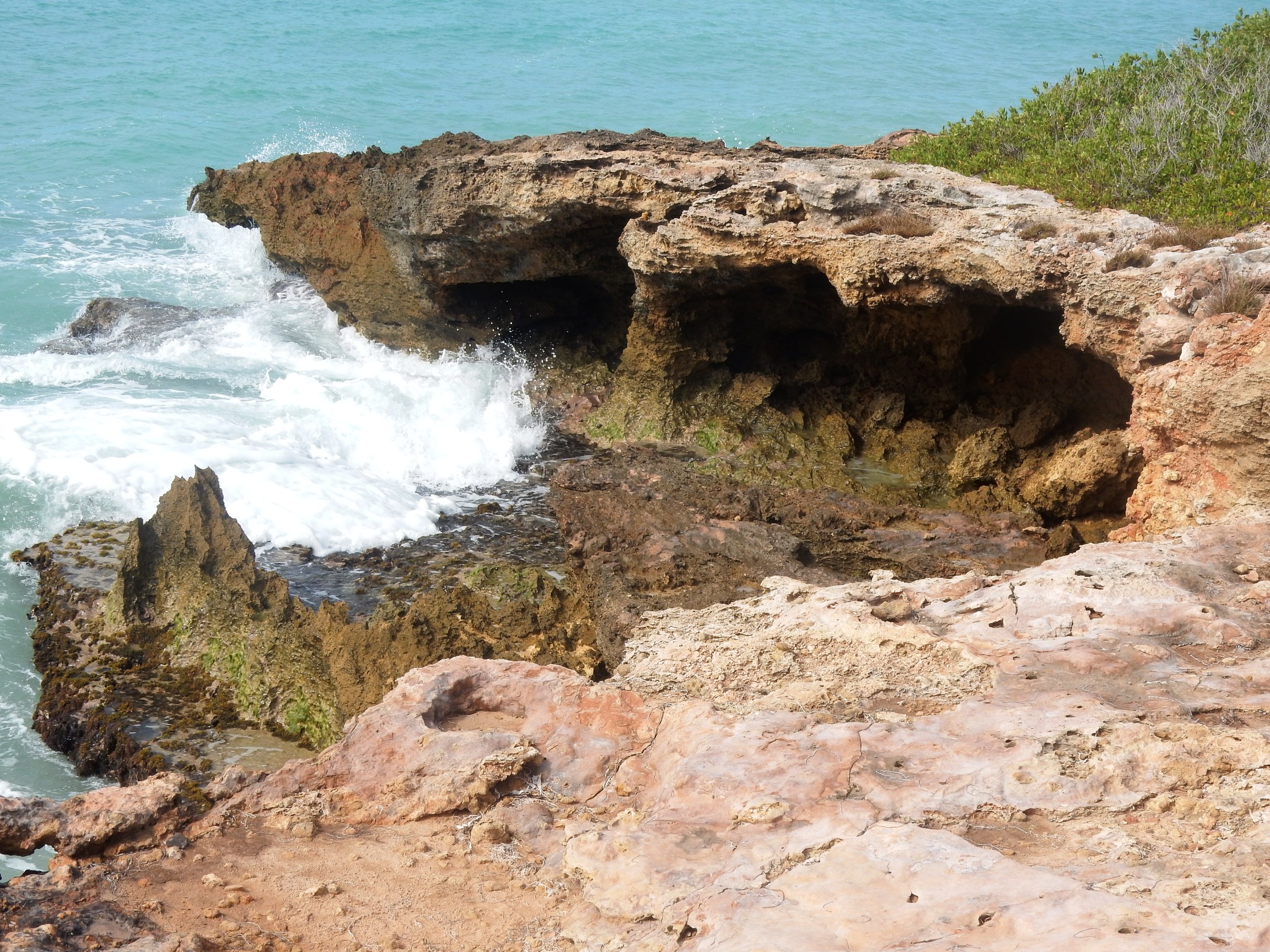 
     Tuesday, Feb 13  The last day in this condo. We spent most of the time doing laundry, sorting and packing, figuring out what to eat to use up the most groceries! We did walk down to the beach one last time and, coming back, commemorated it with a final photo. The "I Love Combate" sign is at the visitor information center that is not open (presumably it will be later when the real tourist season opens - while winter is high season for tourism in much of Puerto Rico, the southwest is a primary destination for islanders and its "season" is in the summer). Wednesday, Feb 14   As we started our journey east to Caguas, closer to San Juan, we
saw a blimp. Apparently it has been there all the time but we
just don't usually head in this direction! I am told that it's a
Border Patrol vehicle, watching the coast primarily for traffic from
the Dominican Republic. We also were on Route 303, known as the
Rute de los Extraterres (The Extraterrestrial Route). Apparently
there are lots of unexplained things that occur in this area! I
liked the sign, but not enough to stop and pose in it! As we started our journey east to Caguas, closer to San Juan, we
saw a blimp. Apparently it has been there all the time but we
just don't usually head in this direction! I am told that it's a
Border Patrol vehicle, watching the coast primarily for traffic from
the Dominican Republic. We also were on Route 303, known as the
Rute de los Extraterres (The Extraterrestrial Route). Apparently
there are lots of unexplained things that occur in this area! I
liked the sign, but not enough to stop and pose in it!  We
found our apartment for the last 2 nights but it was well before
check-in time so we went to a nearby panaderia (bakery) and got some sandwiches
for lunch and mallorcas for breakfast, then went to the Jardín
Botánico y Cultural de Caguas which is only a couple of miles from
where we were staying. It also suffered a lot of damage from the
last hurricane and is still working on renovations. It was closed
up for a while, but now it has reopened and there are enough areas to
make it a worthwhile stop. They are lacking signage and it's
rather hard to find your way around - they have some maps posted that
they suggest you photograph so you can use them, but they aren't really
very helpful. But again, these are just a few samples of the
sorts of things that are available. We enjoyed it. At
the right is a Peace Post, to the left is the aquatic exhibit with lots
of water lilies and koi. Below in the top row are: ruins left
from the Hacienda San Jose, a sugar plantation and rum distillery from
the early 1800's; heliconia and ginger plants. There are also
other parts of the old plantation remaining, some equipment and a
chimney, for example. We
found our apartment for the last 2 nights but it was well before
check-in time so we went to a nearby panaderia (bakery) and got some sandwiches
for lunch and mallorcas for breakfast, then went to the Jardín
Botánico y Cultural de Caguas which is only a couple of miles from
where we were staying. It also suffered a lot of damage from the
last hurricane and is still working on renovations. It was closed
up for a while, but now it has reopened and there are enough areas to
make it a worthwhile stop. They are lacking signage and it's
rather hard to find your way around - they have some maps posted that
they suggest you photograph so you can use them, but they aren't really
very helpful. But again, these are just a few samples of the
sorts of things that are available. We enjoyed it. At
the right is a Peace Post, to the left is the aquatic exhibit with lots
of water lilies and koi. Below in the top row are: ruins left
from the Hacienda San Jose, a sugar plantation and rum distillery from
the early 1800's; heliconia and ginger plants. There are also
other parts of the old plantation remaining, some equipment and a
chimney, for example.      In the bottom row above, a couple
of turtles are enjoying the sun on a rock in the Rio Caguitas; a green heron at the
edge of the river and an iguana with an enormous tail also sunning by
the river! It was a great outdoors day.
Even though this is at the end of the trip, we made a stop at the Amigos grocery to fill out our menus for tonight and tomorrow. The apartment was furnished well and the kitchen was fine but there were some other quirks. People had warned us about this as being a fairly common practice, this was the only place we stayed that provided no hot water except in the bathroom. The shower was great, but we had to do dishes in cold water. Not a huge problem for us but it is interesting how much we take for granted. Thursday and Friday, Feb 15-16  It turned out that, though we had a list of galleries
and museums to visit in Caguas, we had worn ourselves out and ended up
just napping, packing and reading on Thursday, hoping to be alert enough for
travel on Friday! We had no problems, though - returned the car
to the airport around 11:00 a.m. and got through the USDA and TSA security
lines easily. Had some lunch then later bought some supper to
carry on the plane. And we had the real very last sunset of the
trip from the plane, over the clouds, about half way back to MSP! It turned out that, though we had a list of galleries
and museums to visit in Caguas, we had worn ourselves out and ended up
just napping, packing and reading on Thursday, hoping to be alert enough for
travel on Friday! We had no problems, though - returned the car
to the airport around 11:00 a.m. and got through the USDA and TSA security
lines easily. Had some lunch then later bought some supper to
carry on the plane. And we had the real very last sunset of the
trip from the plane, over the clouds, about half way back to MSP!
Click here to
go back to Part 1 of the Puerto Rico Trip |