The route from Crawford to the North Rim of the Black Canyon of the Gunnison National Park was a little tricky – but once we figured out we had to go PAST the State Park Reservoir, it was marked pretty well.
We got to the campground around 1 PM so the first order of business was lunch. We picked a site (#2), had lunch and set up the tent, then went back to the North Rim Ranger Station, signed in and paid up. It cost $15 entrance to the park for a week and $12/night for camping. We are "off the grid" here - no cell phone signal, no electricity; but it's quite a nice campground in the piñons and junipers, with drinking water and clean vault toilets.

 After
lunch we walked the short Chasm View nature trail (no guides were
available) right in the campground. Beautiful views, lovely
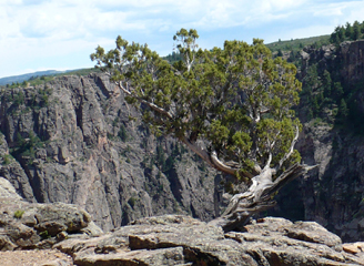
wildflowers (cactus flowers to the left) and old, gnarled trees - I
love the natural Bonsai on the rim, pictured at right. Canyon
views below - in the first one, you can see the Gunnison River at the
bottom. You begin to see why it's known as the Black Canyon!
The trail was only about half a mile but we were wiped out
(maybe
the heat or added elevation - it's about 7700 feet here) and took a
short nap afterwards.
After
lunch we walked the short Chasm View nature trail (no guides were
available) right in the campground. Beautiful views, lovely
wildflowers (cactus flowers to the left) and old, gnarled trees - I
love the natural Bonsai on the rim, pictured at right. Canyon
views below - in the first one, you can see the Gunnison River at the
bottom. You begin to see why it's known as the Black Canyon!
The trail was only about half a mile but we were wiped out
(maybe
the heat or added elevation - it's about 7700 feet here) and took a
short nap afterwards. 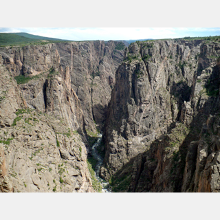

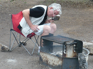 John
grilled trout for supper and I made a carrot/raisin salad (note to
self: pack a grater next trip). Yum. We had to
"cook" water
for doing the dishes; that isn't much fun but it's part of
camping. We also took advantage of the coals and treated
ourselves to s'mores. Then we drove over to North
Rim Drive
as we had been told there were great sunset views there.
However,
it was windy, cloudy and cold so we just stopped at a couple of
viewpoints then came back here and crawled under the covers.
I
went to bed with a bad headache that I eventually learned was likely
altitude sickness (typically it comes on at night, sometimes waking you
up with sudden headache). I've been in higher mountains
before
with no problem, but I started out sick this time - one theory is that
the infection stressed my body and made it more susceptible to the
altitude issues.
John
grilled trout for supper and I made a carrot/raisin salad (note to
self: pack a grater next trip). Yum. We had to
"cook" water
for doing the dishes; that isn't much fun but it's part of
camping. We also took advantage of the coals and treated
ourselves to s'mores. Then we drove over to North
Rim Drive
as we had been told there were great sunset views there.
However,
it was windy, cloudy and cold so we just stopped at a couple of
viewpoints then came back here and crawled under the covers.
I
went to bed with a bad headache that I eventually learned was likely
altitude sickness (typically it comes on at night, sometimes waking you
up with sudden headache). I've been in higher mountains
before
with no problem, but I started out sick this time - one theory is that
the infection stressed my body and made it more susceptible to the
altitude issues.Tuesday June 29

 I
woke up feeling much better this morning; it cooled off
overnight. So after breakfast, I donned my moistened neck
wrap
(it was totally dried out within an hour...) and we went off to the
Deadhorse Trail at the end of the North Rim Drive. After the
first .75 mile I knew I wasn't going to be able to do all 5
miles.
I
woke up feeling much better this morning; it cooled off
overnight. So after breakfast, I donned my moistened neck
wrap
(it was totally dried out within an hour...) and we went off to the
Deadhorse Trail at the end of the North Rim Drive. After the
first .75 mile I knew I wasn't going to be able to do all 5
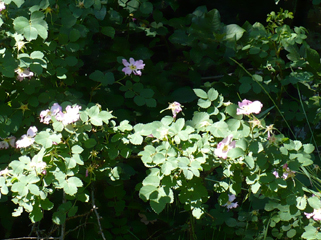
miles.  The area is full of
wildflowers
The area is full of
wildflowers 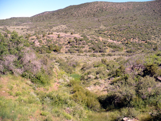 (wild
roses to the right above) and it was very nice, but parts were quite
steep and it was way too sunny and hot. At
the end of the trail you're at another point on the canyon rim, which
I'm sure is a great view, but they are ALL great views and I just
didn't feel like I could do that long of a hike today. The
picture to the right is looking back from where
(wild
roses to the right above) and it was very nice, but parts were quite
steep and it was way too sunny and hot. At
the end of the trail you're at another point on the canyon rim, which
I'm sure is a great view, but they are ALL great views and I just
didn't feel like I could do that long of a hike today. The
picture to the right is looking back from where 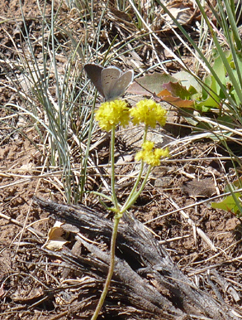 we stopped -
  you
can see the environment we were trekking through and get a
sense of the hills. I
told John I would be fine sitting
in the shade reading if he wanted to continue but he also was wearing
out so we went as far as the stock pond (above left - picture
by
John) and then
turned back. Around the pond we enjoyed watching the swallows
who
congregate near the water. I took the picture to the right,
of
the twigs, for
my sister-in-law, an artist who has been patiently teaching us to find
natural
you
can see the environment we were trekking through and get a
sense of the hills. I
told John I would be fine sitting
in the shade reading if he wanted to continue but he also was wearing
out so we went as far as the stock pond (above left - picture
by
John) and then
turned back. Around the pond we enjoyed watching the swallows
who
congregate near the water. I took the picture to the right,
of
the twigs, for
my sister-in-law, an artist who has been patiently teaching us to find
natural  beauty in unexpected
places. That branch somehow spoke to
me! Partial list of
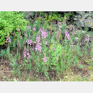
wildflowers we saw: globe mallow,
daisies, lupine, vetch, thistle, paint brush, scarlet trumpets,
penstemon,
clover, wild rose - and some new ones like the yellow sulphur
flowers to the left.
beauty in unexpected
places. That branch somehow spoke to
me! Partial list of
wildflowers we saw: globe mallow,
daisies, lupine, vetch, thistle, paint brush, scarlet trumpets,
penstemon,
clover, wild rose - and some new ones like the yellow sulphur
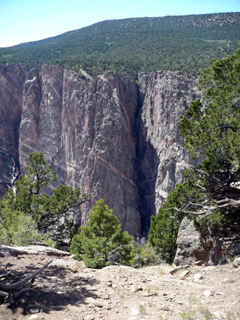
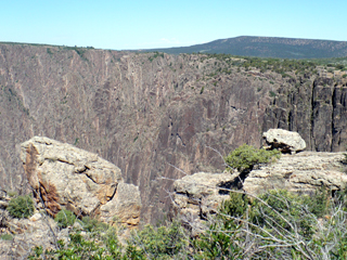
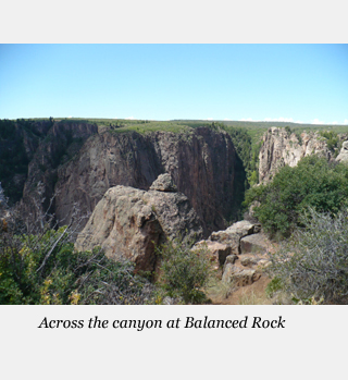
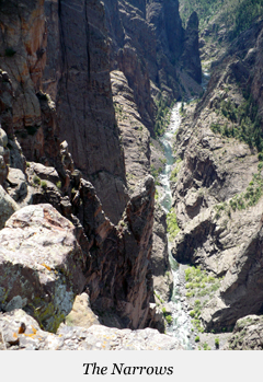
flowers to the left. After we cooled down in the car a little bit, we drove slowly back down North Rim Drive, stopping at the viewpoints – it was amazing how many DIFFERENT views there are. I had my usual trouble with taking every picture that came along but I tried to pick just one from each place.
The first two were taken from an un-named trail off the loop at the very end of North Rim Drive (past the Deadhorse Trailhead). I justify two because one was a view across the canyon, the other is a wonderful old tree!



 Back
at camp, we had sandwiches for lunch. I had
(brilliantly) set out sun tea when we left so I got to have iced tea
(stole some ice from the cooler) with my turkey sandwich,
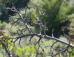
banana and yogurt and granola bar. We've seen
wrens (this one at left was quite interested in my lunch), lots of
swallows and magpies. We HEAR loads of birds but they hide
pretty
well.
Back
at camp, we had sandwiches for lunch. I had
(brilliantly) set out sun tea when we left so I got to have iced tea
(stole some ice from the cooler) with my turkey sandwich,
banana and yogurt and granola bar. We've seen
wrens (this one at left was quite interested in my lunch), lots of
swallows and magpies. We HEAR loads of birds but they hide
pretty
well.A family from Kentucky moved in across from us this evening – 2 adults plus FIVE big teen aged boys, all of their equipment, 2 tents, food, etc. were all packed in a Suburban. I am so impressed! We've got this big minivan for just two of us and we pretty much use all of the space.
 We
had a sort of chili for supper - "sort of" because we had
to use up all of the ground beef and that was more meat that we are
used to using, so that meant there was less tomato and beans
proportionately – but it was easy
and good. After
supper we walked the Chasm View trail again; it's interesting
how the views are altered by changes in light. John
went to
watch
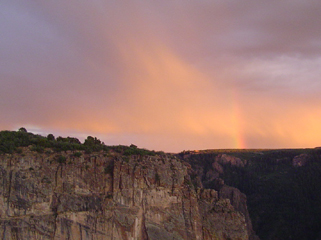
the sunset along the rim drive; it had been raining
and he
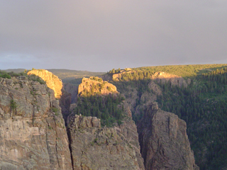
captured some very interesting effects - here are two of my favorites:
the sun highlighting the tops of the canyon wall and the bottom of the
"rainbow" at sunset on the right?
We
had a sort of chili for supper - "sort of" because we had
to use up all of the ground beef and that was more meat that we are
used to using, so that meant there was less tomato and beans
proportionately – but it was easy
and good. After
supper we walked the Chasm View trail again; it's interesting
how the views are altered by changes in light. John
went to
watch
the sunset along the rim drive; it had been raining
and he
captured some very interesting effects - here are two of my favorites:
the sun highlighting the tops of the canyon wall and the bottom of the
"rainbow" at sunset on the right?Wednesday June 30
 We
broke camp right after breakfast and headed down to Gunnison on Hwy
92. It’s a gorgeous drive (still part of
the West Elk
Loop). We stopped frequently at short trails and viewpoints,
mostly in the Curecanti National Recreation Area
– that was
very nice. Some of the scenery made me gasp and I
took way
too many pictures!
We
broke camp right after breakfast and headed down to Gunnison on Hwy
92. It’s a gorgeous drive (still part of
the West Elk
Loop). We stopped frequently at short trails and viewpoints,
mostly in the Curecanti National Recreation Area
– that was
very nice. Some of the scenery made me gasp and I
took way
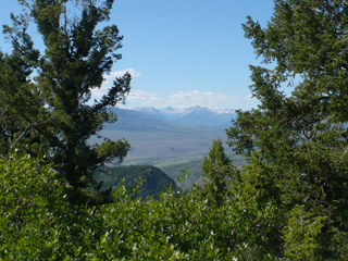
too many pictures!  At
left is one of the first views of the San Juan Mountains; at right we
are posing nicely with the mountains at Hermit's Rest.
At
left is one of the first views of the San Juan Mountains; at right we
are posing nicely with the mountains at Hermit's Rest. The next place we stopped was at Pioneer Point. Besides oohing and ahhing about the views, we chatted with some AmeriCorps students that were working on infrastructure (this group was putting seal coats on the wooden fences). They said if we had time we MUST take the boat tour that goes seven miles into the canyon along the Gunnison River. Since we (read: me) are apparently not going to be able to do as much hiking as we had planned, we thought that sounded like a good idea so we did reserve places for the Friday morning tour.
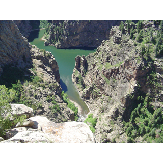
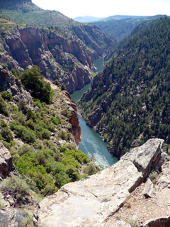
The pictures below were all taken from Pioneer Point. At left you can see the Curecanti Creek at the bottom of the picture - it is emptying into the Gunnison River that runs along the top. Hold that thought - on Friday we'll be looking up at Pioneer Point from that spot! In the middle is the Morrow Point Reservoir (on the Gunnison River) where we will be boating Friday, and on the right is the view on the other side of the highway!
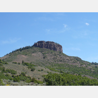
 CO
Highway 92 intersects US Highway 50 just west of the Blue Mesa
Reservoir (picture left). Driving from there into Gunnison is
another scenic drive. Given the health issues I've
had, I
wimped out on camping and we
booked into the Super 8 here in Gunnison.
I
couldn't tell what part of my symptoms were just from the
heat,
what might be from the original illness, or a reaction to the
medication, or altitude. So I wanted a place I could relax as
needed and where we had room to sit and read, etc. We were
really
very pleased with the motel - the manager, AJ, was
very helpful
and the facility was clean, comfortable and a good value. The strong
internet
connection was a bonus.
CO
Highway 92 intersects US Highway 50 just west of the Blue Mesa
Reservoir (picture left). Driving from there into Gunnison is
another scenic drive. Given the health issues I've
had, I
wimped out on camping and we
booked into the Super 8 here in Gunnison.
I
couldn't tell what part of my symptoms were just from the
heat,
what might be from the original illness, or a reaction to the
medication, or altitude. So I wanted a place I could relax as
needed and where we had room to sit and read, etc. We were
really
very pleased with the motel - the manager, AJ, was
very helpful
and the facility was clean, comfortable and a good value. The strong
internet
connection was a bonus. 
 Gunnison
is a nice town; we enjoyed walking around it. Later on in the
trip we passed through again and enjoyed a picnic lunch in their town
park. Today we had lunch at the Gunnisack (142 N. Main St.)
– a pub type of restaurant that emphasizes trans-fat free, organic and
locally-produced menu items. John had a
bacon cheeseburger salad and I had a turkey wrap; they were very
nice about modifying my wrap to fit my dietary requirements.
After
Gunnison
is a nice town; we enjoyed walking around it. Later on in the
trip we passed through again and enjoyed a picnic lunch in their town
park. Today we had lunch at the Gunnisack (142 N. Main St.)
– a pub type of restaurant that emphasizes trans-fat free, organic and
locally-produced menu items. John had a
bacon cheeseburger salad and I had a turkey wrap; they were very
nice about modifying my wrap to fit my dietary requirements.
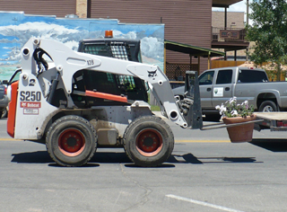
After 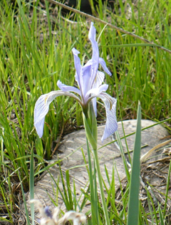 lunch
we watched this cute little forklift (right) carrying big potted plants from a
flat bed truck onto the sidewalk. John wants one (actually probably BOTH the plants and the equipment)!
lunch
we watched this cute little forklift (right) carrying big potted plants from a
flat bed truck onto the sidewalk. John wants one (actually probably BOTH the plants and the equipment)! After a short rest, we decided to go try the close (5 miles west of Gunnison), short (1.5 miles total), flat, Neversink Trail. The part of the description they left out was "take your bug repellent!" We were attracted by the idea of shade and birdwatching.
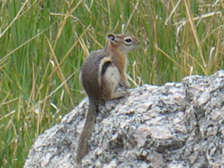 The
trail follows the Gunnison River - we saw lots of nice flowers,
including wild rose and wild iris (left) and heard lots of birds but
only saw a couple. The friendly fellow at the right was as
close
as we got to wildlife!
The
trail follows the Gunnison River - we saw lots of nice flowers,
including wild rose and wild iris (left) and heard lots of birds but
only saw a couple. The friendly fellow at the right was as
close
as we got to wildlife! We had supper at the Double Dragon Chinese restaurant (113 West Tomichi Avenue which is Hwy 50). It was reasonable and pretty much like the Chinese food we're used to, service wasn't great. Then we did a laundromat run, giving us more flexibility for tomorrow. We discovered, when we started collecting clothes, that one of our water jugs had leaked and soaked into my leather duffel bag, staining up some of my clothes. Fortunately, only one pair of slacks would be considered a major loss.
Thursday July 1 -
I had a bad night last night. It actually sounds like a very classic set of altitude sickness symptoms. Sudden onset of headache overnight and the next day feeling like you have a hangover. It's been about 40 years since I had a hangover, but that sounds about right to me! So I was very glad we were in a nice motel and I could stay cool and rest most of the day.

 John
went off to Dillon Pinnacles and had a great time so it worked out
fine. First, he encountered a herd of big horn sheep and got
some
great pictures of them. Then he started on the Dillon
Pinnacle
trail but didn't go the whole 4 miles because he got distracted by too
many wonderful wildflowers and rocks. He did some further
exploring, wandering along the reservoir, and then came back to get me
(by that time
John
went off to Dillon Pinnacles and had a great time so it worked out
fine. First, he encountered a herd of big horn sheep and got
some
great pictures of them. Then he started on the Dillon
Pinnacle
trail but didn't go the whole 4 miles because he got distracted by too
many wonderful wildflowers and rocks. He did some further
exploring, wandering along the reservoir, and then came back to get me
(by that time 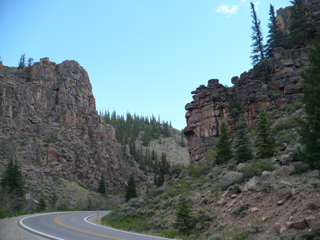 I was feeling much better)
and we
I was feeling much better)
and we  took
a drive down Hwy 114 (east of town) about 15 miles through Cochetopa
Canyon. It is so interesting how each canyon
(Glenwood
Springs, Black Canyon and now this one) is a little different - but all
are great scenery!
took
a drive down Hwy 114 (east of town) about 15 miles through Cochetopa
Canyon. It is so interesting how each canyon
(Glenwood
Springs, Black Canyon and now this one) is a little different - but all
are great scenery!Thursday evening we ate at El Paraiso Mexican Restaurant on South Main St. Best deal in town I think! It's a family run business, they have seating both indoors and out on a nice terrace. I had a chimichanga and John had the special which was crab enchilada with assorted sides. They brought a frosty glass with lime slice with his beer – without being asked! Very good food, low costs, nice, friendly staff, easy to find, lots of parking.
Friday July 2 -

 We
had reservations for the 10 AM boat trip and knew it was at least an
hour to get there so we were up and packed and checked out bright and
early. Fortunately, yesterday seemed to be the end of my
altitude problems and I was good to go for the rest of the trip!
We start at the Pine Creek trailhead, a few miles west of
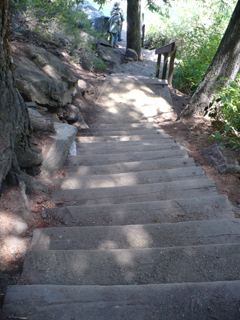
where Hwy 92 met Hwy 50. There really ARE 232 steps down
to the river level (more importantly, 232 steps to climb back UP)
and then it's a
very pleasant half mile walk to the boat dock. The little
waterfall (picture by John) is near the top of the stairs;
the pictures below are of the walk, along the river. It
would make a nice hike - it runs about a mile along an old railroad bed
so, except for the stairs, it is an easy, level walk, beautiful scenery
and shaded picnic tables available at several places.
We
had reservations for the 10 AM boat trip and knew it was at least an
hour to get there so we were up and packed and checked out bright and
early. Fortunately, yesterday seemed to be the end of my
altitude problems and I was good to go for the rest of the trip!
We start at the Pine Creek trailhead, a few miles west of
where Hwy 92 met Hwy 50. There really ARE 232 steps down
to the river level (more importantly, 232 steps to climb back UP)
and then it's a
very pleasant half mile walk to the boat dock. The little
waterfall (picture by John) is near the top of the stairs;
the pictures below are of the walk, along the river. It
would make a nice hike - it runs about a mile along an old railroad bed
so, except for the stairs, it is an easy, level walk, beautiful scenery
and shaded picnic tables available at several places. 
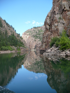
 It's impossible to capture the
whole 90 minute
boat trip! But
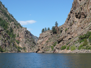
here are some samples of what we saw. Our guide, Ranger Nick,
did
a great job of pulling together the nature, geology and history and
making it meaningful to us. To the left is the pontoon
boat we were on - the canopy rolls out over all of the seats
in case of
rain.
It's impossible to capture the
whole 90 minute
boat trip! But
here are some samples of what we saw. Our guide, Ranger Nick,
did
a great job of pulling together the nature, geology and history and
making it meaningful to us. To the left is the pontoon
boat we were on - the canopy rolls out over all of the seats
in case of
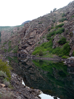
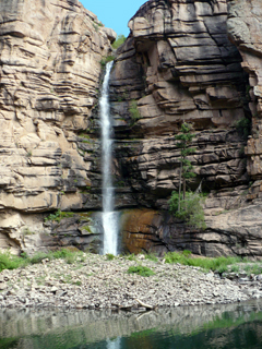
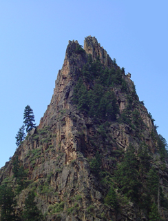
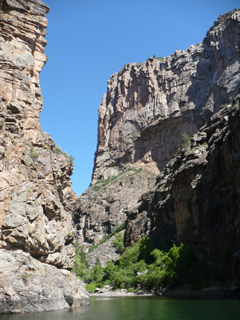
rain. Below left is Chipeta Falls, named for a Ute Princess. The Utes were the native people here who were treated very badly when the US government decided they wanted the land. In the center is the Curecanti needle (John's picture) seen as we headed east and the picture on the right is taken at the intersection of Curecanti Creek (right in front of us - in the middle of the picture - it curves to the left as it goes around that canyon wall) and the Gunnison River that we saw from above a few days ago. If you have sharp eyes, you can see some fence posts at the viewpoint at Pioneer Point, on the right cliff - remember the "looking down" picture earlier?
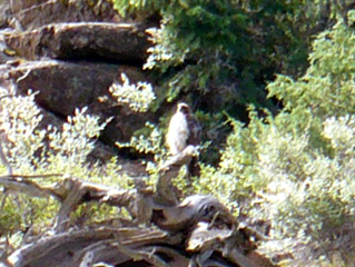
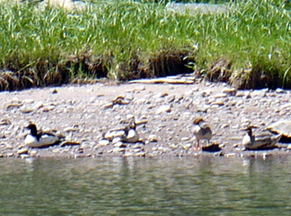
It's always hard to capture wildlife pictures on a trip like this - we're in a crowd and also moving! I did get a somewhat blurred pictures of what the "experts" agreed was a ferruginous hawk (left) and some merganser ducks who were just hanging out near the needle. We also saw a Golden Eagle, far up on the cliff, with binoculars, but it was way too far for my camera!

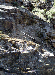
Back in 1882, the Denver and Rio Grande Western Railroad completed a narrow gauge railway line through this canyon. In fact, the passengers must have enjoyed similar scenery to what we saw today, minus the reservoir! The rail line is about 100 feet under water now, at the deepest points. But the bed does resurface gradually as we come out of the reservoir. On the left you can see an old, bent, telegraph pole left from those days; in the center is the Curecanti needle as seen coming from the west. That image was the logo for the railroad (right) and featured in their ads for many years. (There is an interesting article about the railroad posted on the NPS website if you'd like to read about its history and the challenges of construction!)

 Then we had to trek all the way back
UP to the trailhead. We stopped before the
stairs and had lunch at one of the picnic areas along the
trail. Fortunately, I felt much better today and the
long
climb on the stairs wasn't a problem! This
morning was one of the highlights of our trip and I encourage anybody
else in the area to do it - you can make reservations in person at the
Elk Creek Visitor Center or over the phone; here's the information!
Then we had to trek all the way back
UP to the trailhead. We stopped before the
stairs and had lunch at one of the picnic areas along the
trail. Fortunately, I felt much better today and the
long
climb on the stairs wasn't a problem! This
morning was one of the highlights of our trip and I encourage anybody
else in the area to do it - you can make reservations in person at the
Elk Creek Visitor Center or over the phone; here's the information!If you're interested in more views from the boat trip, there are plenty posted in the "Pictures Without Comment" section of my web page!
The next section of the Trip Log begins with the drive down to Creede!